
National Register of Historic Places listings in Gallatin County, Montana facts for kids

Welcome to Gallatin County, Montana! This page is all about the cool, old places here that are super important to history. These special spots are listed on something called the National Register of Historic Places. Think of it like a hall of fame for buildings, areas, and landmarks that tell amazing stories about the past.
Gallatin County is home to 106 of these historic places. One of them is even more special and is called a National Historic Landmark. That means it's super important to the history of the entire United States!
Contents
What is the National Register of Historic Places?
The National Register of Historic Places is the official list of the nation's historic places worth saving. It's managed by the National Park Service. When a place is added to this list, it means it's recognized for its history, architecture, or archaeological importance. It helps protect these places for future generations to enjoy and learn from.
Why are these places important?
These historic places are like time capsules. They show us how people lived, worked, and played long ago. They can be old schools, homes, businesses, or even natural sites where important events happened. By protecting them, we keep our history alive!
Discovering Historic Places in Gallatin County
Gallatin County has a rich history, and many of its buildings and sites reflect that. From old schools to grand hotels, each place has a unique story. Let's look at a few examples of the types of places you can find on this list.
Historic Buildings in Bozeman
Bozeman, a major city in Gallatin County, has many buildings on the National Register.
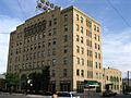
- Hotel Baxter: Located at 105 W. Main St., this hotel was listed in 1984. It's a famous landmark in downtown Bozeman.
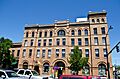
- Bozeman Carnegie Library: Found at 35 N. Bozeman Ave., this library was added to the list in 1979. Carnegie libraries were built all over the country with money from Andrew Carnegie, a famous businessman.
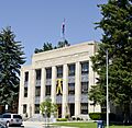
- Gallatin County Courthouse: This important building at 301 W. Main was listed in 1987. It's where a lot of the county's official business happens.
- Emerson School: At 111 S. Grand Ave., this school was listed in 1990. Many old schools are on the list because they were central to community life.
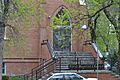
- First Presbyterian Church: Located at 26 W. Babcock, this church was added in 1987. Churches often have beautiful architecture and long histories.
Historic Districts in Bozeman
Sometimes, not just one building, but a whole group of buildings or an area is considered historic. These are called Historic Districts.
- Main Street Historic District: This district includes a large part of downtown Bozeman's main street. It was listed in 1987 and shows how the city grew over time.
- Montana State University Historic District: Listed in 2013, this district includes many of the older buildings on the university campus. It highlights the history of education in the state.
Historic Places in Three Forks
Three Forks is another important town in Gallatin County, especially known for where three rivers meet to form the Missouri River.
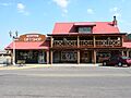
- Sacajawea Hotel: This historic hotel at 5 Main St. was listed in 1980. It's a beautiful old building that has welcomed travelers for many years.
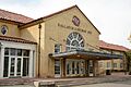
- Ruby Theatre: Located at 212 Main St., this theater was listed in 1982. Imagine watching movies or shows here decades ago!
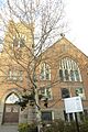
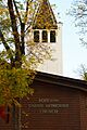
- Methodist Episcopal Church: This church at 116 Cedar St. was listed in 2000. It's a great example of early church architecture in the area.
Historic Places in West Yellowstone
West Yellowstone is famous as a gateway to Yellowstone National Park.
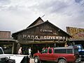
- Eagle's Store: At 3 Canyon St., this store was listed in 1986. It's a reminder of the early days of tourism to the park.
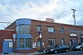
- Kennedy Building: Located at 127 Yellowstone Ave., this building was listed in 1983. It's part of the town's history as a tourist hub.
- West Yellowstone Oregon Shortline Terminus Historic District: This district, listed in 1983, includes the old train station area. It shows how people used to arrive at Yellowstone by train.
Other Notable Historic Sites
Gallatin County also has historic sites outside of its main towns.
- Gallatin Gateway Inn: Found on U.S. Route 191 in Gallatin Gateway, this inn was listed in 1980. It's a grand building that served as a stop for tourists heading to Yellowstone.
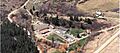
- Madison Buffalo Jump State Monument: Located south of Logan, this site was listed in 1970 and is a National Historic Landmark. It's an ancient hunting site where Native Americans used to hunt bison by driving them off cliffs. It's a very important archaeological site!
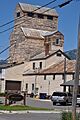
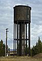
- Bozeman National Fish Hatchery: At 4050 Bridger Canyon Rd., this hatchery was listed in 1983. It's a place where fish are raised to help keep rivers and lakes stocked.
Images for kids
-
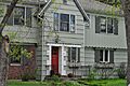
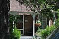
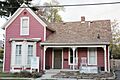
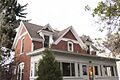
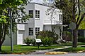
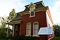
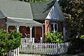
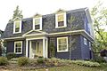
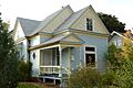
Jack Bartlett House
-
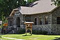
Beall Park Community Center
-
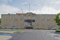
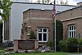
Belgrade City Hall and Jail
-
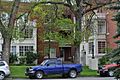
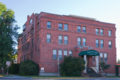
Blackmore Apartments
-
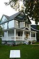
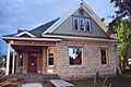
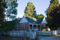
Bohart House
-
Bon Ton Historic District
-
Bozeman Armory
-
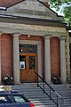
Bozeman Carnegie Library
-
Bozeman National Fish Hatchery
-
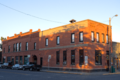
Bozeman Sheet Metal Works
-
Bozeman YMCA
-
Brandenburg House
-
Colburn House
-
Dokken-Nelson Funeral Home
-
Eagle's Store
-
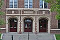
Emerson School
-
First Baptist Church
-
First Presbyterian Church
-
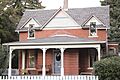
Burr Fisher House
-
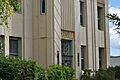
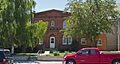
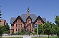
Gallatin County Courthouse
-
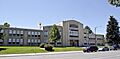
Gallatin County High School
-
Gallatin County Jail
-
Gallatin Gateway Inn
-
Gallatin Valley Seed Company
-
Graf Building
-
Hamill Apartments
-
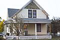
Harris House
-
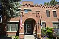
Holy Rosary Church Rectory
-
Hotel Baxter
-
House at 22 West Lamme
-
House at 714 North Tracy
-
Johnson House
-
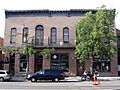
Kennedy Building
-
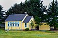
Little Bear School
-
Lonesomehurst Cabin
-
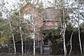
Madison Buffalo Jump State Monument
-
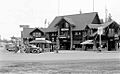
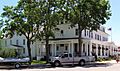
Madison Hotel and Cafe
-
Main Street Historic District
-
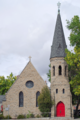
Methodist Episcopal Church (Bozeman)
-

Methodist Episcopal Church (Three Forks)
-
MISCO Grain Elevator
-
Montana State University Historic District
-
Newman House
-
North Tracy Avenue Historic District
-
Peterson House
-
Pine Butte School
-

Ruby Theatre
-
Sacajawea Hotel
-
South Tracy Avenue Historic District
-
South Tracy-South Black Historic District
-
South Willson Historic District
-
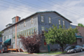
Spieth and Krug Brewery
-
Spieth Houses
-
St. James Episcopal Church and Rectory
-
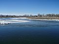
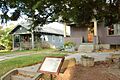
Three Forks of the Missouri
-
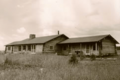
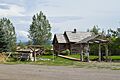
Watkins Creek Ranch
-
West Yellowstone Oregon Shortline Terminus Historic District


_-_Gallatin_County,_Montana.png)


_-_Gallatin_County,_Montana.png)


_-_Gallatin_County,_Montana.png)


_-_Gallatin_County,_Montana.png)


_-_Jefferson_County,_Montana.png)


_-_Gallatin_County,_Montana.png)


_-_Galltin_County,_Montana.png)


