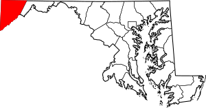
National Register of Historic Places listings in Garrett County, Maryland facts for kids
Garrett County, Maryland, is a beautiful area known for its mountains, lakes, and forests. But did you know it's also home to many important historical places? These special spots are listed on the National Register of Historic Places. This is a list kept by the United States government to honor places that are important to our country's history, architecture, or archaeology.
When a place is on this list, it means it's recognized for its unique value. It helps protect these places for future generations to learn from and enjoy. In Garrett County, there are 20 different buildings, bridges, and areas that have earned a spot on this important list. One of them is even a National Historic Landmark, which is an even higher level of historical importance!
Contents
Historic Buildings and Homes
Garrett County has many old buildings and homes that tell stories of the past. These places show us how people lived, worked, and built things long ago.
Churches and Chapels
- Anderson Chapel: This historic chapel is located in Swanton. It's a beautiful old building that has served its community for many years.
- Mercy Chapel at Mill Run: Found near Selbysport, this chapel is another important religious building on the list.
Homes and Cottages
- Borderside: This historic home is in Bloomington. It's a great example of the kind of houses built in the area a long time ago.
- Creedmore: Located in Mountain Lake Park, Creedmore is a historic house that stands out with its unique design.
- James Drane House: Near Accident, this old house gives us a peek into the lives of early settlers in Garrett County.
- Fuller-Baker Log House: Just west of Grantsville, this log house is a wonderful example of how people built homes using natural materials in the past. It shows us the simple, sturdy way pioneers lived.
- Glamorgan: This historic home is in Deer Park. It's another example of the beautiful architecture found in the county.
- Pennington Cottage: Also in Deer Park, this charming cottage is recognized for its historical importance.
Public and Commercial Buildings
- Baltimore and Ohio Railroad Station, Oakland: This old train station in Oakland was once a busy hub for travelers and goods. It reminds us of the important role railroads played in connecting communities.
- Garrett County Courthouse: Located in Oakland, this courthouse is where many important decisions for the county have been made over the years. It's a symbol of local government and justice.
Important Bridges and Roads
Some of Garrett County's most important historical sites are not buildings, but parts of its transportation history. These bridges and roads helped people travel and trade.
Historic Bridges
- Bloomington Viaduct: This impressive bridge crosses the Potomac River near Bloomington. It's a great example of early engineering.
- Casselman's Bridge, National Road: East of Grantsville, this bridge is very special because it's a National Historic Landmark. It was part of the National Road, one of the first major improved highways in the United States. It helped people travel west and connect different parts of the country.
Old Mills
- Kaese Mill: North of Accident, this old mill was once a place where grains were ground into flour. Mills were very important for local communities.
- Stanton's Mill: Also near Grantsville, Stanton's Mill is another historic mill that shows us how important these structures were for daily life and the economy.
Historic Districts and Sites
Sometimes, it's not just one building that's important, but a whole area or group of places. These are called historic districts or sites.
Historic Districts
- Inns on the National Road: This district includes several old inns along the National Road near Grantsville. These inns provided places for travelers to rest and eat during their long journeys.
- Mountain Lake Park Historic District: This area in Mountain Lake Park is recognized for its unique collection of historic buildings and its special community layout.
- Oakland Historic District: This district in Oakland includes many historic buildings that together tell the story of the town's development.
Archaeological Sites
- Hoye Site: This site near Oakland is important for its archaeological findings. It helps scientists learn about ancient cultures and how people lived thousands of years ago. The exact location is kept secret to protect it.
- Meyer Site: Similar to the Hoye Site, this archaeological site near Westernport also holds clues about the past. Its location is also kept private for protection.
- Tomlinson Inn and the Little Meadows: This historic inn, located east of Grantsville, was another important stop along the National Road. It played a role in the history of travel and hospitality.
Images for kids


