
National Register of Historic Places listings in Glacier National Park facts for kids
Glacier National Park is a super special place in Montana, USA. It's famous for its amazing mountains, huge glaciers, and beautiful lakes. But did you know it's also home to many historic places? These are buildings, roads, and other spots that are important because of their history.
The National Register of Historic Places is like a special list kept by the United States government. It helps protect places that are important to American history, architecture, or culture. When a place is on this list, it means it's worth saving for future generations to learn from and enjoy.
Glacier National Park has a lot of these historic places – 90, to be exact! Three of them are even more special, called National Historic Landmarks. These are places that are super important to the whole country's history. Let's explore some of these cool historic spots in Glacier National Park!
Contents
Famous Landmarks You Should Know
Some places in Glacier National Park are so important that they are called National Historic Landmarks. These are like the superstars of historic sites!
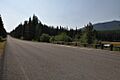
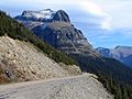
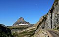
Going-to-the-Sun Road

The Going-to-the-Sun Road is one of the most famous roads in the world. It's a super scenic mountain road that crosses the park. It was built a long time ago, between 1921 and 1932. Building this road was a huge challenge because of the tough mountain terrain. It's an amazing example of early road engineering in national parks. The road is also a National Historic Landmark, meaning it's very important to the history of the United States. It offers incredible views and connects the east and west sides of the park.
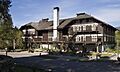
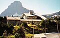
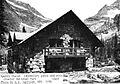
Lake McDonald Lodge

The Lake McDonald Lodge is a beautiful old hotel right on the shore of Lake McDonald. It was built in 1913-1914 and looks like a Swiss chalet. It's a great example of the rustic style used in national park buildings. The lodge was designed to fit in with the natural beauty of the park. It's also a National Historic Landmark and a popular place for visitors to stay. Imagine staying in a place that's over 100 years old!
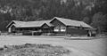
Great Northern Railway Buildings
The Great Northern Railway Buildings are a collection of historic buildings connected to the railway. The Great Northern Railway played a big role in bringing early tourists to Glacier National Park. They built many hotels and chalets to encourage people to visit. These buildings show how important railways were in developing tourism in national parks. This group of buildings is also a National Historic Landmark District.
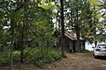
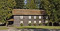
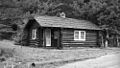
Historic Buildings and Cabins
Many other buildings in the park are also on the National Register of Historic Places. These include fire lookouts, patrol cabins, and ranger stations. They tell us about the people who worked and lived in the park long ago.
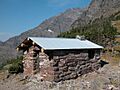
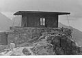
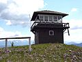
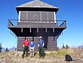
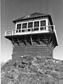
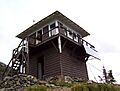
Fire Lookouts

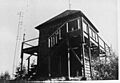
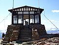
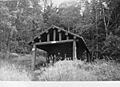
Fire lookouts are small buildings, usually on top of mountains. People called fire lookouts would live there during the summer to watch for wildfires. If they saw smoke, they would report it quickly to park rangers. This helped protect the forests from big fires. Several fire lookouts in Glacier National Park are historic, like the Apgar Fire Lookout, Heaven's Peak Fire Lookout, and Mount Brown Fire Lookout. They remind us of the important job of protecting the park's natural beauty.
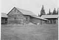
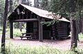
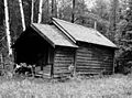
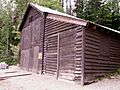
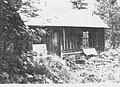
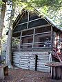
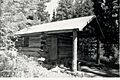
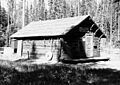
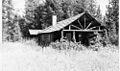
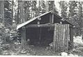
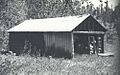
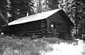
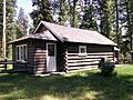
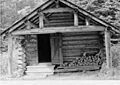
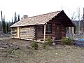
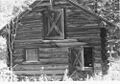
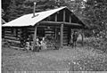
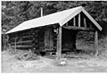
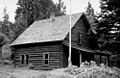
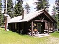
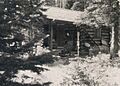
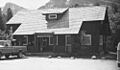
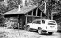
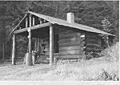
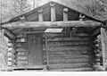
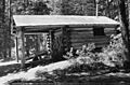
Patrol Cabins and Snowshoe Cabins

Patrol cabins and snowshoe cabins were small, simple shelters used by park rangers. Rangers would use these cabins when they were patrolling remote areas of the park, especially during winter. They were essential for rangers to stay safe and warm while doing their jobs, like checking on wildlife or maintaining trails. Examples include the Bowman Lake Patrol Cabin and the Kootenai Creek Snowshoe Cabin. These cabins show the rugged life of early park rangers.
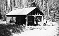
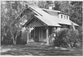
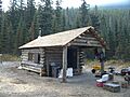
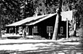
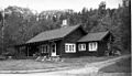
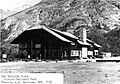
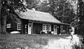
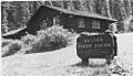
Ranger Stations

Ranger stations are where park rangers lived and worked. They were important centers for managing different parts of the park. Many of these stations are now historic districts, meaning a group of buildings together is protected. The Belly River Ranger Station Historic District and the Polebridge Ranger Station Historic District are good examples. They show how the park was managed and how rangers lived in the past.
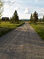
Historic Roads and Trails
Besides buildings, some roads and trails in Glacier National Park are also historic. They were built to help people explore the park and connect different areas.
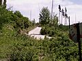
Bowman Lake Road

The Bowman Lake Road is a historic road in the North Fork area of the park. It leads to the beautiful Bowman Lake. Roads like this were important for allowing visitors to reach different parts of the park and enjoy its scenery.
Camas Creek Cutoff Road
The Camas Creek Cutoff Road is another historic road within the park. These roads were carefully planned and built to blend in with the natural landscape. They are part of the park's history of making nature accessible to visitors.
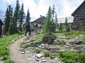
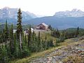
Tourist Trails
The Glacier National Park Tourist Trails include famous routes like the Inside Trail, South Circle, and North Circle. These trails were developed to help tourists explore the park's wilderness safely. They allowed people to hike to amazing places like Granite Park Chalet. These trails are not just paths; they are part of the park's history of outdoor adventure.
Other Interesting Historic Sites
Glacier National Park has even more unique historic listings!
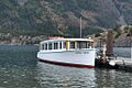
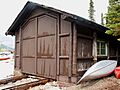
Historic Boats

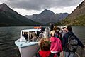
Did you know there are historic boats on the park's lakes? The Little Chief (also known as Rising Wolf) is a historic wooden boat that operates on Two Medicine Lake. The Morning Eagle is another historic boat on Lake Josephine. These boats have been carrying visitors across the lakes for many years, offering unique views of the park. They are a fun way to experience the park's history on the water.
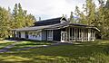
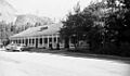
Visitor Centers
Even some of the park's visitor centers are historic! The Logan Pass Visitor Center and the Saint Mary Visitor Center are important places where visitors learn about the park. Their design and construction are part of the park's history of welcoming and educating people.
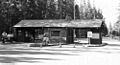
Campgrounds and Auto Camps
Places like the Rising Sun Auto Camp and the Swiftcurrent Auto Camp Historic District are also on the list. These were early versions of campgrounds and places where people could stay with their cars. They show how tourism changed over time, from grand hotels to more accessible camping experiences.
Glacier National Park is not just a place of natural wonders; it's also a treasure chest of history. Each historic building, road, and even boat tells a story about the people who explored, protected, and enjoyed this incredible park over the years.
Images for kids
-
Apgar Fire Lookout
-
Belly River Ranger Station Barn
-
Bowman Lake Patrol Cabin
-
Bowman Lake Road
-
Camas Creek Cutoff Road
-
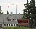
Chief Mountain Border Station and Quarters
-
Coal Creek Patrol Cabin
-
Cut Bank Ranger Station
-
Fielding Snowshoe Patrol Cabin
-
Fish Creek Bay Boathouse
-
Ford Creek Patrol Cabin
-
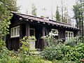
Granite Park Chalet
-
Goathaunt Bunkhouse
-
Going-to-the-Sun Road
-
Going-to-the-Sun Road
-
Granite Park Chalet
-
Greve's Tourist Cabins
-
Gunsight Pass Shelter
-
Harrison Lake Patrol Cabin
-
Headquarters Historic District Residence
-
Heaven's Peak Fire Lookout
-
Howes' Lake McDonald Cottage Sites Historic District
-
Huckleberry Fire Lookout
-
Kelly's Camp Historic District
-
Kintla Lake Ranger Station
-
Kishenehn Ranger Station
-
Kootenai Creek Snowshoe Cabin
-
Lake McDonald Lodge Coffee Shop
-
Lake McDonald Lodge
-
Lake McDonald Lodge Historic District
-
Lee Creek Snowshoe Cabin
-
The Little Chief boat
-
Logan Creek Patrol Cabin
-
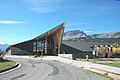
Logan Pass Visitor Center
-
Logging Creek Ranger Station
-
Loneman Fire Lookout
-
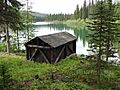
Lower Logging Lake Boathouse
-
Lower Nyack Snowshoe Cabin
-
Lower Park Creek Patrol Cabin
-
McCarthy Homestead Cabin
-
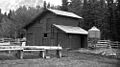
Many Glacier Barn
-
Many Glacier Campground Camptender's Cabin
-
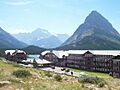
Many Glacier Hotel
-
The Morning Eagle boat
-
Mount Brown Fire Lookout
-
North Fork Road
-
Numa Ridge Fire Lookout
-
Nyack Ranger Station Barn
-
Pass Creek Snowshoe Cabin
-
Polebridge Ranger Station
-
Polebridge to Numa Ridge Phoneline
-
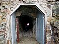
Ptarmigan Tunnel
-
Quartz Lake Patrol Cabin
-
Rising Sun Auto Camp
-
Roes Creek Campground Camptender's Cabin
-
Saint Mary Ranger Station
-

St. Mary Utility Area Historic District
-
Saint Mary Visitor Center, Entrance Station and Checking Stations
-
Sherburne Ranger Station
-
Skyland Camp-Bowman Lake Ranger Station
-
Slide Lake-Otatso Creek Patrol Cabin and Woodshed
-
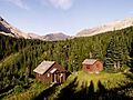
Sperry Chalet
-
Sun Camp Fireguard Cabin
-
Swanson Boathouse
-
Swiftcurrent Auto Camp Historic District
-
Swiftcurrent Fire Lookout
-
Swiftcurrent Ranger Station
-
Two Medicine Campground Camptender's Cabin
-
Two Medicine Store
-
Upper Kintla Lake Patrol Cabin
-
Upper Lake McDonald Ranger Station Historic District
-
Upper Logging Lake Snowshoe Cabin
-
Upper Nyack Snowshoe Cabin
-
Upper Park Creek Patrol Cabin
-
Walton Ranger Station Historic District
-
West Entrance Station


_-_panoramio.jpg)


