
National Register of Historic Places listings in Guilford County, North Carolina facts for kids

Welcome to Guilford County, North Carolina! This place is home to many special buildings and areas that are super important to American history. These places are so important that they are listed on something called the National Register of Historic Places. Think of it like a special list of treasures that we want to keep safe and remember forever!
When a building or an area is on this list, it means it has a unique story to tell about our past. It could be a house where someone famous lived, a school where important events happened, or even a whole neighborhood that looks just like it did many years ago.
Contents
What is the National Register of Historic Places?
The National Register of Historic Places is the official list of places in the United States that are worth saving. It's like a hall of fame for historic buildings, sites, and districts. These places are important because they show us how people lived, worked, and built communities long ago.
Why are places listed?
Places get listed for many reasons. Maybe they are:
- Connected to important events: Like a battlefield or a place where a big decision was made.
- Linked to famous people: A home or workplace of someone who made a difference.
- Great examples of architecture: Buildings that show off cool styles from the past.
- Important to local history: Places that tell the unique story of a town or community.
When a place is on this list, it helps protect it and makes people more aware of its value. It also means that people who own these places might get special help or grants to keep them in good shape.
Types of Historic Places
You'll see a few different types of listings in Guilford County:
- Historic Property (NRHP): This is usually a single building, like a house or a church.
- Historic District (HD): This is a whole area or neighborhood with many historic buildings that together tell a story.
- National Historic Landmark (NHL): These are the very best of the best! They are places that are important to the history of the entire country, not just one state or county.
Historic Treasures in Guilford County
Guilford County has many amazing places on the National Register. Let's explore a few examples!
Historic Homes and Mansions
Many old houses in Guilford County tell stories of the families who lived there and how life used to be.
- The John H. Adams House in High Point is a beautiful old home.
- Blandwood Mansion and Gardens in Greensboro is super special because it's a National Historic Landmark! It was once the home of a former North Carolina governor.
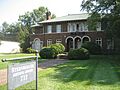
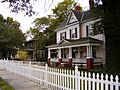
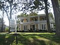
- The Bumpas-Troy House and the Dixon-Leftwich-Murphy House in Greensboro are other examples of grand old homes.
- The John Marion Galloway House in Greensboro, built in 1895, shows off the fancy Queen Anne style of architecture.
Important Schools and Colleges
Education has always been important in Guilford County, and several historic schools are on the list.
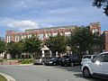
- The Agricultural and Technical College of North Carolina Historic District in Greensboro includes buildings from a historically important college.
- Bennett College Historic District, also in Greensboro, is another significant college campus.
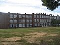
- James B. Dudley High School in Greensboro is a historic school that has been a center for learning for many years.
- The Former Jamestown High School building is a reminder of how schools looked and operated in the past.
- The Oak Ridge Military Academy Historic District in Oak Ridge shows the history of military education in the area.
Churches and Cemeteries
Churches are often central to communities and have long histories.
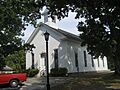
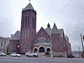
- The Buffalo Presbyterian Church and Cemetery in Greensboro has been a place of worship for a very long time.
- The Deep River Friends Meeting House and Cemetery in High Point is another historic religious site.
- The Tabernacle Methodist Protestant Church and Cemetery in Greensboro also holds a lot of history.
- Union Cemetery in Greensboro is a historic burial ground with many stories.
Downtown Areas and Mills
Some listings include entire parts of cities or old factories that were important for jobs and the economy.
- The Downtown Greensboro Historic District shows what the heart of Greensboro looked like in earlier times.
- The Guilford Mill near Oak Ridge is an example of an old mill that was important for making goods.
- The Revolution Cotton Mills in Greensboro was a big part of the textile industry.
- The Oakdale Cotton Mill Village in Jamestown shows how communities grew up around these factories.
Other Unique Places
- The Guilford Courthouse National Military Park in Greensboro is a National Military Park, meaning it's super important for understanding a key battle during the American Revolutionary War. It's a place where you can learn about brave soldiers and important moments in history.
- The Greensboro Historical Museum building itself is a historic site, once a Presbyterian Church and even a Confederate Hospital!
- The Jefferson Standard Building in Greensboro was a very tall and important building when it was first built.
- The World War Memorial Stadium in Greensboro is a historic sports venue.
Former Listings
Sometimes, a place might be removed from the National Register. This usually happens if the building is changed too much or is no longer standing.
- Founders Hall in Greensboro was once on the list but was later removed because it was torn down in 1973.
Guilford County is full of amazing historic places that help us understand the past and appreciate the stories of the people who lived here before us!
Images for kids
-
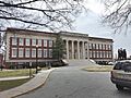
The Dudley Memorial Building at North Carolina A&T State University.
-
Blandwood Mansion, a National Historic Landmark.
-
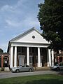
The original part of Buffalo Presbyterian Church.
-
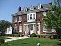
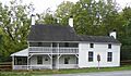
The historic Bumpas-Troy House.
-
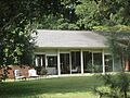
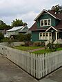
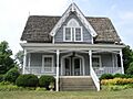
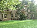
The Wilbur and Martha Carter House.
-
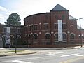
The old Central Fire Station in Greensboro.
-
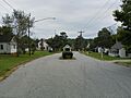
A street in the College Hill Historic District.
-
The Dixon-Leftwich-Murphy House.
-
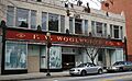
The former Woolworth store in the Downtown Greensboro Historic District, a site of important Civil Rights history.
-
James B. Dudley Senior High School.
-
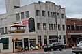
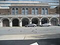
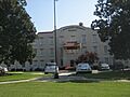
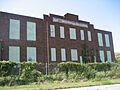
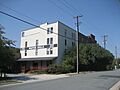
The Enterprise Building in High Point.
-
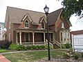
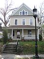
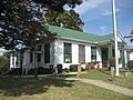
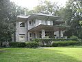
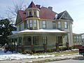
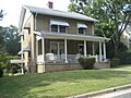
The William Fields House.
-
A view of the Fisher Park Historic District.
-
The former East White Oak School.
-
The old Jamestown High School building.
-
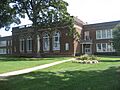
The former Charles D. McIver School.
-
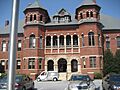
The former L. Richardson Memorial Hospital.
-
The Edward J. Forney House, now part of UNC-Greensboro.
-
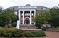
The Julius I. Foust Building at UNC-Greensboro.
-
The John Marion Galloway House.
-
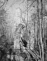
The Gatekeeper's House at Green Hill Cemetery.
-
The Greensboro Historical Museum building.
-
Greensboro Senior High School, also known as Grimsley High School.
-
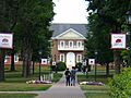
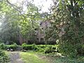
A walkway at Guilford College.
-
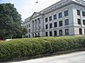
The Guilford County Courthouse.
-
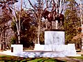
A statue of Nathaniel Greene at Guilford Courthouse National Military Park.
-
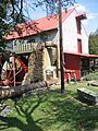
The historic Guilford Mill.
-
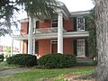
The Hillside home.
-
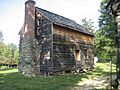
The Hoskins House.
-
The Charles H. Ireland House (destroyed by fire in 1996).
-
The Allen Jay School Rock Gymnasium.
-
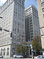
The Jefferson Standard Building.
-
The Kimrey-Haworth House.
-
The Latham-Baker House.
-
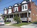
The Lyndon Street Townhouses.
-
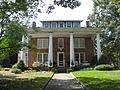
The Harden Thomas Martin House.
-
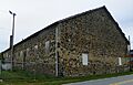
McCulloch's Gold Mill.
-
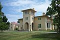
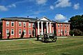
The Richard Mendenhall Plantation Buildings.
-
The Mock, Judson, Voehringer Company Hosiery Mill.
-
Buildings at Oak Ridge Military Academy.
-
The entrance to Oakdale Cotton Mill Village.
-
Revolution Cotton Mills.
-
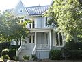
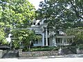
The Michael Sherwood House.
-
The Atkinson House in the South Greensboro Historic District.
-
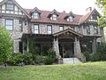
The Sigmund Sternberger House.
-
A street in the Summit Avenue Historic District.
-
The first building of Tabernacle Methodist Protestant Church.
-
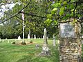
Union Cemetery.
-
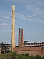
Wafco Mills.
-
The Dr. David P. Weir House.
-
West Market Street Methodist Episcopal Church, South.
-
A view of the White Oak New Town Historic District.
-
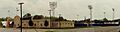
World War Memorial Stadium.


_1.jpg)
_1.jpg)


_1.jpg)
.jpg)
_1.jpg)

_1.jpg)

_1.jpg)


_1.jpg)


_1.jpg)

_1.jpg)


_1.jpg)
_1.jpg)
_2.jpg)

_1.jpg)
_1.jpg)
_1.jpg)
_1.jpg)
_1.jpg)
.jpg)

_1.jpg)


_1.jpg)
_1.jpg)


_first_building.jpg)
_1.jpg)
_2.jpg)
_1.jpg)


