National Register of Historic Places listings in Itasca County, Minnesota facts for kids
Hey there! Have you ever wondered about the cool old buildings and special places around you? In Itasca County, Minnesota, there are many historic spots that are so important, they're listed on something called the National Register of Historic Places. This is like a special list kept by the United States government to protect and celebrate places that tell important stories about our past.
This list helps us remember and learn about the history of Itasca County, from old schools and churches to mining sites and even ancient Native American spots. Each place has its own unique story, showing us how people lived, worked, and built communities long ago. Let's explore some of these amazing historic treasures!
Contents
Historic Buildings and Community Hubs
Many of the buildings on this list were important centers for their communities, often built during tough times like the Great Depression to help people and provide jobs.
Bigfork Village Hall
The Bigfork Village Hall is a cool building made of fieldstone. It was built in 1936 with help from the Works Progress Administration, or WPA. The WPA was a government program during the Great Depression that created jobs. This hall was super important for Bigfork, serving as a place for government and community events.
Bovey Village Hall
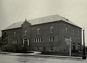
The Bovey Village Hall was built a bit earlier, from 1934 to 1935. It's a great example of a building constructed with federal help during the Great Depression, specifically from the Public Works Administration (PWA). It was one of Minnesota's first PWA projects and has a neat mix of old architectural styles.
Central School in Grand Rapids
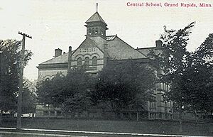
The Central School in Grand Rapids is a true landmark! Built in 1895, it's a beautiful old school with a unique style called Richardsonian Romanesque. It was one of the very first high schools in northern Minnesota outside of Duluth. This school was used for 77 years and is one of the few 19th-century buildings still standing in Grand Rapids.
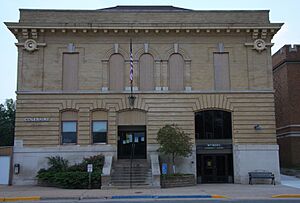
Coleraine Carnegie Library
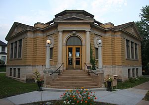
The Coleraine Carnegie Library was built in 1912 in a fancy Neoclassical style. It was funded by Andrew Carnegie, a famous businessman who helped build libraries all over the country. This library was important for educating and helping immigrant mine workers and their families learn English and adapt to their new lives. It shows how big mining companies sometimes helped their workers.
Coleraine City Hall
The Coleraine City Hall, built in 1910, is another impressive building in the Renaissance Revival style. It was built to house Coleraine's government offices, fire department, jail, and even an auditorium! It shows how Coleraine grew from a mining town into a proper village.
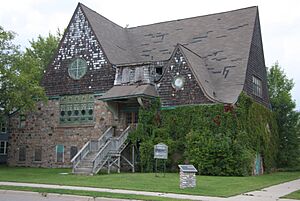
Coleraine Methodist Episcopal Church
This church, built from 1908 to 1909, was the biggest church on the western Mesabi Range. It's a great example of Shingle style architecture and was a key part of the planned community of Coleraine. It even had a YMCA (Young Men's Christian Association) on its lower level, offering activities and support for the community.
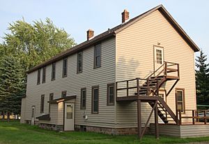
Oliver Boarding House
The Oliver Boarding House in Marble was built around 1909. It's the only boarding house left that was run by the Oliver Iron Mining Company in the western Mesabi Range. Boarding houses were super important because they helped solve the constant housing shortages for the many mine workers who came to the area.
Mining History and Industry
Itasca County has a rich history tied to iron mining. Several sites on the National Register tell the story of this important industry.
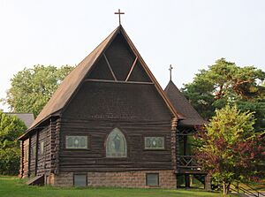
Church of the Good Shepherd
This beautiful log church was built in 1908 by U.S. Steel, a giant mining company. It served as a religious and social center for the company's managers. It shows how mining companies supported their upper-level employees with lavish facilities.
General Superintendent's House
This large house, built in 1911, was where the general superintendent of the mining company lived. It's a good example of the kind of housing provided for managers by the mining companies.
Hill-Annex Mine State Park
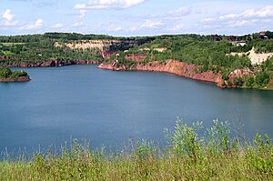
The Hill-Annex Mine was an open-pit iron mine that started in 1912. It was one of the most productive mines on the Mesabi Range! Today, it's a state park where you can see the old mining complex and learn about how iron was mined long ago.
Nature, Parks, and Dams
Beyond buildings, Itasca County's natural beauty and important infrastructure are also recognized.
Marcell Ranger Station
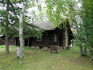
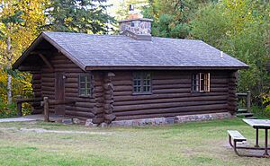
The Marcell Ranger Station is a well-preserved complex of five log buildings built from 1934 to 1935. It's located in the Chippewa National Forest and was built during the New Deal era, another time when the government created jobs during the Great Depression. It's known for its beautiful National Park Service rustic architecture.
Old Cut Foot Sioux Ranger Station
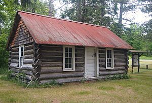
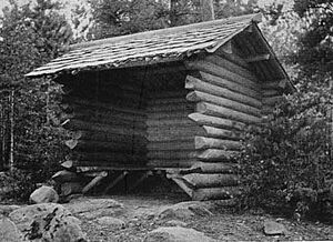
This ranger station, built in 1904, is one of the oldest surviving National Forest ranger stations in the entire United States! It's located in the Chippewa National Forest near Squaw Lake and is now a popular visitor attraction.
Scenic State Park Historic Resources
Scenic State Park has several historic areas. The "CCC/Rustic Style Service Yard" includes four log structures built from 1934 to 1935. These are the only all-log support facilities left in a Minnesota state park! They show how federal work relief programs helped develop state parks. Another part of the park, the "CCC/WPA/Rustic Style Historic Resources," includes six park facilities also built from 1934 to 1935. These buildings are great examples of the New Deal programs and the rustic log architecture used in national parks.
Winnibigoshish Lake Dam
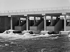
The Winnibigoshish Lake Dam was built from 1899 to 1900 on the Mississippi River. It was part of a big federal project to control the flow of the Upper Mississippi River. This dam was the first and largest of several reservoirs created in the region to manage the river's water levels.
Ancient History and Native American Sites
Itasca County is also home to very old sites that tell us about the earliest people who lived here.
Turtle Oracle Mound
The Turtle Oracle Mound near Squaw Lake is a rare type of mound called an intaglio, which means it's shaped like a turtle, but it's dug into the ground instead of built up. This unique site remembers battles between the Dakota and Ojibwe people that happened in the 1700s.
White Oak Point Site
The White Oak Point Site near Zemple is an incredibly old place that has been lived in almost continuously for over 10,000 years! It includes six burial mounds, the location of an old Ojibwe village, and even a British fur trading post. It's a place where many layers of history can be found.


