
National Register of Historic Places listings in Jackson County, Missouri: Kansas City other facts for kids

This article lists some of the amazing historic places in Kansas City, Missouri, that are outside the downtown area. These special spots are recognized on the National Register of Historic Places, which is like a national "hall of fame" for buildings, sites, and districts that are important to American history, architecture, or culture.
Kansas City, Missouri, has many historic places, and 171 of them are located in the Jackson County parts of the city, but not in the main downtown area. The downtown area is generally considered to be between the Missouri River to the north, 31st Street to the south, Troost Avenue to the east, and State Line Road to the west. These places help us remember and learn about the past!
What is the National Register of Historic Places?
The National Register of Historic Places (often called the NRHP) is the official list of the United States' historic places worth saving. When a place is added to this list, it means it's important to the history of a community, state, or even the whole country. It could be a building, a neighborhood, a park, or even a trail!
Why are these places important?
Historic places are like giant storybooks. They show us how people lived, worked, and played in the past. They can teach us about important events, famous people, and how our cities grew. Protecting these places helps future generations understand where we came from and how our world was shaped.
Discovering Kansas City's Historic Gems
Kansas City is full of fascinating historic sites. Let's explore a few examples from the list that are outside the downtown area.
Homes of Famous People
Some houses on the list belonged to people who made a big impact.
Walt Disney's Childhood Home

Did you know that the famous creator of Mickey Mouse, Walt Disney, lived in Kansas City? His house at 3028 Bellefontaine Avenue is on the National Register. Imagine the stories that house could tell about a young Walt Disney dreaming up his amazing characters! It was added to the list on May 22, 1978.
Thomas Hart Benton's House and Studio

Another famous resident was Thomas Hart Benton, a well-known American painter. His house and studio at 3616 Belleview Street is also a historic place. This is where he created many of his famous artworks. It became historic on November 21, 1980.
Historic Neighborhoods and Districts
Sometimes, a whole area or neighborhood is important because of its history or how it looks. These are called "historic districts."
18th and Vine Historic District

The 18th and Vine Historic District is a very special place in Kansas City. It's famous for its rich history in jazz music and African American culture. Many legendary jazz musicians played here. This district, roughly bounded by 18th Street, Woodland Avenue, 19th Street, and The Paseo, was added to the National Register on September 9, 1991.
Hyde Park Historic District
The Hyde Park Historic District is a large area roughly bounded by Armour and Harrison Boulevards, 39th Street, and Gillham Road. This neighborhood has many beautiful old homes and buildings that show how Kansas City looked in the past. It was recognized as historic on November 21, 1980.
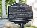
Santa Fe Place Historic District
The Santa Fe Place Historic District, located around 27th Street, Indiana Avenue, 30th Street, and Prospect Avenue, is another important neighborhood. It was listed on May 30, 1986, for its historical significance.
Important Buildings and Landmarks
Many individual buildings are also recognized for their unique stories or architecture.
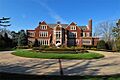
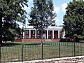
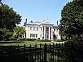
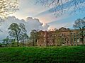
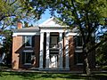
Kansas City Museum (R.A. Long House)

The Kansas City Museum, located at 3218 Gladstone Boulevard, is a beautiful building that was once the home of R.A. Long, a wealthy lumber baron. Now it's a museum where you can learn about Kansas City's history. It became a historic place on November 14, 1980.
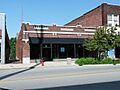
Uptown Building and Theatre

The Uptown Building and Theatre at 3700–3712 Broadway is a well-known landmark. This theater has hosted many concerts and shows over the years. It was added to the National Register on June 27, 1979.
Waldo Water Tower

The Waldo Water Tower, found at 75th Street and Holmes Road in Tower Park, is an iconic structure. Water towers are important for providing water to a city, and this one has been a landmark for a long time. It was listed on April 18, 1977.
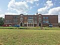
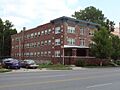
Historic Schools
Several schools in Kansas City are also listed, showing their importance to education and the community's history.
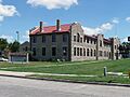
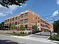
- Attucks School (1815 Woodland Avenue), listed on September 9, 1991.
- Bancroft School (4300 Tracy Avenue), listed on January 12, 2012.
- Lincoln High School (2111 Woodland Avenue), listed on January 15, 2014.
- Norman School (3514 Jefferson Street), listed on January 15, 2014.
- Seven Oaks School (3711 Jackson Avenue), listed on October 9, 2012.
- E.F. Swinney School (1106 W. 47th Street), listed on October 16, 2013.
- St. Francis Xavier School (5220 Troost Avenue), listed on October 23, 2017.
- Westport High School (315 E. 39th Street), listed on February 2, 2015.
- Westport Junior High School (300 E. 39th Street), listed on April 15, 2014.
These schools represent important parts of Kansas City's educational past.
Historic Trails
Some historic places aren't buildings at all, but parts of old trails that people used to travel across the country.
Santa Fe Trail Segments

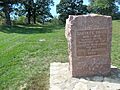
Parts of the famous Santa Fe Trail are preserved in Kansas City. For example, the "Three Trails" Trail Segment at 85th and Manchester, and the "Three Trails" Trail Swales near W. Santa Fe Trail. These segments show where wagons and travelers once passed on their journey west. They were listed on August 22, 2012, and June 30, 1994, respectively.
Byram's Ford Historic District
The Byram's Ford Historic District, located at 63rd Street and Manchester Trafficway at the Big Blue River, is another important trail-related site. It was added to the register on October 16, 1989.
Images for kids
-
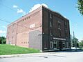
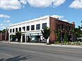
The A.B.C. Storage and Van Company Building.
-
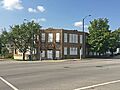
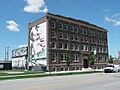
The ACME Cleansing Company Building.
-
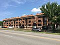
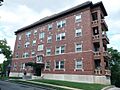
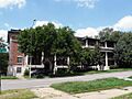
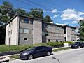
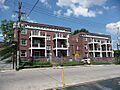
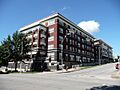
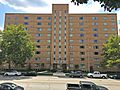
The Agee Apartments Historic District.
-
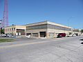
The Aines Farm Dairy Building.
-
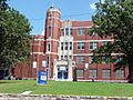
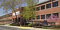
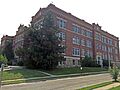
Attucks School.
-
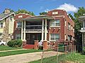
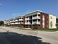
The Aurora Apartments.
-
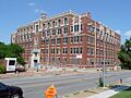
Bancroft School.
-
The Barclay Building.
-
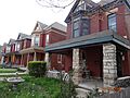
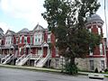
A building in the Bellefontaine Avenue Historic District.
-
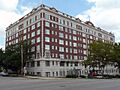
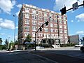
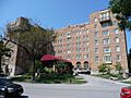
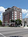
The Bellerive Hotel.
-
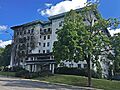
The Belmont Hotel.
-
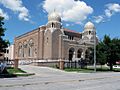
The Beth Shalom Synagogue.
-
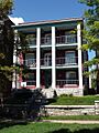
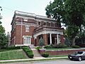
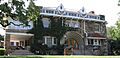
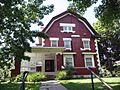
The Walter E. Bixby House.
-
Blenheim School.
-
The Bon Air Apartments Building.
-
The Charles A. Braley House.
-
The Burnette-Berry House.
-
Byram's Ford Historic District.
-

The Campbell-Continental Baking Company Building.
-
The Philip E. Chappell House.
-
The Chatham Hotel.
-
The Chicago Apartments.
-
The Circle Apartments.
-
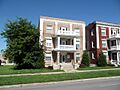
The Colonnade Apartment Building at 4302 Oak Street.
-
The Bernard Corrigan House.
-
The O.H. Dean Building.
-
The Dorson Apartment Building.
-
The East 27th Street Colonnades Historic District.
-
The Ellsworth Apartments.
-
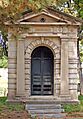
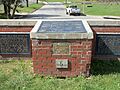
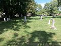
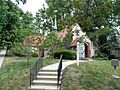
Elmwood Cemetery.
-
The First Swedish Baptist Church.
-
The Hunter Gary House.
-
The Gillham Court Apartments Building.
-
The Gillis Orphans' Home.
-
The Goodenow Textiles Company Building.
-
The Gotham Apartments.
-
The Col. John Harris House.
-
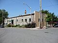
The Ferd. Heim Brewing Company Bottling Plant.
-
The Dr. Generous Henderson House.
-
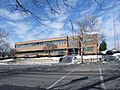
The Hiland Telephone Exchange Building.
-
The House at 54 E. 53rd Terrace.
-
The Independence Boulevard Christian Church.
-
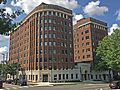
The Interstate Bakeries Corporation Headquarters.
-
Janssen Place Historic District.
-
The R. Bryson Jones House.
-
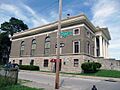
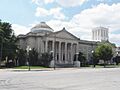
The Kansas City Athenaeum.
-
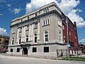
The Kansas City Masonic Temple.
-
The Michael H. and Rose Katz House.
-
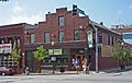
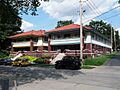
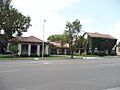
Kelly's Westport Inn.
-
The Kessler Apartments.
-
The Knickerbocker Apartments.
-
The William Baker and Mary Knight House.
-
The Kuehne-Schmidt Apartments.
-
Lincoln High School.
-
The Linwood Presbyterian Church and Home for Convalescent Employed Women.
-
The Locust Street Apartments.
-
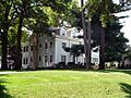
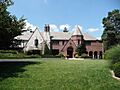
The Jacob Loose House.
-
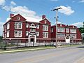
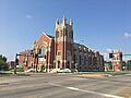
Loretto Academy.
-
The Luzier Special Formula Laboratories Building.
-
The Maine Apartments.
-
The Majestic Apartments.
-
The Alexander Majors House.
-
The Maples Apartments.
-
The Maryland Apartments.
-
The McConahay Building.
-
The Levi McIntire House.
-
The McMahon Apartments.
-
The August Meyer House.
-
The Michelson Building.
-
The Milo Apartments.
-
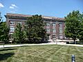
Mineral Hall.
-
The Missouri Apartments.
-
The Mutual Ice Company Building.
-
The Mutual Musicians' Foundation Building.
-
The George J. Myers House.
-
The George H. Nettleton Home.
-
The New England Apartments.
-
New Santa Fe "Three Trails" Trail Swales.
-
The Newbern Hotel.
-
The D.W. Newcomer's Sons Funeral Home.
-
The George E. Nicholson House.
-
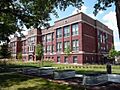
Norman School.
-
The Parade Park Maintenance Building.
-
The Paris and Weaver Apartment Buildings.
-
The Park Lane Apartments.
-
The Parkview.
-
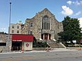
The Paseo YMCA.
-
Pilgrim Lutheran Church for the Deaf of Greater Kansas City and Parsonage.
-
The Plaza House Apartments.
-
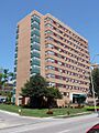
The Plaza Towers.
-
The Pratt and Whitney Plant Complex.
-
President Gardens Apartments Historic District.
-
The William D. Repp House.
-
Row House Buildings.
-
St. Francis Xavier School.
-
The St. Regis Hotel.
-
St. Teresa's Academy Music and Arts Building.
-
Santa Fe Trail-Minor Park, Kansas City, Trail Segments.
-
The Rev. Nathan Scarritt House.
-
The Edward Lucky Scarritt House.
-
The William Chick Scarritt House.
-
Seven Oaks School.
-
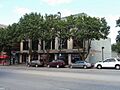
The Shankman Building.
-
The William Francis Shelley House.
-
The Sophian Plaza.
-
The Edward A. Stevens House.
-
E.F. Swinney School.
-
The Tocoma.
-
The Alfred Toll House.
-
The Norman Tromanhauser House.
-
The Valentine on Broadway Hotel.
-
The Ira C. and Charles S. Van Noy Houses.
-
The Villa Serena Apartment Hotel.
-
The Virginia Apartments.
-
The William Volker House.
-
The Seth E. Ward Homestead.
-
Westminster Congregational Church.
-
Westport High School.
-
Westport Junior High School.
-
Wheatley-Provident Hospital.
-
Windsor Hall Apartments.
-
The F. W. Woolworth Building.
-
The Wornall House.


.jpg)

.jpg)


.jpg)


.jpg)


.jpg)


