National Register of Historic Places listings in Lexington, Virginia facts for kids
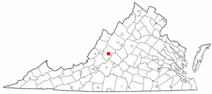
Welcome to Lexington, Virginia! This city is full of amazing old buildings and places that tell stories from the past. Many of these special spots are listed on the National Register of Historic Places. Think of this register as a VIP list for important historical sites across the United States.
Lexington has 17 places on this list. Four of them are even more special, called National Historic Landmarks. These landmarks are recognized as being super important to the history of the entire country!
Discovering Lexington's Historic Treasures
What is the National Register of Historic Places?
The National Register of Historic Places is an official list kept by the United States government. It helps protect and celebrate buildings, sites, and objects that are important in American history, architecture, archaeology, engineering, or culture. When a place is on this list, it means it's recognized for its special value. It also helps preserve these places for future generations to learn from and enjoy.
Famous Landmarks in Lexington
Lexington is home to several truly important historical sites. These places are not just old buildings; they are living parts of American history.
Virginia Military Institute (VMI)
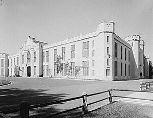
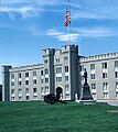
The Virginia Military Institute (VMI) is a famous military college. Its main building, known as the Barracks, is a National Historic Landmark. This means it's one of the most important historic places in the entire country! VMI has a long history, training leaders and soldiers for many years. The Barracks building itself is a key part of the institute's story.
Lee Chapel at Washington and Lee University
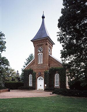
Another National Historic Landmark is Lee Chapel on the campus of Washington and Lee University. This beautiful chapel is named after Robert E. Lee, a famous general who later became the president of the university. The chapel is a place of history and remembrance, holding many important artifacts and stories from the university's past.
Stonewall Jackson House
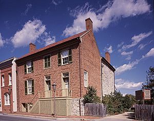
The Stonewall Jackson House was once the home of Thomas "Stonewall" Jackson, another well-known general from American history. This house is now a museum, showing what life was like in the 1850s. It helps visitors understand the time period and the people who lived there.
Washington and Lee University
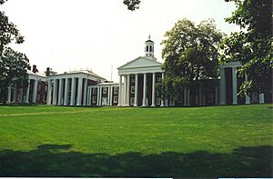
The entire campus of Washington and Lee University is recognized as a National Historic Landmark District. This means that many buildings and areas within the university grounds are historically significant. The university itself has a rich history, dating back to 1749, making it one of the oldest colleges in the United States.
Other Important Historic Places
Beyond the National Historic Landmarks, Lexington has many other fascinating places on the National Register. Each one adds to the city's unique historical character.
Old Homes and Buildings
Lexington has many beautiful old homes that are listed for their historical importance.
- The Alexander-Withrow House is a lovely old building located right in the heart of Lexington. It shows the architectural style of the early 1800s.
- Blandome is another historic home, recognized for its unique design and long history in the community.
- Col Alto is a grand estate that tells the story of early Lexington families. Its architecture is quite impressive.
- Mulberry Hill is a historic house with a long past, showing how people lived and built homes centuries ago.
- The Reid-White-Philbin House is another example of Lexington's beautiful historic residences, preserved for its architectural and historical value.
- Stono is a historic house located near the meeting point of two important roads, showing its connection to the area's development.
Schools and Churches
Important community buildings like schools and churches are also recognized for their history.
- The Lylburn Downing School was a significant school for African American students during a time of segregation. It represents an important part of Lexington's social history.
- The First Baptist Church-Lexington and the Lexington Presbyterian Church are both historic places of worship. They have served the community for many years and feature beautiful architecture.
Historic Districts
Sometimes, not just one building, but a whole area is considered historic.
- The Jordan's Point Historic District includes an area where the Maury River and Woods Creek meet. This spot was important for early industry and transportation in Lexington.
- The Lexington Historic District covers a large part of downtown Lexington. It includes many of the city's oldest and most important buildings, showing what the city looked like in earlier times.
The Old Toll House
The Lexington and Covington Turnpike Toll House is a small but important building. It was once where travelers paid a fee to use a special road called a turnpike. This house reminds us of how people traveled and how roads were funded in the past.
Images for kids


