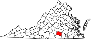
National Register of Historic Places listings in Lunenburg County, Virginia facts for kids
This article is about special places in Lunenburg County, Virginia that are listed on the National Register of Historic Places. This register is like a special list of buildings, areas, or objects that are important to American history. When a place is on this list, it means it's worth protecting and learning about.
Lunenburg County is a county in Virginia, United States. It has many interesting old places that help us understand the past. There are 11 properties and districts in Lunenburg County that are on this important list. You can see where these places are on an online map if you have their exact location details.
Historic Places in Lunenburg County
These are some of the cool historic places you can find in Lunenburg County. Each one has a story to tell about the past.
| Name on the Register | Image | Date listed | Location | City or town | Description | |
|---|---|---|---|---|---|---|
| 1 | Bechelbronn |
(#08000389) |
1223 Rubermont Rd. 37°04′03″N 78°10′45″W / 37.067500°N 78.179028°W |
Victoria | ||
| 2 | Brickland |
(#05000524) |
6877 Brickland Rd. 36°52′53″N 78°05′15″W / 36.881389°N 78.087500°W |
Kenbridge | ||
| 3 | Eubank Hall |
(#07000233) |
319 Eubanks Rd. 36°57′12″N 78°28′26″W / 36.953472°N 78.473889°W |
Fort Mitchell | ||
| 4 | Fifth Avenue Historic District |
(#06000066) |
100-500 blocks of E. 5th Ave. 36°57′38″N 78°07′11″W / 36.960556°N 78.119722°W |
Kenbridge | ||
| 5 | Flat Rock |
(#79003051) |
SW of Kenbridge on VA 655 36°56′16″N 78°08′57″W / 36.937639°N 78.149167°W |
Kenbridge | ||
| 6 | Fort Mitchell Depot |
(#09000640) |
5570-5605 Fort Mitchell Dr. 36°55′04″N 78°29′05″W / 36.917639°N 78.484861°W |
Fort Mitchell | ||
| 7 | Jones Farm |
(#96001052) |
Afton Grove Rd., approximately 0.75 miles north of its junction with Brickland Rd. 36°54′02″N 78°06′44″W / 36.900556°N 78.112222°W |
Kenbridge | ||
| 8 | Lunenburg Courthouse Historic District |
(#72001509) |
Jct. of SR 40 and 49 and CR 675 36°57′42″N 78°15′58″W / 36.961667°N 78.266111°W |
Lunenburg | ||
| 9 | Spring Bank |
(#07000825) |
1070 Courthouse Rd. 36°52′12″N 78°24′38″W / 36.870000°N 78.410556°W |
Lunenburg Courthouse | ||
| 10 | Victoria High School |
(#95001561) |
Jct. of Eighth St. and Lee Ave. 36°59′46″N 78°13′28″W / 36.996111°N 78.224444°W |
Victoria |

All content from Kiddle encyclopedia articles (including the article images and facts) can be freely used under Attribution-ShareAlike license, unless stated otherwise. Cite this article:
National Register of Historic Places listings in Lunenburg County, Virginia Facts for Kids. Kiddle Encyclopedia.


