National Register of Historic Places listings in McCreary County, Kentucky facts for kids
Have you ever wondered about really old buildings or places that tell a story about the past? In McCreary County, Kentucky, there are special spots listed on the National Register of Historic Places. This is like a special list kept by the United States government that helps protect important historical sites. It's a way to make sure these places are remembered and taken care of for future generations.
When a place is on this list, it means it's super important to the history of the country, state, or local area. It could be an old house, a whole neighborhood, a park, or even a special archaeological site where people used to live long ago. McCreary County has three amazing places on this list! You can even see where they are on a map if you know their exact location.
Contents
What is the National Register of Historic Places?
The National Register of Historic Places is the official list of places in the United States that are worth saving. It's part of a program to help people learn about and protect America's history. When a place gets added to this list, it means it has a special story to tell about our past. This could be because of its unique architecture, its connection to important events, or because famous people lived or worked there. It's like giving a gold star to places that have made a big difference in history!
Exploring McCreary County's Historic Sites
McCreary County is home to some fascinating places that show us what life was like many years ago. Let's take a closer look at the three sites that are recognized for their historical importance.
Barren Fork Coal Camp and Mine Archeological District
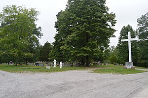
Imagine a whole town built around digging for coal! The Barren Fork Coal Camp and Mine Archeological District is one such place. It's located north of Whitley City, Kentucky, on Barren Fork Road. This area was added to the National Register on September 23, 1997.
This district isn't just one building; it's an entire area where people lived and worked in a coal mining community. An "archeological district" means that experts study the remains of old buildings and tools found here. They learn about how people lived, what their homes were like, and how they mined coal. It's like a giant outdoor history puzzle!
Stearns Administrative and Commercial District
The town of Stearns, Kentucky, has its own special historic area called the Stearns Administrative and Commercial District. This district was added to the National Register on November 16, 1988. You can find it along Old U.S. Route 27.
This area was once the busy heart of the Stearns Coal and Lumber Company. It includes buildings where the company's business was managed, as well as shops and other places where people in the town worked and bought things. It shows us how important the coal and lumber industries were to Stearns and how a company could shape an entire community.
Stearns Golf Course
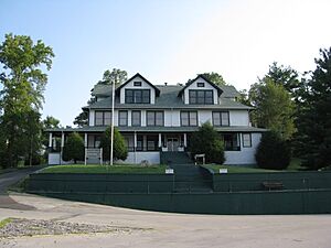
Did you know a golf course could be historic? The Stearns Golf Course, located at 131 Clubhouse Drive in Stearns, Kentucky, was added to the National Register on September 29, 2015.
This golf course isn't just a place to play a game; it's important because of its connection to the history of the Stearns community. Often, historic golf courses are recognized for their unique design, their age, or their role in the social life of a town. It's a great example of how even places we use for fun today can have a rich past!


