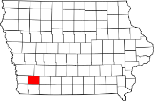
National Register of Historic Places listings in Montgomery County, Iowa facts for kids
Have you ever wondered about the old buildings and special places in your town? Many of these places have amazing stories to tell! In Montgomery County, Iowa, there's a special list of places called the National Register of Historic Places. This list helps protect buildings, areas, and objects that are important to American history. When a place is on this list, it means it's recognized for its unique past, beautiful design, or connection to important events.
Think of it like a hall of fame for historic sites! People can visit these places to learn about how life used to be. In Montgomery County, there are 19 places currently on this list, and one place that used to be on it. These sites are spread across different towns like Red Oak, Elliott, Grant, Pilot Grove Township, Washington Township, and Villisca.
Contents
What is the National Register of Historic Places?
The National Register of Historic Places is the official list of the nation's historic places that are worth saving. It's part of a program by the United States government to help people understand and protect important parts of our history. When a building or place is added to this list, it means it has special meaning because of its age, its unique architecture, or the important events or people connected to it.
Being on the National Register doesn't stop people from changing a property, but it does encourage them to think about its history. It can also help owners get special grants or tax breaks to help care for these historic places. It's all about celebrating and preserving the stories that these places hold for future generations.
Historic Places in Montgomery County
Montgomery County is home to many interesting places that have been added to the National Register. These sites include old parks, train stations, farmsteads, and even a courthouse. Each one tells a different part of the county's story, from its early days to more recent times.
Chautauqua Park in Red Oak
One of the oldest places on the list is Chautauqua Park in Red Oak. It was added to the National Register in 1972. This park was once a popular spot for Chautauqua events. Chautauquas were like traveling shows or festivals that offered education, entertainment, and culture to communities across America in the late 1800s and early 1900s. People would gather in parks like this one to listen to speakers, enjoy music, and learn new things.
Old Train Depot in Red Oak
The Chicago, Burlington Northern and Quincy Depot in Red Oak is another important site. This old train station was listed in 1999. Train stations were once very busy places, connecting towns and cities and helping people and goods travel across the country. This depot reminds us of a time when trains were a main way to get around and how important they were for the growth of towns like Red Oak.
Montgomery County Courthouse
The Montgomery County Courthouse in Red Oak is a grand building that was added to the list in 1981. Courthouses are usually very important buildings in a county. They are where local government decisions are made, and where many important records are kept. This courthouse has been a center of community life and law for many years.
Historic Districts in the County
Some listings are not just single buildings but entire areas called "historic districts." These districts include several buildings or places that together tell a bigger story.
- The William and Amanda J. Ellis Farmstead Historic District near Elliott was listed in 2015. A farmstead is a group of buildings on a farm, and this one shows what farming life was like in the past.
- The Grant Commercial Historic District in Grant, listed in 2002, includes parts of 2nd Street and U Avenue. This area was once the main business center of Grant, showing how towns grew and developed.
- The Red Oak Downtown Historic District was added in 2016. This district covers a large part of downtown Red Oak, including many historic shops and buildings. It helps preserve the look and feel of the town's historic center.
Unique Structures: Round Barns
Montgomery County is also home to some unique buildings, like the Round Barn, Pilot Grove Township and the Round Barn, Washington Township. Both of these round barns were listed in 1986. Round barns are special because they are not shaped like typical rectangular barns. Farmers built them this way for different reasons, like being more efficient for feeding animals or being stronger against winds. They are a cool example of different building styles from the past.
Other Notable Sites
- The Thos. D. Murphy Co. Factory and Power Plant in Red Oak, listed in 2008, tells the story of local industry. This company was known for printing calendars and other advertising materials.
- The Nodaway River Bridge near Grant, listed in 1998, is an old bridge that is now part of a pedestrian path. Bridges are important for connecting communities and helping people travel.
- The Red Oak Public Library, listed in 1983, is a beautiful building that has served as a place for learning and reading for many years.
- The Villisca National Guard Armory in Villisca, listed in 2015, was a place where the National Guard trained. Armories are important for understanding military history and community defense.
Former Listings
Sometimes, a place might be removed from the National Register. This can happen if the building is changed too much, or if it is no longer standing. In Montgomery County, the B. F. Runnels House near Red Oak was once on the list but was removed in 2000.
These historic places in Montgomery County help us remember the past and understand how our communities have grown and changed over time. They are important treasures that connect us to the people and events that came before us.
Images for kids


