National Register of Historic Places listings in Owyhee County, Idaho facts for kids
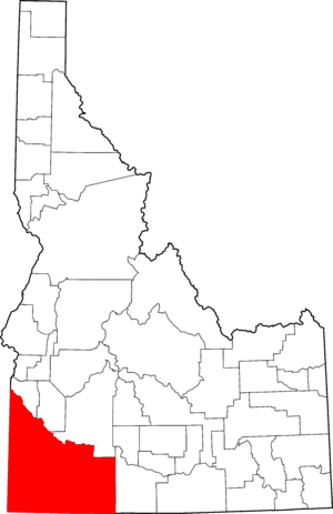
Welcome to Owyhee County, Idaho! This place is full of history, and many important spots are listed on the National Register of Historic Places. This special list helps protect buildings, places, and objects that are important to American history. Think of it like a hall of fame for historic sites!
In Owyhee County, there are 14 different places that have made it onto this list. These sites help us learn about the past, from old churches and courthouses to places where people used to live and work long ago. Let's explore some of these amazing historic spots!
Contents
What is the National Register of Historic Places?
The National Register of Historic Places is the official list of places in the United States that are important to our history. It's like a special honor roll for historic buildings, sites, structures, objects, and districts. When a place is added to this list, it means it's worth saving and learning about.
Why are places listed?
Places are listed for many reasons. They might be important because of their age, their unique design, or because famous events happened there. Sometimes, they are listed because they show us how people lived a long time ago. Listing a place helps protect it and makes sure future generations can also enjoy and learn from it.
Historic Sites in Owyhee County
Owyhee County has a rich past, with many stories to tell. From old travel routes to mining towns, these sites give us a peek into what life was like in Idaho's early days.
Bernard's Ferry
Imagine a time before bridges were common! Bernard's Ferry was a very important crossing point on the Snake River. It helped people and goods move across the river, connecting different parts of the region. This ferry played a big role in travel and trade many years ago. It's located north of Murphy, off State Highway 78.
Bruneau Episcopal Church
The Bruneau Episcopal Church is a beautiful old church in the town of Bruneau. Built a long time ago, it shows us the kind of buildings people constructed in the past. Churches like this were often central to community life, serving as places for worship and gatherings. You can find it off State Highway 51.
Delamar Historic District
Have you ever heard of a ghost town? The Delamar Historic District is a fascinating example! It's a mining ghost town located about six miles west of Silver City. In the late 1800s, Delamar was a busy place, full of miners hoping to strike it rich. Today, it's a quiet reminder of Idaho's mining history, showing us what life was like in a booming mining camp.
Guffey Butte – Black Butte Archeological District
This large area along the Snake River is an archeological district. This means it's a place where scientists study the past by digging up old tools, campsites, and other things left behind by ancient people. The Guffey Butte – Black Butte Archeological District helps us understand how early humans lived in this part of Idaho thousands of years ago. It covers parts of several counties, including Owyhee.
Noble Horse Barn
The Noble Horse Barn is an old barn located southwest of Murphy. Barns like this were essential for farming and ranching, which were very important activities in Owyhee County's history. This barn is a great example of the kind of structures built to support the agricultural way of life.
Our Lady, Queen of Heaven Church
Another historic church in Owyhee County is Our Lady, Queen of Heaven Church in Oreana. This church, built many years ago, stands as a testament to the community's faith and history. It's a significant landmark in the area, showing the architectural styles and community spirit of its time.
Owyhee County Courthouse
The Owyhee County Courthouse in Murphy is a very important building. Courthouses are where local government happens, and where important records are kept. This building has seen many decisions made and many historical events unfold over the years. It's a symbol of the county's government and history, located right on State Highway 78.
Poison Creek Stage Station
Imagine traveling across Idaho in a horse-drawn stagecoach! The Poison Creek Stage Station was a stop along an old stagecoach route. These stations were vital places where travelers could rest, change horses, and get food. This station tells us about the challenges and adventures of travel in the old West. It's located south of Homedale.
Silver City Historic District
Silver City is another amazing historic district in Owyhee County. Like Delamar, it was once a bustling mining town, famous for its silver mines. Today, Silver City is a well-preserved ghost town that looks much like it did over a hundred years ago. Walking through Silver City is like stepping back in time, with old buildings and streets that tell stories of the mining boom.
Wickahoney Post Office and Stage Station
Similar to Poison Creek, the Wickahoney Post Office and Stage Station was an important stop for mail and travelers. Post offices were crucial for communication, connecting people across long distances. This station highlights the importance of mail delivery and stagecoach travel in developing the region. It's located near Wickahoney Creek.
Images for kids


