
National Register of Historic Places listings in Riley County, Kansas facts for kids

Welcome to Riley County, Kansas! Did you know that many special buildings and places here are protected because of their history? These places are listed on something called the National Register of Historic Places. It's like a special list of important landmarks across the United States.
When a place is on this list, it means it has a unique story or is a great example of old architecture. It helps make sure these places are kept safe for future generations to enjoy and learn from. In Riley County, there are 40 different buildings and areas that have earned a spot on this important list. Let's explore some of them!
Contents
What is the National Register of Historic Places?
The National Register of Historic Places is the official list of the nation's historic places. It is part of a program to help identify and protect America's historic and archaeological resources. These places can be buildings, structures, objects, sites, or even entire historic districts.
Why are places listed?
Places are added to the National Register for many reasons. They might be important because of their history, like where a famous event happened. They could also be special because of their design or how they were built. Sometimes, they are important because of a famous person who lived or worked there. Being on the list helps people understand and value these historic treasures. It also encourages their preservation.
Historic Places in Riley County
Riley County has many fascinating places on the National Register. Each one tells a part of the area's rich history.
Anderson Hall

Anderson Hall is a very important building on the Kansas State University campus in Manhattan. It was built a long time ago, and it's known for its beautiful architecture. This building has been a central part of the university's history for many years. It was added to the National Register in 1980.
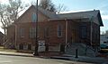
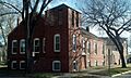
Bethel A.M.E. Church

The Bethel A.M.E. Church is located on Yuma Street in Manhattan. This church has been a vital part of the community for a long time. It served as an important gathering place for its members. The church was recognized for its historical significance in 2012.
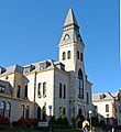
Downtown Manhattan Historic District

Instead of just one building, the Downtown Manhattan Historic District is a whole area! It includes several blocks in the heart of Manhattan. This district is special because it shows what downtown Manhattan looked like many years ago. It has many old buildings that tell the story of the city's growth. This entire district was added to the National Register in 2007.
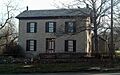
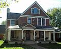
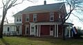
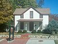
Goodnow House

The Goodnow House is a historic home on Claflin Road in Manhattan. It belonged to Isaac Goodnow, who was a very important person in the early history of Kansas and Kansas State University. This house gives us a peek into what life was like for important figures in the past. It became a protected historic site in 1971.
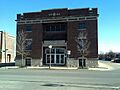
Manhattan Carnegie Library Building

The Manhattan Carnegie Library Building is a beautiful old building located at 5th Street and Poyntz Avenue. It was one of many libraries built across the country with money from Andrew Carnegie, a famous businessman. These libraries were important for education and community life. This building was listed in 1987.
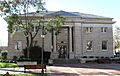
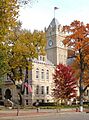
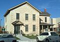
Riley County Courthouse
_County_Courthouse_1.jpg)
The Riley County Courthouse is the main building for the county government. It's located on Courthouse Plaza in Manhattan. Courthouses are often important landmarks in a city. They represent justice and local government. This courthouse was recognized for its historical value in 2005.
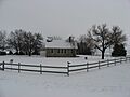
Rocky Ford School

The Rocky Ford School is an old school building on Barnes Road in Manhattan. Schools are often central to a community's history, showing how education has changed over time. This building served many students over the years. It was added to the National Register in 2012.
Images for kids
-
Anderson Hall at Kansas State University
-
Bethel A.M.E. Church
-
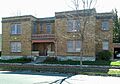
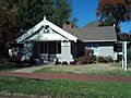
Community House
-
Downtown Manhattan Historic District
-
Mattie M. Elliot House
-
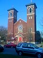
First Congregational Church
-
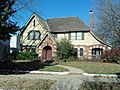
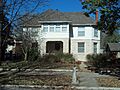
Leslie A. Fitz House
-
Goodnow House
-
Hulse-Daughters House
-
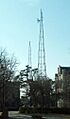
KSAC Radio Towers
-
Lyda-Jean Apartments
-
Manhattan Carnegie Library Building
-
Jeremiah Platt House
-
Riley County Courthouse
-
Rocky Ford School
-
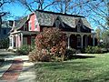
Damon Runyon House
-
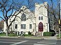
Second Baptist Church
-
Seven Dolors Catholic Church
-
Strasser House
-
Robert Ulrich House
-
E. A. and Ura Wharton House
-
Woman's Club House


