
National Register of Historic Places listings in Rio Arriba County, New Mexico facts for kids

This article is about special places in Rio Arriba County, New Mexico, that are listed on the National Register of Historic Places. Think of the National Register as an official list of buildings, sites, and objects that are important to the history of the United States. These places are worth protecting and remembering!
Rio Arriba County has many amazing historic spots. There are 116 places on this list, and three of them are even more special, called National Historic Landmarks. These landmarks are recognized as being important to the entire country's history.
What is the National Register of Historic Places?
The National Register of Historic Places is like a treasure map for history! It's the official list of places in the United States that are important for their history, architecture, archaeology, engineering, or culture. When a place is added to this list, it means it's recognized for its special value and efforts are made to preserve it for future generations.
Why are places listed?
Places get listed for many reasons. Maybe an important event happened there, or a famous person lived there. Sometimes, buildings are listed because they show a unique style of architecture. Ancient ruins or archaeological sites are also listed to protect clues about how people lived long ago.
Amazing Historic Places in Rio Arriba County
Rio Arriba County is full of history, from ancient Native American sites to old towns and important buildings. Here are a few examples of the cool places you can find on the National Register.
Ancient Sites and Pueblos
Many of the listed places are ancient sites, showing us where people lived thousands of years ago. These sites often include old villages, cliff dwellings, or places where people made rock art.
- Adolfo Canyon Site (LA 5665): This is an archaeological site near Tierra Amarilla. It gives us clues about early communities in the area.
- Crow Canyon Archaeological District: This large area near Farmington is super important for understanding ancient cultures. It even has cool rock carvings called petroglyphs!
- Frances Canyon Ruin: Located near Blanco, this ruin tells us about the people who lived here long ago.
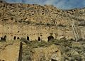
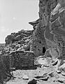
- Puye Cliff Dwellings: Near Espanola, these amazing cliff dwellings were once home to early Pueblo people. You can see homes carved into the cliffs and ruins of a large pueblo on top of the mesa. It's a National Historic Landmark!
- San Gabriel de Yungue-Ouinge: This site near Espanola is historically significant because it was the first capital of New Mexico when the Spanish arrived. It's also a National Historic Landmark.
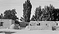
- Ohkay Owingeh Pueblo: This is a living Native American pueblo that has been continuously inhabited for centuries. It's a vibrant community with deep historical roots.
- Santa Clara Pueblo: Another historic Pueblo community south of Espanola, known for its rich culture and traditions.
- Mesa Prieta Petroglyphs: Near Velarde, this site has thousands of ancient rock carvings, offering a glimpse into the art and beliefs of early people.
Historic Towns and Buildings
Rio Arriba County also has many historic buildings and entire districts that tell the story of more recent times, like the early days of New Mexico as a territory and state.
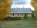
- Frank Bond House: Located in Espanola, this house is an important example of historic architecture in the area.
- Embudo Historic District: The town of Embudo, along State Road 68, has a historic district that shows what a traditional New Mexico community looked like.
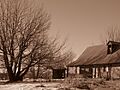
- Foster Hotel: In Chama, this old hotel is a reminder of the town's past, especially when railroads were a big deal.
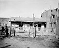
- Jicarilla Apache Historic District: In Dulce, this district highlights the history and culture of the Jicarilla Apache Nation.
- Los Luceros Hacienda: This beautiful historic estate near Los Luceros gives us a look into the grand homes of New Mexico's past.
- Los Ojos (Parkview) Historic District: This district in Los Ojos shows the traditional layout and buildings of a historic New Mexico village.
- Tierra Amarilla Historic District: The town of Tierra Amarilla also has a historic district that preserves its unique history and architecture.
- E.D. Chimayo Trading Post and Trujillo House: In Espanola, this trading post was an important place for commerce and community life.
Railroads and Transportation
Railroads played a huge role in developing New Mexico. Some historic listings celebrate this part of the past.
- Cumbres and Toltec Scenic Railroad: This amazing railroad, stretching between Antonito, Colorado, and Chama, New Mexico, is a National Historic Landmark. It's one of the best-preserved narrow-gauge steam railroads in the country, offering scenic rides through beautiful landscapes.
- Rio Grande Bridge at San Juan Pueblo: This bridge over the Rio Grande near Alcalde is an important part of the region's transportation history.
Famous Homes
Sometimes, a place is famous because of the person who lived there.
- Georgia O'Keeffe Home and Studio: In Abiquiú, this was the home and studio of the famous American artist Georgia O'Keeffe. She was inspired by the New Mexico landscape, and her home is now a National Historic Landmark.
Community Ditches
You might wonder why a ditch is historic! In New Mexico, water is incredibly important. Community ditches, called acequias, are ancient irrigation systems that bring water from rivers to farms and villages. They are a vital part of the culture and history of many communities.
- El Barranco Community Ditch, El Porvenir Community Ditch, Encenada Community Ditch, La Puente Community Ditch, Parkview Community Ditch, Plaza Blanca Community Ditch, and Tierra Amarilla Community Ditch: These are all examples of historic acequias in Rio Arriba County that have been used for generations to support farming and life in these communities.
Images for kids
-
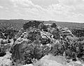
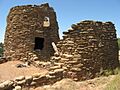
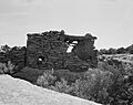
Adolfo Canyon Pueblito
-
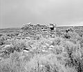
Crow Canyon Pueblito
-
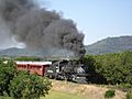
A train on the Cumbres and Toltec Scenic Railroad
-
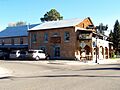
Embudo Station
-
Foster Hotel in Chama
-
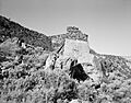
Frances Canyon Ruin
-
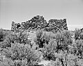
Gomez Canyon Ruin
-
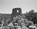
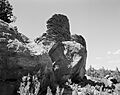
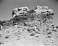
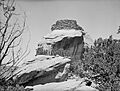
Gould Pass Ruin
-
Hill Road Ruin
-
Hooded Fire Pueblito
-
Kin Naa Daa Pueblito
-
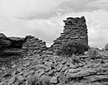
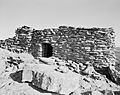
Largo School Ruin
-
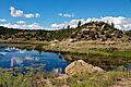
Dulce Lake in the Jicarilla Apache Historic District
-
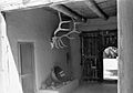
Georgia O'Keeffe Home and Studio
-
Pointed Butte Ruin
-
Puye Cliff Dwellings
-
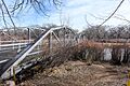
Rio Grande Bridge at San Juan Pueblo
-
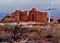
San Gabriel de Yungue-Ouinge
-
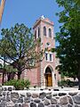
San Juan Bautista Church at Ohkay Owingeh Pueblo
-
Samuel Sanchez House
-
Sanchez-March House
-
Santa Clara Pueblo
-
Santa Rosa de Lima de Abiquiu
-
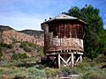
Shaft House
-
Split Rock Ruin
-
Tapicito Ruin
-
Tsama Pueblo


.jpg)


