
National Register of Historic Places listings in St. Johns County, Florida facts for kids

Welcome to St. Johns County, Florida! This area is full of amazing places that are super important to American history. Many of these special spots are listed on the National Register of Historic Places. This means they are recognized by the United States government for their historical value and are protected so future generations can enjoy them.
In St. Johns County, there are 55 places and areas on this list. Six of these are even more special and are called National Historic Landmarks. These landmarks are considered to be among the most important historical sites in the entire country! Let's explore some of these cool places.
Contents
Famous Forts and Landmarks
Castillo de San Marcos National Monument

One of the most famous landmarks in St. Johns County is the Castillo de San Marcos National Monument. This huge fort was built by the Spanish a long, long time ago to protect their land. It's made of a special stone called coquina, which is a type of limestone formed from ancient shells. The fort has stood strong for centuries, surviving many battles and hurricanes. It's a fantastic place to visit and imagine what life was like for soldiers hundreds of years ago.
Fort Matanzas National Monument

About 15 miles south of St. Augustine, you'll find another historic fort called Fort Matanzas National Monument. This smaller fort was also built by the Spanish to guard the Matanzas Inlet, preventing enemies from sneaking into St. Augustine by water. It's a great example of how important these waterways were for defense. You can even take a short boat ride to get to the fort, which makes the visit even more exciting!
Second Fort Mose Site

The Second Fort Mose Site is incredibly important because it was the first free African settlement in what would become the United States. In the 1700s, enslaved Africans who escaped from British colonies found freedom here under Spanish rule. This site, now a state park, tells a powerful story of courage and the fight for freedom. It's a National Historic Landmark because of its unique role in American history.
Historic Buildings and Districts
Hotel Ponce De Leon (Flagler College)

The Hotel Ponce De Leon is a stunning building that was once a fancy hotel built by Henry Flagler, a famous businessman, in the late 1800s. Today, it's home to Flagler College, but you can still see its amazing architecture, beautiful stained glass, and grand halls. It was one of the first large buildings in the United States to be built with poured concrete, which was a very new idea at the time!
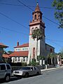
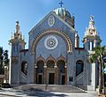
Cathedral Basilica of St. Augustine

The Cathedral Basilica of St. Augustine is a very old and important church. It's the oldest Catholic church in Florida and has been a place of worship for centuries. Its beautiful architecture and long history make it a significant landmark in the city.
Gonzalez-Alvarez House

The Gonzalez-Alvarez House is known as the "Oldest House" in St. Augustine. It has parts that date back to the early 1700s, making it a rare example of Spanish colonial architecture. It shows how people lived in St. Augustine during different periods of its history.
Llambias House

Another very old and well-preserved house is the Llambias House. Built in the 1760s, it's a great example of Spanish colonial homes. It helps us understand the daily lives of early settlers in St. Augustine.
St. Augustine Town Plan Historic District

The St. Augustine Town Plan Historic District isn't just one building; it's a whole area! It includes the original layout of the city, which was designed by the Spanish. Walking through this district feels like stepping back in time, with its narrow streets and historic buildings that show how the city grew over hundreds of years.
Lightner Museum (Alcazar Hotel)

The Alcazar Hotel, now known as the Lightner Museum, was another grand hotel built by Henry Flagler. It was designed to be a luxurious resort with a huge swimming pool and many fancy rooms. Today, it houses a museum with amazing collections, including art, furniture, and even shrunken heads!
Bridge of Lions

The Bridge of Lions is a famous landmark that connects downtown St. Augustine to Anastasia Island. It's known for the two marble lion statues that guard its entrance. The bridge is a beautiful example of early 20th-century bridge design and offers great views of the city and the Matanzas Bay.
Old St. Johns County Jail

The Old St. Johns County Jail looks like a castle, but it was actually a jail built in 1891. It was designed to look less like a typical jail and more like the other grand buildings in St. Augustine. Today, you can take a tour and learn about what life was like for prisoners and jailers over a hundred years ago.
St. Augustine Lighthouse and Keeper's Quarters

The St. Augustine Lighthouse and Keeper's Quarters is a tall, striped lighthouse that has guided ships safely to shore for many years. You can climb to the top for incredible views of the coast. The keeper's quarters, where the lighthouse keepers and their families lived, are also part of the historic site.
Other Interesting Historic Places
Fountain of Youth Archeological Park

The Fountain of Youth Archeological Park is a famous site linked to the legend of explorer Ponce de León, who was said to be searching for a magical fountain that would make people young forever. While the legend is fun, the park is actually an important archaeological site where scientists have found evidence of the first Spanish settlement in St. Augustine and Native American villages.
St. Augustine Alligator Farm Historic District

The St. Augustine Alligator Farm Historic District is home to one of Florida's oldest and most famous animal attractions. It started in the late 1800s and has grown into a popular zoo focused on reptiles, especially alligators and crocodiles. It's a fun place to learn about these amazing creatures and the history of animal parks.
Spanish Coquina Quarries

The Spanish Coquina Quarries are located in Anastasia State Park. This is where the Spanish mined the coquina stone that was used to build the Castillo de San Marcos and many other historic buildings in St. Augustine. You can still see the marks left by the tools used to cut the stone centuries ago.
These are just a few of the many amazing historic places you can find in St. Johns County, Florida. Each one tells a unique story about the past, helping us understand how this area and the United States came to be.
Images for kids
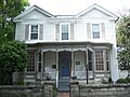
-
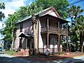
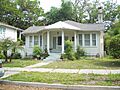
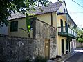
A home in the Abbott Tract Historic District.
-
The Avero House.
-
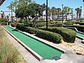
The City of St. Augustine Miniature Golf Course.
-
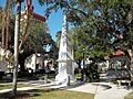
The Constitution Obelisk in Plaza de la Constitution.
-

A section of the Dixie Highway.
-
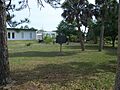
The Fort Matanzas National Monument Headquarters and Visitor Center.
-
A house in the Fullerwood Park Residential Historic District.
-
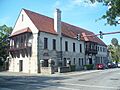
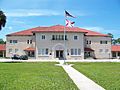
The Government House in St. Augustine.
-
Grace United Methodist Church.
-
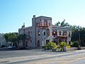
The Hastings Community Center.
-
Hastings High School.
-
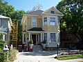
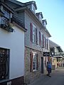
A house in the Lincolnville Historic District.
-
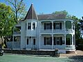
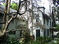
The Lindsley House.
-
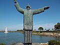
The Father Francisco Lopez Statue.
-
The Xavier Lopez House.
-
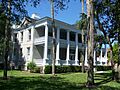
Markland in St. Augustine.
-
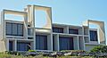
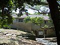
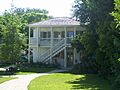
The Arthur Milam House in Ponte Vedra Beach.
-
A building in the Model Land Company Historic District.
-
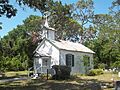
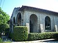
Moultrie Church.
-
A street in the Nelmar Terrace Historic District.
-
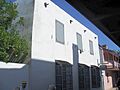
A building in the North City Historic District.
-
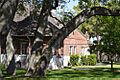
The O'Reilly House.
-
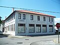
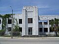
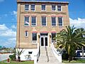
The Record Building.
-
The Rodriguez-Avero-Sanchez House.
-
The St. Augustine Civic Center.
-
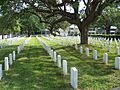
The St. Augustine National Cemetery.
-
The St. Augustine Water Works.
-
The Sanchez Homestead.
-
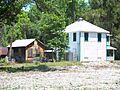
The area of the Sanchez Powder House Site.
-
The Solla-Carcaba Cigar Factory.
-
The Stanbury Cottage.
-
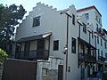
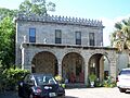
Villa Zorayda.
-
The Horace Walker House.
-
The Ximenez-Fatio House.


.jpg)


