National Register of Historic Places listings in Ste facts for kids
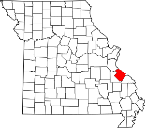
This is a list of the National Register of Historic Places listings in Ste. Genevieve County, Missouri.
This is intended to be a complete list of the properties and districts on the National Register of Historic Places in Ste. Genevieve County, Missouri, United States. Latitude and longitude coordinates are provided for many National Register properties and districts; these locations may be seen together in a map.
There are 6 properties and districts listed on the National Register in the county, including 2 National Historic Landmarks.
Current listings
| Name on the Register | Image | Date listed | Location | City or town | Description | |
|---|---|---|---|---|---|---|
| 1 | Louis Bolduc House |
(#69000305) |
123 S. Main St. 37°59′21″N 90°03′13″W / 37.989167°N 90.053611°W |
Ste. Genevieve | ||
| 2 | Common Field Archeological Site |
(#69000306) |
Northern side of Cotton Woods Rd., east of its junction with U.S. Route 61 37°57′22″N 90°00′50″W / 37.956111°N 90.013889°W |
Ste. Genevieve | ||
| 3 | Jacques Dubreuil Guibourd House |
(#69000307) |
Northwestern corner of 4th and Merchant Sts. 37°58′46″N 90°02′52″W / 37.979444°N 90.047778°W |
Ste. Genevieve | ||
| 4 | Kreilich Archeological Site |
(#69000308) |
Along U.S. Route 61 at the junction of Saline Creek and the old Mississippi River bed 37°54′03″N 89°58′34″W / 37.900833°N 89.976111°W |
Ste. Genevieve | ||
| 5 | Ste. Genevieve Historic District |
(#66000892) |
Most of central Ste. Genevieve and riverfront farmlands 37°58′47″N 90°01′55″W / 37.979849°N 90.031980°W |
Ste. Genevieve | Landmark district listed for its 18th-century French buildings and landscape. | |
| 6 | Ste. Genevieve Historic District |
(#02000357) |
Toughly bounded by Main St. and St. Mary's Rd., Roberts, 7th, and Seraphin Sts. 37°58′44″N 90°02′35″W / 37.978889°N 90.043111°W |
Ste. Genevieve | Historic district encompassing most of the built center of the city, listed for 19th and 20th-century architectural history. |

All content from Kiddle encyclopedia articles (including the article images and facts) can be freely used under Attribution-ShareAlike license, unless stated otherwise. Cite this article:
National Register of Historic Places listings in Ste Facts for Kids. Kiddle Encyclopedia.


