National Register of Historic Places listings in Union County, Kentucky facts for kids
Have you ever wondered about old buildings and places that are super important to history? In Union County, Kentucky, there are some really special spots that are listed on the National Register of Historic Places. This is like a special list kept by the United States government. It helps protect places that are important because of their history, amazing architecture, or what happened there.
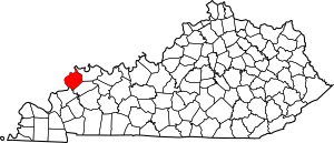
These places tell us stories about the past. They help us understand how people lived long ago and what events shaped our country. Union County has 7 of these amazing places. You can even see where they are on a map if you know their exact location!
What is the National Register of Historic Places?
The National Register of Historic Places is the official list of the nation's historic places worth saving. It's like a hall of fame for buildings, structures, objects, sites, and districts that are important to American history. When a place is on this list, it means it's recognized for its special value.
Why are places added to the list?
Places are added for many reasons. Maybe they are very old and show how people built things a long time ago. Perhaps an important person lived there, or a big event happened there. Sometimes, a whole area is listed because it has many historic buildings together.
How does it help?
Being on the list helps protect these places. It can also make it easier for owners to get grants or tax breaks to help fix up and preserve the historic property. This way, future generations can also learn from and enjoy these important parts of our past.
Historic Places in Union County
Union County has several fascinating places on this special list. Let's take a look at some of them and what makes them unique.
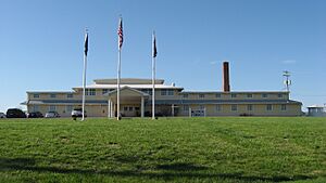
Camp Breckinridge Non-Commissioned Officers' Club
This building is located at 1116 N. Village Road in Morganfield, Kentucky. It was added to the National Register on August 14, 2001. This club was part of Camp Breckinridge, a large military training camp used during World War II and the Korean War. It was a place where non-commissioned officers, who are important leaders in the military, could relax and socialize.
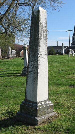
Confederate Monument of Morganfield
You can find this monument in the city cemetery in Morganfield, Kentucky, at the junction of W. O'Bannon and S. Townsend Streets. It was listed on July 17, 1997. This monument honors soldiers who fought in the American Civil War. Many towns have similar monuments that remember the people and events of this important time in American history.
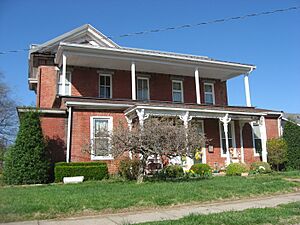
Daniel H. Hughes House
The Daniel H. Hughes House is a historic home located at 213 W. O'Bannon Street in Morganfield, Kentucky. It was added to the list on May 27, 1980. This house is a great example of the architecture from its time. It shows us how people lived and built their homes in the past.
Morganfield Commercial District
The Morganfield Commercial District includes parts of Main, Court, and Morgan Streets in Morganfield, Kentucky. This area was recognized on July 19, 1984. A "commercial district" means an area where businesses are located. This district is important because it shows how the town's businesses and shops developed over time. The buildings here tell a story about the town's economic history.
George N. Proctor House
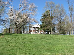
The George N. Proctor House is located near Waverly, Kentucky, on Kentucky Route 1180. It was added to the National Register on October 1, 1990. This house is another example of important historical architecture in Union County. It helps us understand the styles and ways of life from when it was built.
Saline Island
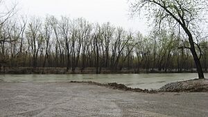
Saline Island is a unique natural and historical site located in the Ohio River, near Curlew, Kentucky. It was listed on October 30, 1998. Even though it's on the Illinois side of the river, it's connected to the history of this part of Kentucky. Islands like Saline Island often played a role in river travel and trade in earlier times.
Union County Courthouse
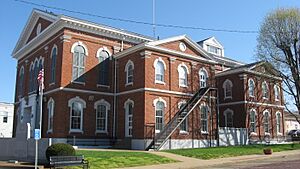
The Union County Courthouse is on Main Street in Morganfield, Kentucky. It was added to the National Register on November 17, 1978. A courthouse is a very important building in any county. It's where legal matters are handled, and many important decisions about the community are made. This building has seen a lot of history happen within its walls.
These places are all important pieces of Union County's history. They help us remember the past and understand how our communities grew and changed over time.


