National Register of Historic Places listings in Wabasha County, Minnesota facts for kids
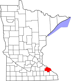
Welcome to Wabasha County, Minnesota! This page is all about the amazing and historic places in the county that are listed on the National Register of Historic Places. Think of the National Register as a special list of buildings, sites, and objects across the United States that are important to our history and culture. When a place is on this list, it means it's worth protecting and remembering for future generations.
In Wabasha County, there are 25 different places on this important list. We'll explore some of these cool spots, from old houses and churches to bridges and even ancient campsites. Get ready to discover the stories behind these special landmarks!
Contents
- Cool Historic Places in Wabasha County
- Bear Valley Grange Hall: A Community Hub
- Bridge No. 5827-Zumbro Falls: A WPA Project
- William H. and Alma Downer Campbell House: A Grand Home
- Lorenz and Lugerde Ginthner House: Detailed Italianate Style
- Grace Memorial Episcopal Church: Designed by a Famous Architect
- Historic Anderson House Hotel: A River Town Landmark
- King Coulee Site: An Ancient Campsite
- Lucas Kuehn House: Wabasha's First Italianate Home
- Lake City and Rochester Stage Road: An Early Highway
- Lake City City Hall: A Prominent Public Building
- Lake Zumbro Hydroelectric Generating Plant: Power from Water
- Patrick H. Rahilly House: A Rural Italian Villa
- Reads Landing Overlook: A Scenic Viewpoint
- Reads Landing School: A Historic Schoolhouse
- Clara and Julius Schmidt House: Distinctive Brick Home
- Henry S. and Magdalena Schwedes House: Peak Italianate Style
- James C. and Agnes M. Stout House: A Carpenter Gothic Gem
- Swedish Evangelical Lutheran Church: A Church for Many
- Alexander Thoirs House: Wabasha's Oldest Brick House
- Wabasha Commercial Historic District: A Busy Downtown
- Wabasha County Poor House: A Look at Social Care
- Walnut Street Bridge: An Engineer's Masterpiece
- Weaver Mercantile Building: A River Town Relic
- Williamson–Russell–Rahilly House: Elegant Architecture
- Zumbro Parkway Bridge: A New Deal Bridge
- Former Listings
Cool Historic Places in Wabasha County
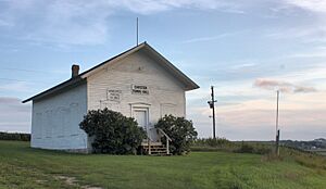
Bear Valley Grange Hall: A Community Hub
The Bear Valley Grange Hall is a super old building from 1874. It's the only Grange hall left in Wabasha County! A Grange was like a community center for farmers. This one is special because the members actually built it themselves, instead of just using an existing building.
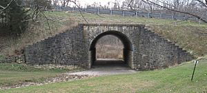
Bridge No. 5827-Zumbro Falls: A WPA Project
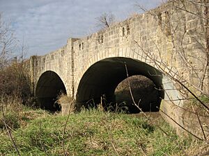
Check out Bridge No. 5827 in Zumbro Falls. This cool arch bridge was built in 1938. It was part of the Works Progress Administration (WPA), a program during the Great Depression that helped people find jobs by building public projects. This bridge has a neat design with iron plates and a stone front.
William H. and Alma Downer Campbell House: A Grand Home
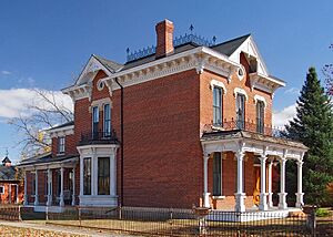
The William H. and Alma Downer Campbell House in Wabasha was one of the biggest and fanciest houses in town when it was built in 1874. It sits high up, looking over the downtown area. Imagine living in such a grand place back then!
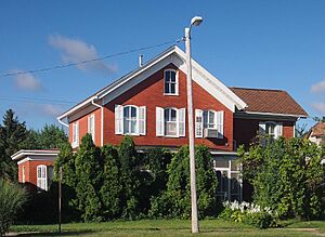
Lorenz and Lugerde Ginthner House: Detailed Italianate Style
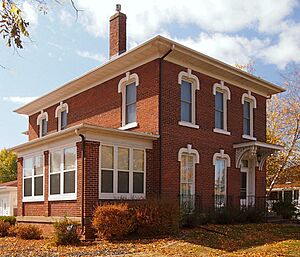
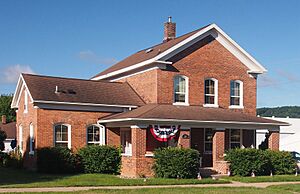
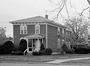
The Lorenz and Lugerde Ginthner House is an amazing example of Italianate architecture. Built in 1882, this house in Wabasha is known for its detailed design. It's one of the best-preserved "Red Brick Houses" in Wabasha, which were homes of important merchants.
Grace Memorial Episcopal Church: Designed by a Famous Architect
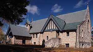
The Grace Memorial Episcopal Church in Wabasha is a beautiful church built in 1900. It's designed in the English Gothic style by a very famous architect named Cass Gilbert. He designed many important buildings, including the United States Supreme Court Building!
Historic Anderson House Hotel: A River Town Landmark
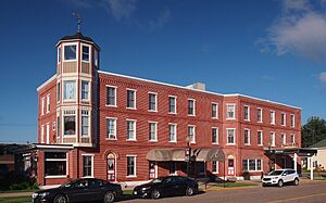
The Hurd House-Anderson Hotel in Wabasha dates back to 1856 and was made even bigger in 1887. This hotel was super important when Wabasha was growing fast as a center for river and train travel. It's a great example of the city's busy past.
King Coulee Site: An Ancient Campsite
The King Coulee Site near Lake City is a very old place. It was a campsite used by people thousands of years ago, from about 3500 BCE to 1000 CE. It helps us learn about the early people who lived in this area.
Lucas Kuehn House: Wabasha's First Italianate Home
The Lucas Kuehn House in Wabasha was built in 1878 and was the very first Italianate style house in the city. It was also the home of Lucas Kuehn, who was a leading merchant in Wabasha during the 1800s.
Lake City and Rochester Stage Road: An Early Highway
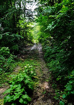
The Lake City and Rochester Stage Road-Mount Pleasant Section is a short part of an old road from 1858. This road was built for stagecoaches and helped connect Lake City with other parts of Minnesota. It was one of the first important roads in southeastern Minnesota.
Lake City City Hall: A Prominent Public Building
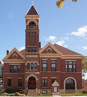
The Lake City City Hall was built in 1899. It's known as Lake City's most important public building because of its beautiful architecture. It has been the center of local government for a very long time.
Lake Zumbro Hydroelectric Generating Plant: Power from Water
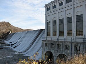
The Lake Zumbro Hydroelectric Generating Plant includes a powerhouse and dam built between 1917 and 1919. This plant uses the power of water to create electricity. It was designed by Hugh Lincoln Cooper, a famous engineer who built hydroelectric plants around the world. This is his only project in his home state of Minnesota!
Patrick H. Rahilly House: A Rural Italian Villa
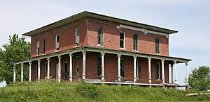
The Patrick H. Rahilly House is an 1880 home located west of Lake City. Patrick Rahilly was one of the first successful business owners and farmers in southern Minnesota. What's cool about this house is that it's an Italian Villa style home, which is usually found in cities, but this one is out in the countryside!
Reads Landing Overlook: A Scenic Viewpoint
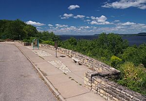
The Reads Landing Overlook was built between 1939 and 1940. It's a beautiful spot along U.S. Route 61 where you can stop and enjoy the view of Lake Pepin. This overlook was built during the Great Depression with federal help and was designed by landscape architect Arthur R. Nichols. It's a great example of the "National Park Service rustic" style.
Reads Landing School: A Historic Schoolhouse
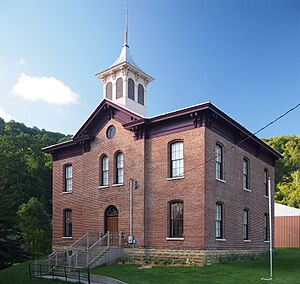
The Reads Landing School was built in 1870 and was one of the first brick schools in Minnesota. It shows how important Reads Landing was when it was a busy town for lumber milling. Today, this historic building is home to the Wabasha County Historical Society Museum.
Clara and Julius Schmidt House: Distinctive Brick Home
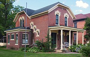
The Clara and Julius Schmidt House in Wabasha was built in 1888. It's another Italianate style brick house, like many built by the wealthy merchants of Wabasha in the late 1800s. This one is special because of its unique tinwork details.
Henry S. and Magdalena Schwedes House: Peak Italianate Style
The Henry S. and Magdalena Schwedes House was built in 1882. This house in Wabasha is a perfect example of the Italianate architecture style during its most popular time in the city.
James C. and Agnes M. Stout House: A Carpenter Gothic Gem
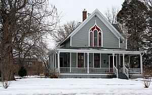
The James C. and Agnes M. Stout House in Lake City is a fantastic example of a Carpenter Gothic cottage. Built in 1872, it shows off the beautiful and detailed wooden designs typical of this style.
Swedish Evangelical Lutheran Church: A Church for Many
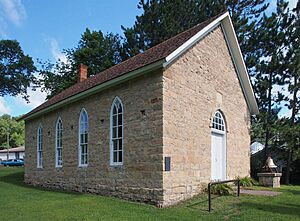
The Swedish Evangelical Lutheran Church in Millville is a small church from 1874 with a cemetery. It's special because it was used by Swedish, Norwegian, and German groups over time. It's the only old ethnic church left in Wabasha County from when many European immigrants came to the area.
Alexander Thoirs House: Wabasha's Oldest Brick House
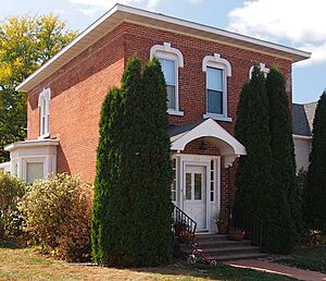
The Alexander Thoirs House in Wabasha was built in 1868. It's the oldest brick house still standing in the city and is built in the Greek Revival style. It's an early example of the brick merchant houses that became common in Wabasha in the 1800s.
Wabasha Commercial Historic District: A Busy Downtown
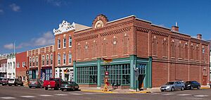
The Wabasha Commercial Historic District is a three-and-a-half block area along Main Street in Wabasha. This district is important because it still looks much like it did in the past, with many buildings built between 1856 and 1928. It shows how the city's downtown has stayed active and important over the years.
Wabasha County Poor House: A Look at Social Care
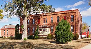
The Wabasha County Poor House is a rare example of how counties used to care for people who couldn't support themselves. It includes an 1879 hospital and an 1883 living hall. It gives us a glimpse into the history of social welfare in Minnesota.
Walnut Street Bridge: An Engineer's Masterpiece
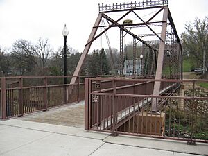
The Walnut Street Bridge in Mazeppa is a Pratt truss bridge built in 1904. It's known for its beautiful decorations and was designed by William S. Hewett, a notable Minnesota engineer and his bridge-building company.
Weaver Mercantile Building: A River Town Relic
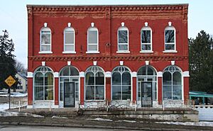
The Weaver Mercantile Building was built in 1875. It's a rare old store building left from when Weaver was a busy river town. It also shows a type of commercial Italianate architecture that was popular along the Upper Mississippi River.
Williamson–Russell–Rahilly House: Elegant Architecture
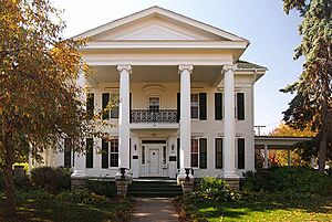
The Williamson–Russell–Rahilly House in Lake City was built around 1868 in the Greek Revival style. Later, around 1910, it was updated with a Neoclassical look. It's a beautiful example of the elegant homes built in Minnesota around the turn of the 20th century.
Zumbro Parkway Bridge: A New Deal Bridge
The Zumbro Parkway Bridge in Zumbro Falls was built in 1937. It's a double arch bridge with iron plates and a stone front. This bridge is one of the best examples of a style used in many of Minnesota's New Deal bridge projects, which were built to create jobs during the Great Depression.
Former Listings
Sometimes, a place might be removed from the National Register of Historic Places. This usually happens if the building is moved or changed so much that it no longer has its historic look or importance.
First Congregational Parsonage: A Moved Home
The First Congregational Parsonage in Wabasha was a beautiful 1872 home. It was known as one of Wabasha's best Italianate buildings made of wood. However, it was moved in 1987 to make way for the Wabasha–Nelson Bridge and was later removed from the National Register in 1992.


