Lake Pepin facts for kids
Quick facts for kids Lake Pepin |
|
|---|---|

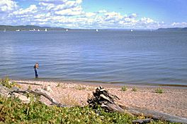
Lake from the Minnesota side
|
|
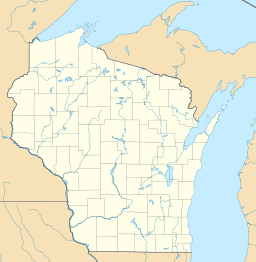
| Location | Goodhue / Wabasha counties in Minnesota and Pepin County, Wisconsin |
| Coordinates | 44°29′54″N 92°18′05″W / 44.4982°N 92.3013°W |
| Primary inflows | Mississippi River |
| Primary outflows | Mississippi River |
| Basin countries | United States |
| Surface area | 45.7 sq mi (118 km2) |
| Average depth | 21 ft (6.4 m) |
| Max. depth | 60 ft (18 m) |
| Frozen | winter |
| Settlements | Lake City, Bay City, Pepin, Maiden Rock, Stockholm, Maple Springs, Camp Lacupolis, Reads Landing |
Lake Pepin is a natural lake located on the Mississippi River. It sits right on the border between the states of Minnesota and Wisconsin. This unique lake formed long ago in a valley. This valley was carved out by a huge river that flowed from a glacial lake at the end of the last Ice Age.
The lake came to be when the Mississippi River, which followed the path of the ancient glacial river, was partly blocked. This blockage happened because a smaller river, the Chippewa River, dumped a lot of sand and dirt into the main valley. This created a natural dam, causing the water to spread out and form Lake Pepin.
Today, Lake Pepin is an important pathway for boats, cars, and trains. It is also famous as the place where water skiing was invented! Many people visit the lake for fun activities like boating and fishing.
Contents
Lake Pepin's Size and Location
Lake Pepin covers an area of about 40 square miles (100 km²). Its average depth is about 21 feet (6.4 m). The lake can be up to 2 miles (3.2 km) wide and stretches for 22 miles (35 km) in length.
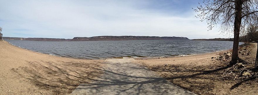
The widest part of the lake goes from Bay City, Wisconsin, in the north, all the way down to Reads Landing, Minnesota in the south. On the Wisconsin side, you'll find the villages of Pepin, Maiden Rock, and Stockholm. A large part of the Minnesota side is taken up by Frontenac State Park. The biggest city right on the lake is Lake City, Minnesota.
Transportation Routes
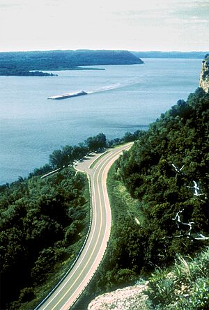
Lake Pepin is a busy corridor for travel. On the Minnesota side, the Canadian Pacific Railway runs along the lake. This railway still carries Amtrak's Empire Builder passenger train. On the Wisconsin side, the Burlington Northern railway also follows the shoreline.
For cars, U.S. Route 61 is on the Minnesota side. Across the lake, Wisconsin State Highway 35 runs just inland from the railroad. Both of these highways are part of the Great River Road, which is a special scenic route.
How Lake Pepin Formed
Lake Pepin sits in a valley that was carved out by a huge ancient river called Glacial River Warren. This river carried massive amounts of water from Lake Agassiz during a giant flood at the end of the last Ice Age. Another smaller glacial lake, Lake Duluth, also drained into this valley through what is now the St. Croix River.
After the Ice Age, the meltwaters found other ways to reach the sea. The mighty River Warren was replaced by the smaller Upper Mississippi River. Over thousands of years, the deep valley slowly filled with sediments, creating a wide, flat area.
Lake Pepin formed when the Chippewa River dumped a lot of sediment into the ancient lake bed near Wabasha. This created a natural dam. The lake then backed up behind this dam. Over the past 10,000 years, more sediment has continued to fill Lake Pepin. This has caused the upper end of the lake to move downstream about 50 miles (80 km) to where it is today.
Lake Pepin's Environment
The process of sedimentation, where dirt and particles settle at the bottom, is still happening in Lake Pepin. This happens because the river's current slows down when it enters the lake, causing it to drop the particles it carries. Some people worry that this is happening much faster now than it used to. This increased rate of sedimentation can threaten the natural plants that grow in the lake.
Scientists believe that some of this extra sediment comes from farms along the Minnesota River. However, other research suggests that many things cause sediment to build up. These include natural erosion of river banks, the way the land is shaped, and how people have changed the river. For example, people have straightened and deepened river channels. Also, more rain due to climate change might be making these processes happen faster.
History of Lake Pepin
The name "Lake Pepin" first appeared on a map of New France in 1703. This map was made for Louis XIV of France. The lake was named after Jean Pepin, who settled on its shores in the late 1600s.
Early European explorers and traders built forts on the lake. Nicolas Perrot built the first fur trading post, Fort Saint Antoine, in 1686. Later, in 1727, René Boucher de La Perrière and Michel Guignas built Fort Beauharnois. Father Guignas was a missionary to the Sioux people.
In the 1800s, Lake Pepin was important for the lumber industry. Freshly cut logs were floated across the lake. Sometimes, steamboats helped to pull large rafts of logs. These rafts were put together at Reads Landing and then towed downstream to sawmills.
In 1890, a sad event happened on the lake. The Sea Wing ferry capsized during a bad storm. This was one of the worst boat accidents on the Mississippi River at the time.
A fun fact about Lake Pepin is that the sport of water skiing was invented here! In 1922, a local person named Ralph Samuelson from Lake City created the sport on the lake. Because of this, Lake City is known as "the birthplace of waterskiing." The city celebrates this every year with a festival called Waterski Days.
See also
 In Spanish: Lago Pepin para niños
 | Janet Taylor Pickett |
 | Synthia Saint James |
 | Howardena Pindell |
 | Faith Ringgold |


