Glacial River Warren facts for kids
The Glacial River Warren, also called River Warren, was a huge ancient river. It flowed in central North America many thousands of years ago. This powerful river drained a giant prehistoric lake called Lake Agassiz. It existed between about 13,500 and 10,650 years ago. A small part of this old river channel is now a special place called a National Natural Landmark.
Contents
How the River Warren Formed


Imagine a time when much of North America was covered by a giant ice sheet. This was during the last ice age. As the ice melted, it formed an enormous lake called Lake Agassiz. This lake was incredibly deep, about 600 to 700 feet (180–210 m) in some places. It covered a huge area, more than 110,000 square miles (280,000 km²).
The ice sheet blocked the lake from flowing north. So, the water level in Lake Agassiz kept rising. Around 13,500 years ago, the water became so high that it spilled over a ridge of rocky debris. This ridge, called the Big Stone Moraine, was left behind by the melting glacier.
This overflow happened near a place called Browns Valley, Minnesota. The rushing water carved a deep gorge through the moraine. This gorge was about 1 mile (1.6 km) wide and 130 feet (40 m) deep. Today, this area is known as the Traverse Gap. This gap is now a dividing line between two major water systems. One leads to the Gulf of Mexico, and the other to Hudson Bay. Because of its importance, the Traverse Gap was named a National Natural Landmark.
The Glacial River Warren began flowing from this Traverse Gap. It carried the meltwater from Lake Agassiz all the way to the Mississippi River valley. The river didn't flow all the time. Lake Agassiz sometimes found other ways to drain. Also, the ice sheet would sometimes grow or shrink. This changed the land's level, which could block or open other paths for the lake's water to reach the sea.
The River's Path
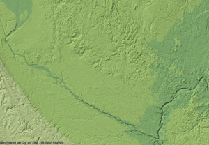
When the Glacial River Warren was active, it was a very powerful and fast-moving river. It carved a huge valley up to 5 miles (8 km) wide and 250 feet (76 m) deep. This valley starts at Traverse Gap near Browns Valley, Minnesota.
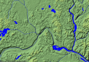
From there, it flows southeast towards Mankato, Minnesota. Then, it turns northeast towards the Twin Cities. Near Fort Snelling, the much smaller Mississippi River joined the mighty River Warren. The valley then continues northeast to modern-day Saint Paul, Minnesota.
Long ago, a massive waterfall, the River Warren Falls, was a major feature in Saint Paul. Over 1,700 years, this waterfall slowly moved upstream. It eventually undercut the Mississippi River near Fort Snelling. At that point, the falls split into two. One part became Saint Anthony Falls in Minneapolis, and also created Minnehaha Falls. The other part of the River Warren falls moved west into the Minnesota River valley. It stopped when it reached an older, buried river valley about 2 miles (3.2 km) west of where the rivers joined.
From Saint Paul, the wide valley continues southeast to Prescott, Wisconsin. Here, it was joined by the St. Croix River. The St. Croix River was once the outlet for another ancient lake, Glacial Lake Duluth, which filled the western part of Lake Superior.
The Glacial River Warren had a big impact on the landscape. It created the tall cliffs, or bluffs, along the Minnesota and Mississippi River valleys. It also helped form Lake Pepin, a wide part of the Mississippi River.
When the River Disappeared
Around 9,400 years ago, the ice sheet finally melted enough to the north. This allowed Lake Agassiz to find a new, permanent way to drain. The lake's water level dropped below the Traverse Gap. When this happened, the Glacial River Warren stopped flowing.
Today, the area that was once Lake Agassiz now drains into the Red River of the North. This river flows north and eventually reaches Hudson Bay. The upper part of River Warren's valley in the Traverse Gap is now home to the tiny Little Minnesota River. This small river flows into Big Stone Lake and then into the Minnesota River. The Minnesota River follows the path of the ancient River Warren to where it meets the Mississippi River. These modern rivers are much, much smaller than the powerful Glacial River Warren that carved their valleys.
How the River Got Its Name
The unique features of this oversized river valley were first studied by General G. K. Warren. He explored the valley in 1868 while looking for possible routes for a transcontinental railroad. To honor his important work, the ancient glacial river that drained Lake Agassiz was named River Warren.
 | Jackie Robinson |
 | Jack Johnson |
 | Althea Gibson |
 | Arthur Ashe |
 | Muhammad Ali |

