Chippewa River (Wisconsin) facts for kids
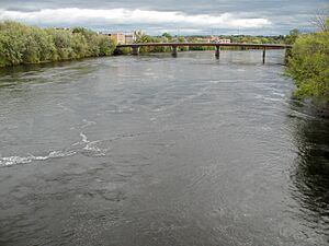
The Chippewa River is a major river in Wisconsin, flowing about 183 miles (294 km) through the western part of the state. It starts in northern Wisconsin and winds its way south before joining the mighty Mississippi River. For many years, people could travel by boat on about 50 miles (80 km) of the river, from where it meets the Mississippi up to Eau Claire. Today, you can enjoy the river by biking or walking along the Chippewa River State Trail, which follows the river from Eau Claire to Durand.

Contents
Where Does the Chippewa River Start?
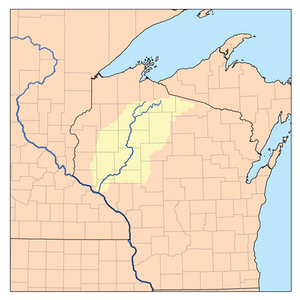
The Chippewa River officially begins at Lake Chippewa. This large reservoir in Sawyer County is formed by two smaller rivers joining together:
- The West Fork Chippewa River, which starts at Chippewa Lake.
- The East Fork Chippewa River, which begins in the swamps of Iron County, Wisconsin.
From Lake Chippewa, the river flows through several counties in Wisconsin, including Rusk, Chippewa, Eau Claire, Dunn, Pepin, and Buffalo Counties. Finally, it empties into the Mississippi River. When the Chippewa River meets the Mississippi, it drops a lot of sand and dirt, creating a delta that helps form Lake Pepin.
Lakes and Tributaries
Along its path, the Chippewa River flows through or past several important lakes and reservoirs. These include the Radisson and Holcombe Flowages, Lake Wissota, and Dell's Pond. The biggest of these is the Chippewa Flowage, which is the third largest lake in all of Wisconsin!
Many smaller rivers flow into the Chippewa River, adding to its water. Some of its main branches, called tributaries, are the Flambeau, Jump, Yellow, Eau Claire, and Red Cedar Rivers.
The main towns and cities along the river's course are Cornell, Chippewa Falls, Eau Claire, and Durand.
A River of History
The Chippewa River has a long and interesting history. Early maps from the 1700s called it "Rivière de bon Secours" or "Hahatonouadeba." This second name comes from the Dakota language. The name "Chippewa" comes from "Ojibwe," which is the name of the Ojibwe people. The Ojibwe controlled much of the upper Chippewa Valley until a treaty in 1837.
Logging and Lumber
In the 1800s, the Chippewa River system was incredibly important for the logging industry. It had more pine forests than any other river system in Wisconsin. Experts believe the Chippewa Valley once held about 46 billion board feet of lumber! One famous logger, Frederick Weyerhaeuser, called it "a logger's paradise" because of its huge pine forests and excellent rivers for moving logs.
The first sawmills in the Chippewa Valley started around 1831. By 1840, people were sawing wood in Chippewa Falls. Even though floods often destroyed these early mills, the lumbermen always rebuilt them. In the late 1800s, Chippewa Falls was home to what was said to be the largest sawmill under one roof in the world!
Moving Logs Downstream
By the 1850s, loggers would tie the cut pine lumber into huge rafts. These rafts were then guided down the lower Chippewa River to sell the wood in markets along the Mississippi. However, the river above Chippewa Falls was too rough for large rafts. Instead, individual logs were floated down by special workers called "log drivers" or "river pigs."
To make log driving easier and more reliable, loggers actually changed the river! They would use dynamite to remove tricky rocks, cut down trees that might snag logs, and build up the riverbanks in some places. They also built many dams on the river and its smaller branches. These dams would hold back water, and then release it in a rush to help push the logs downstream. By 1878, a very large dam at Little Falls (now Holcombe) could raise the Chippewa River by three feet, even 100 miles downstream! Loggers built at least 148 logging dams on the Chippewa and its tributaries.
Fun on the River
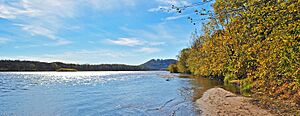
Today, the Chippewa River is a popular spot for outdoor activities. Many people enjoy kayaking and canoeing on its waters. Paddlers can find all sorts of conditions, from calm, slow-moving areas to small rapids.
Fishing is another favorite activity on the Chippewa River. The river is known for different types of fish, including musky, smallmouth bass, walleye, and northern pike.
 | Isaac Myers |
 | D. Hamilton Jackson |
 | A. Philip Randolph |


