
Great River Road facts for kids
Quick facts for kids
|
|
|---|---|
 |
|
| Route information | |
| Length | 2,069.0 mi (3,329.7 km) |
| Location | |
| States: | Minnesota, Wisconsin, Iowa, Illinois, Missouri, Kentucky, Tennessee, Arkansas, Mississippi, Louisiana |
| Highway system | |


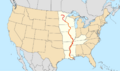
The Great River Road is a special collection of roads. They follow the mighty Mississippi River through ten states in the United States. These states are Minnesota, Wisconsin, Iowa, Illinois, Missouri, Kentucky, Tennessee, Arkansas, Mississippi, and Louisiana. This road used to go even further north into Canada.
The "Great River Road" is both a series of actual roads and a larger area. This area is used to promote tourism and share history in each state. Some states have special areas along the road just for visitors.
The road has two main parts. One is simply called the Great River Road. The other is a special "National Scenic Byway" route. In 2021, eight of the ten state routes were named "All-American Roads." This means they are very important and unique.
The idea for the road started in 1938. Each state has its own group that works on the road. These groups all work together through the Mississippi River Parkway Commission (MRPC). The road is about 2,340 miles (3,765 km) long. You can spot it by its green-and-white signs. These signs show a river steamboat inside a pilot's wheel. They often say "Canada to Gulf." The route usually starts at Lake Itasca in Minnesota and ends in Louisiana.
Contents
Exploring the Great River Road

The Great River Road isn't just one long road. It's a special route made up of many different highways and streets. These roads are cared for by state, county, or local governments.
What are the main routes of the Great River Road?
For many years, there was a single main path called the "National Route." This route went from Canada all the way to the Gulf of Mexico. States would put "National Route" signs above the regular Great River Road markers. They also had other paths called "alternate routes." Today, only Illinois and Minnesota still use the "National Route" signs.
Many parts of the Great River Road are now called a National Scenic Byway. This is a special title given to roads that are very beautiful or important.
Western side of the Mississippi River
The Great River Road follows the Mississippi River on both its western and eastern sides. Let's look at the western side first.
Louisiana's western route
In Louisiana, you might not see many signs for the Great River Road. But the path is set by state law. It starts in Venice and follows different state highways. These include LA 23, LA 18, and LA 1. The road winds through towns like Gretna, Donaldsonville, and Plaquemine. It often stays close to the river.
One part of the route goes inland around a curved lake called False River. This lake used to be part of the Mississippi River. The road then continues north on highways like LA 15 and US 65 towards Arkansas.
Arkansas's western route

The Great River Road enters Arkansas on US 65. It goes through towns like Dumas and Lake Village. The main National Route crosses into Arkansas on the Greenville Bridge.
The road then follows different state highways. These include US 165, Highway 1, and smaller roads like Highway 316 and Highway 20. It passes through places like DeWitt and Elaine.
Near Helena, the road leaves the main highways. It follows smaller streets through neighborhoods. A special part of the road, County Road 239, goes through the St. Francis National Forest. This part is sometimes unpaved. The route then uses roads like Highway 44 and US 79. It passes through Marianna and Hughes. Finally, the Great River Road heads north on Highway 77 and US 61 into Missouri.
Missouri's western route
In Missouri, the Great River Road mostly follows state highways. More than half of it is on US 61. Even though Missouri doesn't use "National Route" signs, you can often tell where it is by signs in Illinois.
One path follows US 61 all the way to Perryville. The main National Route crosses from Illinois on the Chester Bridge. It then joins US 61. Near Festus, the Great River Road joins I-55 and goes into St. Louis. It uses other interstates like I-44 and I-70.
From there, the National Route follows Route 79 to Hannibal. Here, it crosses the Mark Twain Memorial Bridge back into Illinois. Another path in Hannibal uses US 61 and other local roads. It goes through towns like Palmyra and Canton before reaching Iowa.
Iowa's western route
In Iowa, the Great River Road uses many county and local roads. The main National Route can often be figured out by signs in Illinois.
One path crosses the Des Moines River into Keokuk. It follows US 136 and then a winding path through downtown. It then follows the "Mississippi River Road" (CR X28 and CR X21) through Montrose. It then joins US 61 and goes through Fort Madison.

The National Route returns to US 61 and then takes local roads into Burlington. It goes through Crapo Park and follows Main Street. It then uses county roads like CR X99 and CR X61 into Muscatine. From Muscatine, the National Route leaves Iowa on the Norbert F. Beckey Bridge.
Another path continues on US 61 Business. It follows Iowa 22 along the river to Davenport. It uses US 67 through Bettendorf and then US 52 north to Sabula. It passes over the Great River Road Bridge in Bellevue and reaches US 20 in Dubuque.
The National Route reenters Iowa on the Julien Dubuque Bridge (US 20). It then follows US 52 and various county roads. These roads go through towns like Guttenberg and McGregor. The route then continues north on Iowa 76 and county roads to Lansing. Here, the National Route crosses the Black Hawk Bridge into Wisconsin.
Finally, Iowa 26 carries another path from Lansing north to the Minnesota state line.
Minnesota's western route
The Great River Road enters Minnesota on MN 26. It connects to US 61 in La Crescent. Except for a small detour, US 61 carries this path to where it meets the National Route in Hastings.
Eastern side of the Mississippi River
Now let's look at the eastern side of the Mississippi River.
Louisiana's eastern route
One path starts in Gretna and crosses the Crescent City Connection into New Orleans. It follows streets like Tchoupitoulas Street and Magazine Street along the riverfront. In Jefferson Parish, it becomes River Road. The route then uses highways like LA 48 and LA 44. These roads stay close to the river.
The road goes through towns like Norco and LaPlace. It then follows various state highways around the river's curves to Baton Rouge. In Baton Rouge, the Great River Road uses city streets like Government Street and River Road. The National Route crosses the Huey P. Long Bridge (US 190). It then turns north to follow I-110 and US 61 into Mississippi.
In 1811, a large group of enslaved and free Black people rebelled. This event is known as the 1811 German Coast uprising. It started in St. John the Baptist Parish and moved towards New Orleans. A local militia stopped the rebellion. After this, many people involved were put on trial and executed.
Mississippi's eastern route
In Mississippi, much of the Great River Road follows US 61. Between Onward and Lula, it runs closer to the river on MS 1. Historically, the National Route turned off MS 1 at Greenville. It then followed US 82 to the Greenville Bridge.
Tennessee's eastern route
The Great River Road enters Tennessee on US 61. It follows this highway along 3rd Street into Downtown Memphis. The National Route historically crossed the Memphis & Arkansas Bridge. The route then follows many city streets along the riverfront. These include Riverside Drive and Front Street, passing the Pyramid.
It then joins US 51 in northern Memphis. It soon turns off onto SR 388 and then local roads. These roads pass Meeman-Shelby Forest State Park. Some parts, like Herring Hill Road, are unpaved. The route then turns east with SR 59 to Covington. It then runs north on US 51.
After crossing the Hatchie River, the Great River Road leaves US 51 again at Henning. It loops west on SR 87 and north on unpaved roads past Fort Pillow State Park. It then rejoins US 51 at Ripley. It leaves US 51 for the last time at Halls. It follows SR 88 west and then SR 181 on top of a levee. The route continues north on local roads and SR 21 into Tiptonville. The Tennessee part of the Great River Road ends by following SR 78 to the state line.
Kentucky's eastern route
The Great River Road's National Route enters Kentucky from Tennessee on KY 94. It runs northeast and east through Hickman. At Cayce, it turns north to follow KY 239. It continues on KY 123 through Columbus. There are two paths here. One follows KY 123 to Bardwell, and the other goes around the city. The last part in Kentucky takes US 51 to the bridge across the Ohio River into Cairo, Illinois.
There are also signs for an alternate route. This route goes inland through towns like Fulton and Arlington. It uses roads like KY 125 and US 51.
Illinois's eastern route
Parts of the Great River Road in Illinois are marked as the National Route. Other parts do not have this special sign. The National Route signs continue to the Mississippi River bridges. Other paths branch off before these crossings. Many side roads are also marked to lead to parks and interesting places.
The first part in Illinois is the National Route. It enters from Kentucky at Cairo and leaves at Chester. It follows US 51 from the Cairo Ohio River Bridge. Then it follows IL 3 along the river. Before Chester, it turns onto a truck bypass closer to the river. It ends by turning onto the Chester Bridge (IL 150) to Missouri.

Another path goes from Chester to near Fall Creek. It starts at the Chester Bridge. It follows IL 150 and then IL 3. Instead of going through industrial areas, it turns onto I-55 / I-70. It then uses IL 111 and I-270 to rejoin IL 3 in Granite City.
It leaves IL 3 to follow IL 143 into Alton. Then it uses US 67 to reach IL 100. This road runs right along the river for a long way. It turns inland at Grafton. Instead of crossing the Illinois River on a ferry, the Great River Road stays with IL 100. It follows the Illinois River to the Hardin Bridge and then to Kampsville. There, it turns west to rejoin the Mississippi River. It follows IL 96 and former IL 57.
The National Route reenters Illinois on the Mark Twain Memorial Bridge (I-72) from Hannibal, Missouri. It follows I-172 north to the IL 57 interchange. It then follows IL 57 into Quincy. Then it uses US 24 and IL 96 to a point east of Warsaw. It turns onto Main Street in Warsaw and then 6th Street. A short turn on US 136 in Hamilton brings it back to IL 96. This road follows the river through Nauvoo to Niota. The National Route turns northwest on IL 9 to the Fort Madison Bridge into Fort Madison, Iowa.
IL 96 continues to carry another path beyond Niota to Lomax. There, IL 96 turns inland. The Great River Road follows Carman Road to US 34 near Gulfport. It turns north onto IL 164 through Oquawka. It then follows county roads to Keithsburg and Joy. Finally, a county road takes Great River Road traffic to IL 92 across from Muscatine, Iowa.
The National Route reenters from Muscatine. It follows IL 92 east through the Quad Cities. It then turns north along IL 84. This road stays near the river most of the way to Galena. US 20 carries the route through Galena to East Dubuque. Here, the National Route crosses the river one last time into Dubuque, Iowa on the Julien Dubuque Bridge.
Wisconsin's eastern route

WIS 35 runs along Wisconsin's western border. It carries most of the Great River Road in that state. The longest part where it separates from WIS 35 is between Tennyson and Bridgeport. Here, WIS 35 goes inland. The Great River Road follows WIS 133 to Cassville and other county roads. It then returns to WIS 35.
The historic National Route entered Wisconsin on the Black Hawk Bridge (WIS 82). It turned north on WIS 35 near De Soto. US 61 and US 53 take the route through La Crosse. Finally, at Prescott, the Great River Road turns west on US 10. It crosses the St. Croix River on the Prescott Drawbridge into Minnesota.
Minnesota's eastern route
When it enters Minnesota, the eastern path of the Great River Road follows US 10 west and US 61 south. It crosses the Mississippi on the Hastings Bridge into Hastings. Here, it joins with the western path.
Where do the routes meet?
The two sides of the Great River Road come together at the south end of the Hastings Bridge (US 61) in Hastings, Minnesota. From there, a single route continues all the way to the start of the Mississippi River at Lake Itasca.
The route leaves Hastings by following County 42. It then joins MN 55 and US 52. The Great River Road soon splits onto County 56 into South St. Paul. There, it follows I-494 east across the Mississippi on the Wakota Bridge. It turns north on US 10 / US 61 and enters St. Paul.
Shepard Road/Warner Road takes the route west along the St. Paul riverfront. It then turns south on I-35E and crosses the Mississippi again on the Lexington Bridge. MN 13 takes it to Mendota. Here, it crosses the Minnesota River near Fort Snelling.
After MN 55 enters Minneapolis, the Great River Road turns east on 46th Street. It then goes south on Minnehaha Avenue and east on Godfrey Parkway. This leads to the West River Parkway, a scenic drive along the west bank of the Mississippi. This drive goes through downtown Minneapolis. After crossing the Mississippi again, the Great River Road turns north on Marshall Street and East River Road. It then turns west to cross the Mississippi one last time in the Twin Cities area on the I-694 Bridge. From there, it follows old routes of US 169 to Champlin.
County 12 continues along the Mississippi. It becomes County 42 in Wright County. The route turns north on MN 101 and then west on County 39 to Monticello. There, it picks up former MN 152, now County 75, to St. Cloud. Through St. Cloud, it follows Clearwater Road and 9th Avenue. It crosses the Mississippi into Sauk Rapids on the Sauk Rapids Regional Bridge.
County 33 leads to Sartell and another river crossing, the Sartell Bridge. From there, it uses County 78 to reach County 1. This road and its continuations follow the west bank of the Mississippi to Little Falls. Here, it turns east on MN 27 to County 213. The Camp Ripley Bridge takes MN 115 east to MN 371. The Great River Road follows MN 371 north to Baxter, crossing the Mississippi at the south city limits.
The route through Baxter leaves MN 371 at College Drive. It heads east back over the Mississippi on the College Drive Bridge into Brainerd. There, it turns north on East River Road and other streets.
The Great River Road leaves Brainerd to the north on County 3. It crosses the Mississippi again at the city limits. North of Merrifield, it turns east on County 19. This leads to County 11 and then MN 6 south across the Mississippi and into Crosby. MN 210 leads east to Aitkin. Here, the route turns north on County 1 and crosses the river again. It then follows unpaved roads and US 169 to Palisade.
County 10 continues as a paved road from Palisade. It goes north across MN 200 and northwest to Grand Rapids. The Great River Road does not cross the river in Grand Rapids. It turns south on 7th Avenue and west on 10th Street. It then uses county roads to MN 6. The route turns west and enters Cass County. Several more turns take it to another Mississippi crossing onto County 18. From there, it turns west on US 2 into Ball Club. County 39 and MN 46 lead to County 9. This road runs southwest across the river at the Lake Winnibigoshish outlet and back to US 2. It turns west to and beyond Bena.
From Bena to Bemidji, the Great River Road follows many county roads. These roads follow the winding path of the Mississippi. They include County 91, 54, 10, and 39. There are several bridges across the Mississippi near lakes like Cass Lake and Andrusia Lake. The route turns west onto 1st Street to reach MN 197. This road crosses the river again into downtown Bemidji. It then turns west on 5th Street. That road continues west and south as County 7, County 3, and County 10. From there, the Great River Road turns west on County 9. This road becomes County 40 in Clearwater County and crosses the river again. Turning south on County 2, the route crosses the Mississippi River one last time before it crosses MN 200. It then enters Itasca State Park on County 122.
Canadian connections
The Great River Road used to continue north into Canada. There were two paths. One went from Bemidji into Ontario. The other went from Lake Itasca into Manitoba. The Ontario path followed US 71 to the border. Then it followed Highway 71 to the Trans-Canada Highway. The Manitoba path followed MN 200 west from Lake Itasca. Then it used different highways like MN 92 and MN 89 to the border. In Manitoba, it followed Highway 12 and the Trans-Canada Highway to Winnipeg.
History of the Great River Road
The idea for the Great River Road began in 1938. The Mississippi River Parkway Planning Commission was formed to plan it. The Secretary of the Interior, Harold Ickes, asked the governors of the 10 states along the Mississippi River to create this group. State planners had been thinking about a recreational road along the river since 1936.
This commission was very important. It helped plan, build, promote, and develop the parkway. Today, it's called the Mississippi River Parkway Commission. It's located in Minneapolis. The commission still works to protect and improve the Mississippi River Valley and the Great River Road. Representatives from the 10 states and two Canadian provinces are on its board. The road's journey from 1938 to today has been long and had many ups and downs. It took over 30 years for the Great River Road to really grow.
In 1939 and 1940, the U.S. House of Representatives discussed a bill. This bill would have allowed a study to see if the parkway idea was possible. The idea was popular, but World War II soon took over.
It wasn't until 1949 that Congress approved money for a study. This study, called "Parkway for the Mississippi River," was finished in 1951. It was done by the Bureau of Public Roads (BPR).
The study decided that a parkway for the Mississippi River would help the whole country. However, building a completely new parkway would be too expensive. So, the BPR suggested that it should be a "scenic route" instead.
A scenic route would use existing roads along the river. New construction would only be for connecting these roads to make a continuous path. The existing roads would be made better. This new plan would save a lot of money. Also, some of the most beautiful spots along the river already had highways, railroads, or towns.
The idea of a scenic route was chosen. This means the Great River Road is not owned by the National Park Service. True national parkways, like the Blue Ridge and Natchez Trace Parkways, are owned by them. Instead, the states have developed the Great River Road together. The BPR suggested that the chosen route should be improved well. It should be for fun and for traffic. The needed work could be done with regular federal highway money or by the states themselves.
In 1954, Congress approved money for planning. The BPR was allowed to work with each state. They would create rules for the parkway and choose one specific route in each state. By the late 1950s, the familiar green-and-white pilot's wheel signs started appearing. Planning continued through the 1960s. The 1961 Iowa highway map was the first in that state to show the route.
By early 1970, all the planning reports were done. The actual building of the Great River Road could begin. Some states put up signs and used state money for scenic views and road improvements. But full funding wasn't available yet. Money for the Great River Road was first included in the Federal-Aid Highway Act of 1973. From 1973 to 1982, Congress approved a total of $314 million for the Great River Road. Most of this money went directly to the states.
With funds available, development started seriously. In 1976, the Federal Highway Administration (FHWA) set rules for the Great River Road. The states then set up their own ways to choose the route within their borders.
The rules said the Great River Road should be in places with great views. It should let travelers enjoy the unique features of the Mississippi River. The rules also said the road should offer different experiences, like history, geology, and culture. It should also provide easy access to bigger towns and cities. Protecting the Mississippi River area was also important. This was done by choosing the right route and controlling development.
The federal Great River Road follows the FHWA rules. It was eligible for funds in the 1970s and early 1980s. The states have also chosen other routes. These include places with important scenic, historic, and fun features. The Mississippi River Parkway Commission promotes all these routes. However, some states use signs to show if a route is federal or state.
In 2021, eight of the 10 state Great River Road National Scenic Byways were named All-American Roads. This shows their national importance.
Images for kids
-
Map of the Great River Road
-

Great River Road marker
