Niota, Illinois facts for kids
Quick facts for kids
Niota, Illinois
|
|
|---|---|

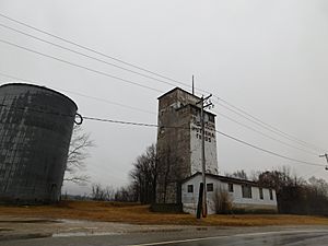
An unused grain elevator in Niota in January 2017
|
|
| Country | |
| State | |
| County | Hancock County |
| Township | Appanoose Township |
| Area | |
| • Total | 0.57 sq mi (1.48 km2) |
| • Land | 0.52 sq mi (1.35 km2) |
| • Water | 0.05 sq mi (0.13 km2) |
| Elevation | 522 ft (159 m) |
| Population
(2020)
|
|
| • Total | 114 |
| • Density | 217.97/sq mi (84.14/km2) |
| ZIP code |
62358
|
| FIPS code | 17-53078 |
| GNIS feature ID | 0414531 |
Niota is a small, unincorporated community in Hancock County, Illinois. It is also known as East Fort Madison or East Fort Madison Station. This community sits right on the bank of the Mississippi River. It is at the eastern end of the Fort Madison Toll Bridge, which connects Niota to Fort Madison, Iowa. Niota is where Illinois Route 9 begins and is also served by Illinois Route 96, which is part of the famous Great River Road.
Niota's History with the River
Niota has faced challenges from the Mississippi River over the years. The community has often had to fight against floods. In April 1965, a big flood hit the Upper Mississippi River. The US Coast Guard even sent a boat called the Goldenrod to help Niota on May 3, 1965.
Another major flood happened in July 1993. During this time, inmates helped local residents build up the levees (protective walls) to try and save the community. Unfortunately, their efforts were not enough. The 1993 flood caused the worst damage in the Mississippi River's history for Niota. The Federal Emergency Management Agency (FEMA) suggested moving the community to a new, safer location. This would have cost about $8.5 million, but most people living in Niota wanted to stay right where they were.
Where is Niota?
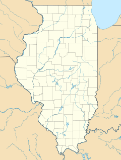
Niota is located at coordinates 40°37′03″N 91°17′17″W / 40.61750°N 91.28806°W. It sits at an elevation of 522 feet (about 159 meters) above sea level.
In 2021, Niota had a total area of about 0.57 square miles (1.48 square kilometers). Most of this area, about 0.52 square miles (1.35 square kilometers), is land. The rest, about 0.05 square miles (0.13 square kilometers), is water.
Who Lives in Niota?
| Historical population | |||
|---|---|---|---|
| Census | Pop. | %± | |
| 2020 | 114 | — | |
| U.S. Decennial Census | |||
According to the 2020 census, 114 people lived in Niota. There were 35 households and 31 families. The community had 52 housing units.
Out of the 35 households, about 62.9% had children under 18 living with them. Most households, 88.57%, were married couples living together. About 11.43% of all households were made up of individuals living alone.
The average age of people in Niota was 51.7 years. About 28.2% of the population was under 18 years old.
Getting Around Niota
Amtrak’s Southwest Chief train passes through Niota. This train travels between Los Angeles and Chicago on BNSF tracks. However, the train does not stop in Niota. The closest train station is in Fort Madison, which is about 1 mile (1.6 kilometers) across the Mississippi River.
 | DeHart Hubbard |
 | Wilma Rudolph |
 | Jesse Owens |
 | Jackie Joyner-Kersee |
 | Major Taylor |


