East Dubuque, Illinois facts for kids
Quick facts for kids
East Dubuque
|
|||
|---|---|---|---|

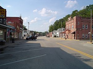
Downtown East Dubuque, along Sinsinawa Avenue
|
|||
|
|||

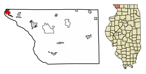
Location of East Dubuque in Jo Daviess County, Illinois.
|
|||

Location of Illinois in the United States
|
|||
| Country | United States | ||
| State | Illinois | ||
| County | Jo Daviess | ||
| Township | Dunleith | ||
| Area | |||
| • Total | 2.81 sq mi (7.29 km2) | ||
| • Land | 2.74 sq mi (7.1 km2) | ||
| • Water | 0.07 sq mi (0.19 km2) | ||
| Elevation | 610 ft (190 m) | ||
| Population
(2020)
|
|||
| • Total | 1,505 | ||
| • Density | 548.87/sq mi (211.94/km2) | ||
| Time zone | UTC-6 (CST) | ||
| • Summer (DST) | UTC-5 (CDT) | ||
| ZIP Code(s) |
61025
|
||
| Area code(s) | 815 | ||
| FIPS code | 17-21683 | ||
| GNIS ID(s) | 407631, 2394598 | ||
| Wikimedia Commons | East Dubuque, Illinois | ||
East Dubuque is a city in Jo Daviess County, Illinois, United States. It's a smaller city with about 1,505 people living there as of 2020. East Dubuque is right next to the famous Mississippi River. If you look across the river, you'll see the city of Dubuque, Iowa. The city stretches along the river all the way to the border between Illinois and Wisconsin.
Contents
The Story of East Dubuque
East Dubuque has an interesting past! It was first called Dunleith. The city was officially planned out in 1853 under that name. Later, its name changed to East Dubuque because it's located just east of the city of Dubuque. A post office opened in Dunleith in 1854. This post office was renamed East Dubuque in 1879.
Getting Around East Dubuque
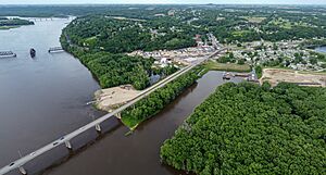
Getting around East Dubuque is easy with its main roads. The two most important roads are Sinsinawa Avenue and U.S. Route 20 (also known as Wall Street). The Julien Dubuque Bridge is a big bridge that connects East Dubuque to Dubuque, Iowa, across the river. If you want to travel to Wisconsin, Illinois Route 35 is the main road to take. In the past, the East Dubuque station also offered train travel for people living here.
Where is East Dubuque?

East Dubuque is located at coordinates 42°29′28″N 90°38′28″W / 42.49111°N 90.64111°W. This helps us find it on a map!
The city covers a total area of about 2.89 square miles (7.29 square kilometers). Most of this area, about 2.81 square miles (7.1 square kilometers), is land. The rest, about 0.08 square miles (0.19 square kilometers), is water.
East Dubuque is part of a special area called the Driftless Area. This means the land here wasn't flattened by glaciers during the Ice Age, so it has unique hills and valleys.
People of East Dubuque
In 2020, about 1,505 people lived in East Dubuque. This number was a bit lower than in 2010, when 1,704 people lived there.
Most of the people living in East Dubuque are White (about 92.5%). There are also smaller groups of Black or African American, Asian, Pacific Islander, and Native American people. About 4.1% of the population are from two or more races. Around 2.3% of the people in East Dubuque are of Hispanic or Latino background.
Famous People from East Dubuque
- Arthur Joseph O'Neill – He was a Roman Catholic bishop.
Important Places to See
- East Dubuque School
- Julien Dubuque Bridge
See also
 In Spanish: East Dubuque para niños
 | Dorothy Vaughan |
 | Charles Henry Turner |
 | Hildrus Poindexter |
 | Henry Cecil McBay |


