
Cass Lake (Minnesota) facts for kids
Quick facts for kids Cass Lake |
|
|---|---|

Canoe Tripping by Girl Scouts of Camp Cassaway on Cass Lake, Minnesota. 1962.
|
|

Cass Lake
Location in Minnesota
|
|
| Location | Beltrami / Cass counties, Minnesota, United States |
| Coordinates | 47°25′05″N 94°32′21″W / 47.4181°N 94.5392°W |
| Primary inflows | Mississippi River / Turtle River / Pike Bay |
| Primary outflows | Mississippi River |
| Basin countries | United States |
| Surface area | 15,958 acres (64.58 km2) |
| Max. depth | 120 ft (37 m) |
| Surface elevation | 1,301 ft (397 m) |
| Islands | Star Island, Potato Islands, Cedar Island, unnamed island |
| Settlements | Cass Lake |
Cass Lake is a large lake in north central Minnesota, United States. It is about 10 mi (16 km) long and 7 mi (11 km) wide. You can find it in Cass and Beltrami counties.
The lake is located within the Chippewa National Forest and the Leech Lake Indian Reservation. The city of Cass Lake is right next to it. Cass Lake is the 11th largest lake in Minnesota. It is also the 8th largest lake that is completely inside the state's borders.
Contents
Lake Cass: What's in a Name?
In the Ojibwe language, the lake is called Gaa-miskwaawaakokaag. This name means "where there are many red cedars." Early explorers and traders knew it by different names. In French, it was Lac du Cedre Rouge, and in English, Upper Red Cedar Lake.
The lake was later renamed Cass Lake. This happened after an expedition led by Lewis Cass visited in 1820. The new name helped tell it apart from another lake called Red Cedar Lake.
Geography of Cass Lake
Cass Lake sits in a special bowl-shaped area. This area was formed by melting glaciers a long time ago. The famous Mississippi River flows right through the lake from west to east. Another important river, the Turtle River, also flows into the lake from the north.
Islands and Connected Waters
Cass Lake has five islands. These include Star Island, Cedar Island, and two Potato Islands. There is also a small unnamed island.
Star Island is very special. It has its own lake on it called Lake Windigo. This means you can find "a lake within an island within a lake"!
South of Cass Lake is Pike Bay. This is a 4,760 acres (19.3 km2) lake that connects to Cass Lake. They are joined by a narrow channel. Even though they are connected, Pike Bay is usually thought of as a separate lake now.
Water Flow and Dams
The Mississippi River leaves Cass Lake from its northeastern corner. From there, it flows into Lake Winnibigoshish.
For many years, the water level of Cass Lake was controlled by the Knutson Dam. This dam was built in 1924. It replaced older dams made by lumber companies. In 2015, the Knutson Dam was removed. It was replaced with a new rock structure. This change helps the water flow more naturally. It also makes it easier for fish to move between the lakes connected by the Mississippi River.
History of Cass Lake
The first recorded visits to Cass Lake by fur traders happened in the 1790s. These traders came from Canada.
Early Explorers and the Mississippi River
David Thompson, a mapmaker, traveled through the lake in 1798. He was one of the first to try and find the source of the Mississippi River. He thought Turtle Lake, which is upstream from Cass Lake, was the source. Finding the source was very important. It helped map the border between Canada and the United States.
In 1806, Zebulon Pike explored the area. He thought Cass Lake was an "upper source" of the river.
In 1820, General Lewis Cass led an expedition to the lake. They couldn't go further upstream because the water was too low. So, they decided Cass Lake was the headwaters. This was because the river was easy to travel on by boat below this point.
Later, in 1832, Henry Schoolcraft found the true source of the river. He discovered it was further upstream at Lake Itasca.
Lumber Industry
In the past, Cass Lake was very important for the lumber industry. Log booms, which are large rafts of logs, were pulled across the lake by steamboats. These logs came from nearby lakes and streams. They were taken to sawmills or sent away by train.
Fun Things to Do at Cass Lake
Cass Lake is a very popular spot for outdoor activities. People love to come here for fishing, boating, and swimming.
Fishing and Wildlife
The lake is well-known for its great fishing. You can catch fish like walleye, northern pike, muskellunge, and yellow perch. Smaller fish called Tullibee are also important here. They are food for the bigger fish.
Camping and Recreation Areas
There are many campgrounds and resorts around the lake. These are great places to stay and enjoy nature. The southern and eastern parts of the lake, along with all the islands, are protected. They are part of the Ten Section Area of the Chippewa National Forest.
Norway Beach recreation area is on the southeast side of the lake. It has the Norway Beach Lodge. This lodge is a cool example of Finnish-style log architecture. It was built by the Civilian Conservation Corps. The city of Cass Lake is located near the southwest side of the lake.
Camps for Kids
Between Cass Lake and Buck Lake, you'll find Camp Chippewa. This is a camp for boys founded in 1935. Camp Chippewa is famous for its wilderness canoe trips. Campers can go on trips that last from one night to three weeks! The camp also offers many activities like archery, swimming, sailing, and climbing.
Another camp, UniStar, is located on Star Island.
Images for kids
-
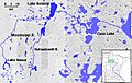
Cass Lake, shown in the watershed of the upper Mississippi River

See also
 In Spanish: Lago Cass (Minnesota) para niños
