Halls, Tennessee facts for kids
Quick facts for kids
Halls, Tennessee
|
|
|---|---|
 |
|

Location of Halls in Lauderdale County, Tennessee.
|
|
| Country | United States |
| State | Tennessee |
| County | Lauderdale |
| Area | |
| • Total | 3.69 sq mi (9.56 km2) |
| • Land | 3.68 sq mi (9.54 km2) |
| • Water | 0.01 sq mi (0.02 km2) |
| Elevation | 318 ft (97 m) |
| Population
(2020)
|
|
| • Total | 2,091 |
| • Density | 567.90/sq mi (219.25/km2) |
| Time zone | UTC-6 (Central (CST)) |
| • Summer (DST) | UTC-5 (CDT) |
| ZIP code |
38040
|
| Area code(s) | 731 |
| FIPS code | 47-31820 |
| GNIS feature ID | 1286606 |
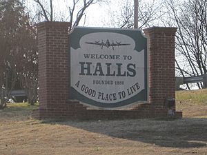
Halls is a small town located in Lauderdale County, Tennessee, in the United States. It was founded in 1882 as a stop for the railroad. The town is named after Hansford R. Hall, who was one of its founders. Early businesses in Halls included sawmills and cotton gins, which helped process local wood and cotton.
In 2020, about 2,091 people lived in Halls.
Contents
History of Halls
How Halls Began
The town of Halls started in 1882. This happened when the Newport News & Mississippi Valley Railroad, which later became the Illinois Central Railroad, built a train stop in northern Lauderdale County. By 1899, Halls had its own bank. The next year, a telephone company connected Halls to Ripley, which is the county seat.
The village was first called Hall's Station. It was named to honor Hansford R. Hall, one of the people who helped start the town. Other important founders were J. S. Stephens and S. A. Jordan. They were early business owners in Lauderdale County.
Early Businesses and Growth
E. Stanfield, a general merchant, was the first person to open a business in Hall's Station in 1882. Other early businesses included Young & Sawyer, which had a steam-powered machine to process cotton. D. P. Shoffner ran a steam sawmill and made wagon parts. J. H. Farmer had a mill that could saw wood, grind grain, and smooth wood, along with a cotton gin. By 1887, about 400 people lived in the community.
World War II and Beyond
In August 1942, the U.S. Army Air Forces built Dyersburg Army Air Field on the north side of town. This was a very important base during World War 2. It was used for large planes like the B-17 and B-24. The base closed in 1946 and was later turned into a local airport for the town.
On January 17, 1999, a tornado hit Halls. It damaged a restaurant and The Halls First United Methodist Church. The church has since been rebuilt in a different spot.
Geography and Location
Halls is located at coordinates 35°52′32″N 89°23′46″W.
The United States Census Bureau says that the town covers a total area of about 3.7 square miles (9.56 square kilometers). Most of this area is land, with a very small part being water.
Halls is also located on the southeastern edge of the New Madrid Seismic Zone. This area has a higher chance of earthquakes.
Population Information
| Historical population | |||
|---|---|---|---|
| Census | Pop. | %± | |
| 1890 | 441 | — | |
| 1900 | 395 | −10.4% | |
| 1910 | 882 | 123.3% | |
| 1920 | 1,400 | 58.7% | |
| 1930 | 1,474 | 5.3% | |
| 1940 | 1,511 | 2.5% | |
| 1950 | 1,808 | 19.7% | |
| 1960 | 1,890 | 4.5% | |
| 1970 | 2,323 | 22.9% | |
| 1980 | 2,444 | 5.2% | |
| 1990 | 2,431 | −0.5% | |
| 2000 | 2,311 | −4.9% | |
| 2010 | 2,255 | −2.4% | |
| 2020 | 2,091 | −7.3% | |
| Sources: | |||
Population in 2020
According to the 2020 United States census, there were 2,091 people living in Halls. These people lived in 887 households, and 557 of those were families.
The population of Halls includes people from different backgrounds. About 63% of the people were White (not Hispanic). About 26.6% were Black or African American (not Hispanic). There were also smaller numbers of Native American, Asian, and people of mixed races. About 3.16% of the population was Hispanic or Latino.
Transportation
Airport
Arnold Field is the airport for Halls. It used to be a military base for B-24 planes during World War II. Today, it has one concrete runway that is 4,700 feet long.
Railroad
The town of Halls is also served by the Fulton Division of the Canadian National Railroad. This railroad helps transport goods to and from the town.
Veterans' Museum
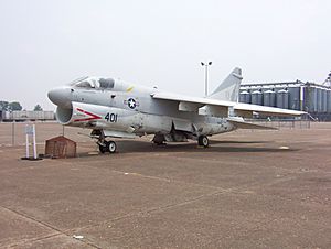
The Veterans' Museum is located on the grounds of the old Dyersburg Army Air Base, which is now Arnold Field. This museum works to save and share information about military activities. It covers wars from World War I all the way to the Iraq War. The museum also tells the story of the air base itself.
See also
 In Spanish: Halls (Tennessee) para niños
 | Precious Adams |
 | Lauren Anderson |
 | Janet Collins |


