
National Register of Historic Places listings in northwestern Worcester, Massachusetts facts for kids
Worcester, Massachusetts, is home to many amazing historic places! These special spots are listed on the National Register of Historic Places. This list includes 109 buildings and areas in the western and northern parts of Worcester. Some of these places, like the old 1767 Milestones and the Blackstone Canal Historic District, even stretch into other parts of the city.
You can find these historic locations on an online map. Just click on "Map of all coordinates" to see where they are!
Discovering Worcester's Historic Gems
Worcester has many buildings and areas that are important to its history. These places are officially recognized on the National Register of Historic Places. This means they are worth protecting because they tell us about the past. Let's explore some of these cool spots!
Historic Buildings and Homes
Many of Worcester's historic listings are old buildings and houses. These places often show us how people lived and worked long ago.
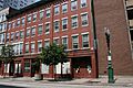
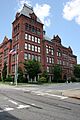
Old Schools and Stores
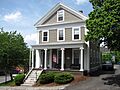
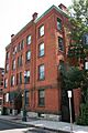
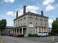
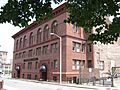
- The Abbott Street School at 36 Abbott Street is one such place. It was listed in 1980.
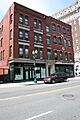
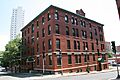
- The Elwood Adams Store at 156 Main Street is another old building that has been around for a long time. It was added to the list in 1980.
- The Ash Street School is also a historic school building.
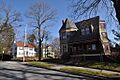
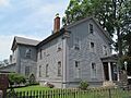
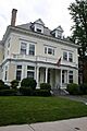
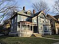
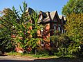
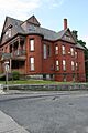
Important Houses
Many houses in Worcester are on the list because of their unique history or architecture.
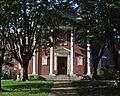
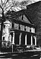
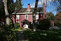
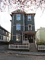
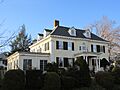
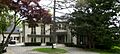
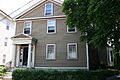
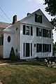
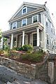
- The Charles Allen House on Elm Street was listed in 1980.
- The William Hogg House at 54 Elm Street is another historic home.
- The Isaac Davis House and the Joseph Davis House are also important old homes.
- The Frank L. and Mabel H. Dean House on Cedar Street was added to the list in 2002.
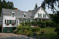
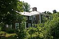
- The Francis Dewey House is another historic home on Elm Street.
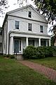
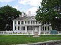
- The Gov. Levi Lincoln House at 4 Avalon Place is a very special historic home.
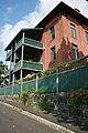
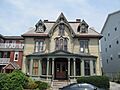
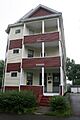
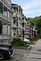
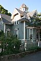
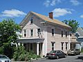
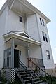
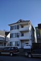
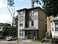
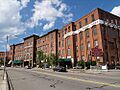
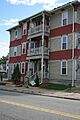
Three-Decker Houses
Worcester is famous for its "three-decker" houses, which are buildings with three apartments, one on top of the other. Many of these are historic!
- The Helen Dodge Three-Decker on Pleasant Street was listed in 1990.
- The Thomas F. Doran Three-Decker on John Street is another example.
- The Elvira Drew Three-Decker on Abbott Street is also a historic three-decker.
- The Edwin Johnson Three-Decker on Austin Street, the James McPartland Three-Decker on Pond Street, and the John Wescott Three-Decker on Pleasant Street are also on the list.
Public and Community Places
Worcester also has many historic public buildings and places where people gathered.
Famous Halls and Theaters
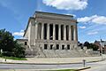
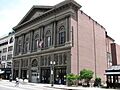
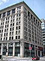
- Mechanics Hall at 321 Main Street is a very famous concert hall. It was built a long time ago and is known for its amazing sound. It was listed in 1972.
- The G.A.R. Hall (Grand Army of the Republic Hall) on Pearl Street was listed in 1975. This building was important for veterans.
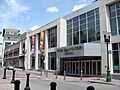
- The Hanover Theatre for the Performing Arts, originally known as Poli's Palace Theater, is a beautiful old theater on Southbridge Street. It was listed in 2011.
Churches and Cathedrals
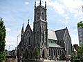
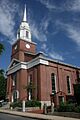
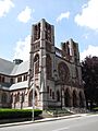
- The Cathedral of St. Paul on Chatham Street is a beautiful and historic church. It was listed in 1980.
- The Mission Chapel on Summer Street is another historic religious building.
- The Union Congregational Church on Chestnut Street is also on the list.
- St. John's Catholic Church on Temple Street is a very old and important church in the city.
City Buildings and Stations
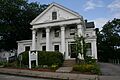
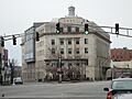
- Worcester City Hall and Common at 455 Main Street is the main building for the city government and the park next to it. It was listed in 1978.
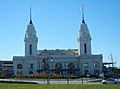
- Union Station on Washington Square is the city's historic train station. It's a grand building that was listed in 1980.
- The U.S. Post Office and Courthouse at 595 Main Street is now called the Harold D. Donohue Federal Building and United States Courthouse. It was listed in 2011.
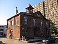
- The Waldo Street Police Station is also a historic building.
Parks and Districts
Some large areas or parks in Worcester are also listed because they have a special history.
Historic Parks
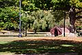
- Elm Park is a beautiful and historic park in Worcester. It was listed in 1970 and is a great place to visit.
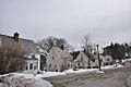
Special Historic Districts
Historic districts are areas with many historic buildings that together tell a story.
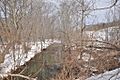
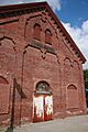
- The Blackstone Canal Historic District follows the path of the old Blackstone Canal. This canal was very important for moving goods long ago. It was listed in 1995 and stretches through many towns, including Worcester.
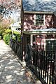
- The Elm Street Historic District includes many historic homes along Elm Street.
- The Hammond Heights area is a historic district with properties on several streets like Germain, Haviland, Highland, and Westland.
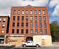
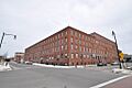
- The Harding-Winter Street Manufacturing District shows where many factories used to be.
- The Indian Hill-North Village district includes properties on streets like Ararat and Delaval Roads.
- The Institutional District has important buildings around Lincoln and Wheaton Squares.
- The Knollwood area on Salisbury Street is also a historic district.
- The Lincoln Estate-Elm Park Historic District includes properties around Elm Park and nearby streets.
- The Lower Pleasant Street District has historic buildings on Main and Pleasant Streets.
- The Massachusetts Avenue Historic District is another important area.
- The Mechanics' Hall District includes buildings around the famous Mechanics Hall.
- The Montvale district has properties on Montvale, Monadnock, and other roads.
- The Oxford-Crown Historic District is a large area with many historic buildings on streets like Chatham, Congress, and Pleasant.
- The Washburn and Moen North Works District on Grove Street was once a big factory area.
Other Notable Places
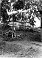
- The 1767 Milestones are old stone markers that were placed along the road between Boston and Springfield. Milestone 48 is in Worcester. These stones helped travelers know how far they had gone!
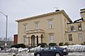
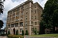
- The American Antiquarian Society at 185 Salisbury Street is a very old and important library. It collects and preserves American history. It was listed in 1968.
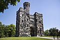
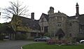
- Bancroft Tower is a cool stone tower on Bancroft Tower Road. It was listed in 1980 and is a local landmark.
- Liberty Farm on Mower Street was listed in 1974. It's a National Historic Landmark, which means it's extra special!
Some buildings that were once listed have been demolished, like the Babcock Block and the Emory Bannister House. The Charles Chamberlain House was also demolished. Even if a building is gone, its history is still remembered.
These are just some of the many fascinating historic places in Worcester that are protected for future generations to learn from and enjoy!
Images for kids
-
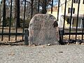
Milestone 47
-
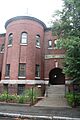
Abbott Street School
-
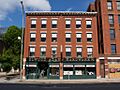
Elwood Adams Store
-
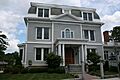
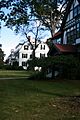
Charles Allen House
-
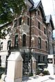
American Antiquarian Society
-
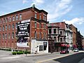
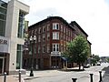
Armsby Block
-
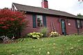
Ash Street School
-
Babcock Block (demolished)
-

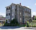
Bancroft Hotel
-
Bancroft Tower
-
Emory Bannister House (demolished)
-
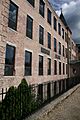
Blackstone Canal
-
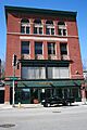
Bliss Building
-
John Brooks House
-
Cathedral of St. Paul
-
Chadwick Square Diner
-
Charles Chamberlain House (demolished)
-
Chamberlain-Flagg House
-
George Cobb House
-
Colton's Block
-
Samuel Copeland House
-
Crompton Loom Works
-
Isaac Davis House
-
Joseph Davis House
-
Frank L. and Mabel H. Dean House
-

Francis Dewey House
-
Dodge Block and Sawyer Building, Bancroft Trust Building
-
Helen Dodge Three-Decker
-
Thomas F. Doran Three-Decker
-
Elvira Drew Three-Decker
-
Elm Park
-
Elm Street Historic District
-
English High School
-
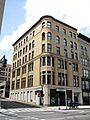
Enterprise Building
-
William Trowbridge Forbes House (demolished)
-
G.A.R. Hall
-
George Gabriel House
-
Gilman Block (demolished)
-
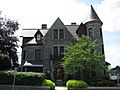
Harry Goddard House
-
Henry Goulding House
-
W.H. Goulding House
-
Gilbert Hadley Three-Decker
-
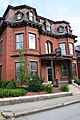
Hammond Heights
-
Harding-Winter Street Manufacturing District
-
Harris-Merrick House
-
John Hastins Cottage
-
Aldus Chapin Higgins House
-
Marcus Hobbs House
-
William Hogg House
-
Indian Hill-North Village
-
Institutional District
-
Edwin Johnson Three-Decker
-
Katz and Leavitt Apartment House
-

Knollwood
-

Liberty Farm
-
Lincoln Estate-Elm Park Historic District
-
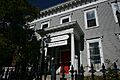
Gov. Levi Lincoln House
-
Lower Pleasant Street District
-
Jerome Marble House
-
Alexander Marsh House
-
Massachusetts Avenue Historic District
-
William McFarland House
-
James McPartland Three-Decker
-
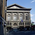
Mechanics Hall
-
Mechanics' Hall District
-
Merrill Double House
-
Mission Chapel
-
Montvale
-
Charles Newton House
-
North Worcester Aid Society
-
Old State Mutual Building
-
Oxford-Crown Historic District
-
Park Building
-
Pleasant Street Firehouse
-
Poli's Palace Theater
-
Otis Putnam House
-
Tilley Raymond House
-
Willard Richmond Apartment Block
-
B. E. Ridyard Three-Decker
-
John Riordan Three-Decker
-
The Russell
-
St. John's Catholic Church
-
Salisbury Factory Building 2
-
Salisbury Factory Building
-
Salisbury House
-
Salisbury Mansion and Store
-
Slater Building
-
Smith-Thaxter-Merrifield House
-
Stevens' Building
-
Thule-Plummer Buildings
-
Horatio Tower House
-
Union Congregational Church
-
U.S. Post Office and Courthouse
-
Union Station
-
Waldo Street Police Station
-
Washburn and Moen North Works District
-
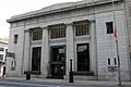
WCIS Bank
-
John Wescott Three-Decker
-
Whitcomb Mansion
-

Worcester City Hall and Common
-
Worcester Five Cents Savings Bank


