
1767 Milestones facts for kids
Quick facts for kids |
|
|
1767 Milestones
|
|

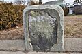
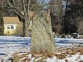
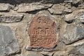
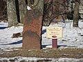
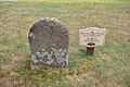
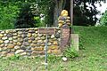
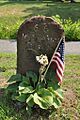
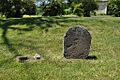
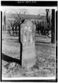
The "Parting Ways" stone in Roxbury
|
|
| Lua error in Module:Location_map at line 420: attempt to index field 'wikibase' (a nil value). | |
| Location | Massachusetts between Springfield and Boston |
|---|---|
| Area | less than one acre |
| Built | various dates; many pursuant to a policy dating to 1767 |
| NRHP reference No. | 71000084 |
| Added to NRHP | April 7, 1971 |
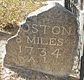
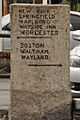
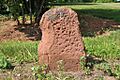
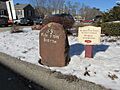
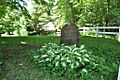
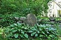
The 1767 Milestones are special old stones found along a historic road in Massachusetts. This road, called the Upper Boston Post Road, connects the cities of Boston and Springfield. These stones are called "1767 Milestones" because in that year, a rule was made to place such stones along important roads.
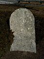
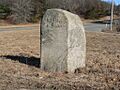
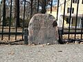
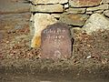
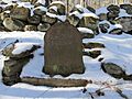
There are 40 of these stones still standing today. They were added to the National Register of Historic Places in 1971. This means they are important historical sites that should be protected. In 2018, many of these old stones were carefully repaired to keep them safe for the future.
The First Milestones
The very first milestone was put up by a man named Paul Dudley. He was an important person in Massachusetts in the early 1700s. He placed this stone in a town called Roxbury. Back then, Roxbury was a separate town, not part of Boston.
Roxbury was a key spot for travelers. It was located at the end of the Boston Neck, which was a narrow strip of land. This strip connected the main land to the Shawmut Peninsula, where Boston was built. If you wanted to travel by land from Boston, you had to go through Roxbury. The spot where Dudley put the first stone was important because several roads branched off there, leading to other parts of New England.
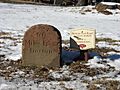
Paul Dudley's Mark
Paul Dudley also put up several other stones along the road from Boston to Cambridge. These stones often have his initials, "PD," carved into them, usually at the bottom. This helps us know which ones he placed. One of his stones, which is not part of this specific collection, is even more detailed. It says "P Dudley" instead of just "PD."
Guideposts, Not Milestones
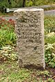
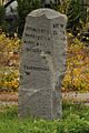
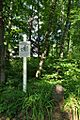
Some of the stones listed for miles 23 through 29 are a bit different. These are in the towns of Wayland and Sudbury. They are actually "guideposts" instead of true milestones. This means they don't tell you the exact mileage to Boston.
Instead, these guideposts were placed at road intersections. They helped travelers know which way to go. These particular stones are made of granite and were likely put in place after the year 1800.
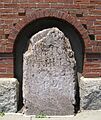
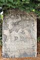
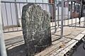
Images for kids
-
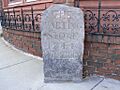
The "Parting Ways" stone in Roxbury, Mile 1
-
Milestone 4 in Boston, Mission Hill
-
Milestone 5 in Brookline
-
Milestone 6 in Boston, Brighton
-
Milestone 7 in Boston, Brighton
-
Milestone 8 in Cambridge
-
Milestone 23 in Wayland
-
Milestone 24 in Sudbury
-
Milestone 25 in Sudbury
-
Milestone 26 in Sudbury
-
Milestone 28 in Sudbury
-
Milestone 29 in Sudbury
-
Milestone 33 in Northborough
-
Milestone 35 in Shrewsbury
-
Milestone 43 in Shrewsbury
-
Milestone 47 in Worcester
-
Milestone 53 in Leicester
-
Milestone 54 in Leicester
-
Milestone 56 in Leicester
-
Milestone 57 in Leicester
-
Milestone 58 in Spencer
-
Milestone 59 in Spencer
-
Milestone 60 in Spencer
-
Milestone 61 in Spencer
-
Milestone 62 in East Brookfield
-
Milestone 63 in East Brookfield
-
Milestone 64 in Brookfield
-
Milestone 65 in Brookfield
-
Milestone 66 in Brookfield
-
Milestone 67 in West Brookfield
-
Milestone 68 in West Brookfield
-
Milestone 69 in West Brookfield
-
Milestone 70 in Warren
-
Milestone 71 in Warren
-
Milestone 72 in Warren
-

Milestone 73 in Warren
-
Milestone 74 in Warren
-
Milestone 99 in Springfield, known as the "Wait Guide Stone"


