Boston Neck facts for kids
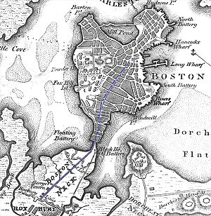
The Boston Neck was a very narrow strip of land that connected the city of Boston to the mainland town of Roxbury. Think of it like a natural bridge! This land was also called the Roxbury Neck.
Over time, as Boston grew bigger, people started to fill in the water around the neck. This made the city much larger. Today, the area where the Boston Neck once was is part of a neighborhood called the South End.
Contents
Exploring the Boston Neck's Past
When it was first settled, the Boston Neck was only about 120 feet (37 meters) wide during high tide. Early settlers built a wooden gate and a dirt wall around 1631. This was to protect Boston from attacks and to control who or what came into the city.
The gate was always guarded. It was usually locked at night, meaning no one could enter or leave Boston during those hours.
Important Locations on the Neck
North of the neck were the Charles River marshes. To the south was a place called Gallows Bay. It got its name because there was a wooden gallows nearby, where criminals were punished. This bay is now known as South Bay. The main road through the neck was called Orange Street in the early 1700s.
Building Stronger Defenses
In 1710, more defenses were built on the neck. There were two wooden gates: one for carriages and one for people walking.
In September 1774, General Thomas Gage, a British leader, made the old defenses even stronger. He added timber and more earth to the brick and stone walls. Gage also ordered a ditch to be dug in front of the defenses. This ditch would fill with salt water during high tide, completely cutting Boston off from the mainland. At low tide, the muddy areas on both sides of the neck made it very hard to enter Boston except through the town gate.
The Midnight Ride and the Neck
On the night of April 18, 1775, a Patriot leader named Doctor Joseph Warren sent Paul Revere and William Dawes on a very important mission. They were to warn John Hancock and Samuel Adams that British soldiers were coming to capture them and seize gunpowder in Concord.
William Dawes was a 30-year-old tanner from Boston. He was known to the British guards at the town gate on Boston Neck. This helped him pass through the checkpoint that evening, even though the city was on lockdown. Dawes took a southern route by land, while Revere took a northern route. Dr. Warren sent both men to make sure at least one of them would get through.
Dawes left around 10 P.M. and rode 17 miles (27 km) in three hours. He met Revere just before 1 A.M. at the Hancock–Clarke House in Lexington. This was hours before the Battles of Lexington and Concord began the American Revolution.
A Small Battle on the Neck
On July 8, 1775, during the Siege of Boston, a small fight happened on the Boston Neck. A few British soldiers faced about 200 Colonial volunteers.
The Colonials moved close to the British guardhouse through the marshes on either side of the neck. They had two cannons. A small group of six men circled behind the guardhouse. When they gave a signal, the two cannons fired into the guardhouse.
When the British guards ran out, the Colonials fired at them from the marshes. Some British soldiers were hurt, and they had to retreat towards Boston. The Colonial group then burned the guardhouse and another building. They also captured two muskets and some other weapons. No Colonial soldiers were hurt or killed in this skirmish.
Filling in the Land
People started adding dirt and other materials to the Boston Neck in the late 1700s. This was because the low-lying area often washed away.
Starting in the 1830s, the muddy areas of the Charles River were filled in. Trains brought loads of gravel from the Needham area to do this. This created the Back Bay section of Boston, which is now dry land.
The remains of the old defenses at the town gate could still be seen in 1822. On July 6, 1824, the part of Orange Street where the town gate once stood was renamed Washington Street.
Modern Changes to the Neck
The Washington Street Elevated train line, known as the “El,” ran above Washington Street from 1901 until 1987. The Orange Line subway now follows a different path. The old elevated tracks and stations were torn down after 1987.
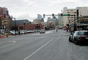
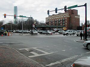
The Dover Street station was located where the old town gate used to be, at the intersection of Dover and Washington Street. Dover Street was later renamed East Berkeley Street. Today, nothing remains of the old town gate or its defenses. The East Berkeley bus rapid transit station is now in that spot.
 | Kyle Baker |
 | Joseph Yoakum |
 | Laura Wheeler Waring |
 | Henry Ossawa Tanner |


