
South End, Boston facts for kids
Quick facts for kids |
|
|
South End District
|
|
 |
|
| Lua error in Module:Location_map at line 420: attempt to index field 'wikibase' (a nil value). | |
| Location | Boston, Massachusetts |
|---|---|
| Architect | Multiple |
| Architectural style | Greek Revival, Late Victorian, Italianate |
| NRHP reference No. | 73000324 |
| Added to NRHP | May 8, 1973 |
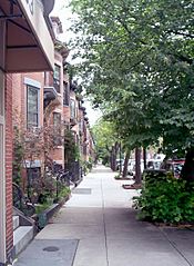
The South End is a cool neighborhood in Boston, Massachusetts, United States. It's next to Back Bay, Chinatown, and Roxbury. What makes it special are its beautiful Victorian-style houses and many green parks.
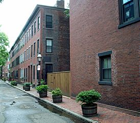
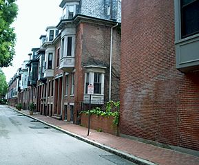
The South End is the biggest area in the country with so many Victorian row houses still standing. It covers over 300 acres and has eleven parks right in the middle of its neighborhoods. In 1973, the South End was added to the National Register of Historic Places, which means it's a really important historical area.
A long time ago, much of this area was just marshland in Boston's South Bay. But it was filled in, and building started on January 7, 1849. Today, the South End is home to many different kinds of people. This includes new immigrants, young families, and professionals. It has been a diverse place since the 1880s, with people from Irish, Jewish, African-American, Puerto Rican, Chinese, Italian, and Greek backgrounds living there.
Contents
Exploring the South End's Location


The South End is located south of Back Bay and northeast of Roxbury. Even though it's called the "South End," it's not directly south of downtown Boston.
This land has been part of Boston since the city was founded. Back then, it was smaller and surrounded by large muddy areas called tidal flats. The neighborhood grew by filling in these marshlands. This was part of a huge project to fill in Boston's Back Bay and South Bay between the 1830s and 1870s.
Workers brought in gravel by train from Needham to fill the land. In the 1800s, they couldn't use strong steel poles to support buildings. Instead, they used a system of wooden timbers buried underground. These timbers supported most South End buildings.
Over the years, the water levels in Boston have dropped. This can damage the old wooden supports by exposing them to air. To help with this, special wells have been drilled. The Boston Groundwater Trust checks the water level and can add water to protect the old foundations.
The South End was once bordered by the Boston and Providence Railroad. This train line is now covered by Southwest Corridor Park, a green space for everyone to enjoy.
The main streets for businesses in the South End are Columbus Avenue, Tremont Street, and Washington Street. Washington Street was once the main path connecting Roxbury to Boston. It has seen a lot of new development since the 1990s. An elevated train used to run along Washington Street, but it was moved underground in the 1980s. Now, part of the Silver Line, which is Boston's first fast bus line, runs here. The MBTA Orange Line train also runs along the Southwest Corridor.
Neighborhood Sections
The city has divided the South End into a few smaller sections:
- SoWa (South of Washington): This area is between Albany and Washington streets, and East Berkeley and Massachusetts Avenue.
- New York Streets: This section is named after cities on the old train route to Albany.
- Back Streets: This area is roughly between the highway, Harrison Street, East Brookline Street, and East Berkeley Street.
- Medical area: This part of the South End is home to several hospitals and medical buildings.
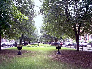
Green Spaces and Parks
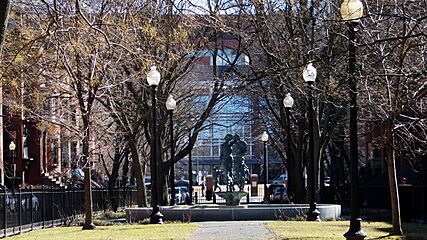
The South End is famous for its eleven residential parks. These parks are different sizes and were inspired by English-style town squares. They were first designed by Charles Bulfinch in downtown Boston.
The neighborhood also has newer parks, like Peters Park. There are also sixteen community gardens and small "pocket parks." These are managed by the Trustees of Reservations, a group that helps protect special places.
A Look Back: South End History
Homes and People Over Time

As the South End grew by filling in land, Boston leaders imagined a big new neighborhood. They hoped it would help ease crowding in downtown and Beacon Hill. Architect Charles Bulfinch planned some of the first filled land. He designed a large park called Columbia Square, which is now Franklin and Blackstone Squares. His idea was to have traffic go around the square, but this plan was changed. Washington Street was allowed to cut through, creating two separate squares.
Many homes in the South End were built for middle-class families. These included business owners, bankers, and even two mayors. But the neighborhood's wealthy period didn't last very long. Economic problems and new housing in other areas led to changes.
By the late 1800s, the South End became a place for many different groups. It attracted immigrants and, later, people from the Black middle class. Many Pullman porters, who worked on trains, lived here.
The first settlement houses in Boston were in the South End. These places helped people in need. In 1960, several of these houses joined together to form United South End Settlements.
Changes and Growth


The South End was one of Boston's biggest projects to create new neighborhoods by filling in land. Building started in 1849 on marshlands. The streets were planned like English towns, with blocks of houses facing small parks. These parks were built to make the neighborhood feel more like a community.
Many townhouses were built between 1850 and 1880, showing a mix of architectural styles. The South End also became a popular area for hospitals. Boston City Hospital was the first, and others followed. One was the Massachusetts Homeopathic Hospital, built in 1875. This hospital used fresh air and home remedies.
The Boston University School of Medicine moved to the South End in 1874. It was part of the New England Female College, which was the first college in the area to accept women. By the late 1800s, more African Americans from the South moved to the South End.
A Black doctor named Cornelius Garland opened Plymouth Hospital in 1908. This hospital also had a nurse's training school. It closed by 1929 because City Hospital started accepting people of color into its medical programs.
The "New York Streets" area was a residential part of the South End. Its streets were named after cities on the train route to Albany, New York. Almost all the buildings in this area were torn down in 1955. This was part of a project to clear older areas and make space for new businesses. The land was redeveloped into the headquarters of the Boston Herald newspaper. Later, this area became a mixed-use space with apartments, shops, and restaurants, called the Ink Block.
The South End is a mix of homes and businesses. Because it was close to train lines and port facilities, many factories and warehouses were built here. Albany Street became a center for furniture and piano making in the 1800s.
Today, new projects are adding more homes and businesses to the South End. For example, a new project on Albany Street will include two hotels and a parking garage. This project is expected to create many new jobs for construction workers and hotel staff.
Jazz Music History

Until the 1950s, the South End and nearby Roxbury were famous for jazz music. Many clubs like the Royal Palms, Eddie Levine's, and Wally's Paradise were here. Wally's is the only one still open today!
The American Federation of Musicians Local 535 was a very important Black musicians' union. It was active from 1915 to 1970. Famous musicians like Duke Ellington and Cab Calloway were part of it. Their offices were once above Charlie's Sandwich Shoppe, which still has photos of jazz musicians on its walls.
Learning in the South End

The South End has five schools for kids from kindergarten to high school. These are part of Boston Public Schools. The McKinley South End Academy helps students with special learning needs. The Josiah Quincy Upper School teaches grades six to 12, focusing on core subjects, languages, and arts.
Blackstone Elementary School has over 500 students from many different backgrounds. The Benjamin Franklin Institute of Technology, started in 1908, is a school for students who want a technical degree.
Community Resources and Help
The South End has three public libraries. The South End Branch has many books, DVDs, and audiobooks for all ages. It also has local history documents and programs for kids and adults. For example, there are book clubs and English conversation classes.
The Blackstone Community Center is a place for young people and families. It offers many programs and services to improve life for Boston residents.
Two major hospitals in the South End are Boston Medical Center and Boston University School of Medicine. The South End Community Health Center is a non-profit organization. It provides high-quality healthcare and social services to everyone, no matter if they can pay. They offer services like adult medicine, dental care, and nutrition.
Other community groups include South End Baseball and Youth Enrichment Services. The South End Historical Society helps preserve the neighborhood's past. The Animal Rescue League of Boston, founded in 1899, is also here. It has an animal shelter, helps investigate animal cruelty, and offers veterinary care.
A Diverse Community

The South End has been a diverse place for a long time, since the 1880s. People from Irish, Lebanese, Jewish, African-American, Puerto Rican, Italian, and Greek backgrounds have made their homes here. Immigrants from Canada also found new opportunities and homes in the South End in the 1930s.
In the 1940s, after World War II, many different people moved into the South End's rooming houses. Later in the decade, the Hispanic population began to grow, often settling near the Cathedral of the Holy Cross. The neighborhood continues to be a mix of people from many different backgrounds.
The South End has a mix of different income levels. It has both wealthier and lower-income residents. The neighborhood has kept its mix of people because of its affordable housing options and a homeless shelter.
While all neighborhoods have some crime, Boston generally has low street crime. Some parts of the South End are known for street crime, but other parts are very family friendly. The neighborhood actually has more public playgrounds per square foot than other Boston neighborhoods.
The South End is known as a growing upper middle class neighborhood. However, it still has many lower-income residents. Some long-time residents are finding it hard to stay because rents and property taxes are going up.
The South End is also known for its art and culture. Existing art galleries are doing well. GardenMoms, a popular online group for parents in Boston, was started by mothers in the South End in 2002.
South End in 2010

In 2010, the South End had 24,577 people living there. This was a 12.2 percent increase from 2000. The population was about 55 percent white, 13 percent Hispanic, 12.5 percent Black, and 16 percent Asian.
About 34 percent of the people were between 20 and 34 years old. Eight percent were under nine years old. The average age in the South End was 36. More than half of the people had a college degree.
Most people (about 65 percent) spoke English as their main language. Spanish was spoken by about 13 percent, and Chinese by about 10 percent. The average yearly income in the South End was $57,699.
There were 12,831 households in the South End. About 23 percent were families with a husband and wife. Almost half (47 percent) of people lived alone. In 2010, about 45 percent of residents did not own a car. About 34 percent used public transportation.
Most people (58 percent) worked in management, business, science, and arts. About 79 percent of the workers were between 20 and 34 years old. In 2010, most South End residents (72.6 percent) had lived in the same place for the past year.
Getting Around: Public Transportation

The South End is close to several MBTA subway stops. You can find Green Line stops like [[{{{station}}} (MBTA station)|{{{station}}}]], [[{{{station}}} (MBTA station)|{{{station}}}]], and [[{{{station}}} (MBTA station)|{{{station}}}]] stations. The Orange Line has stops at [[{{{station}}} (MBTA station)|{{{station}}}]], [[{{{station}}} (MBTA station)|{{{station}}}]], and [[{{{station}}} (MBTA station)|{{{station}}}]] stations.
You can also catch Commuter rail trains at Ruggles and Back Bay stations. These lines go to places like Franklin/Foxboro, Needham, and Providence/Stoughton. The Back Bay station also serves the Framingham/Worcester Line. All these commuter rail lines continue to South Station.
The bus rapid transit routes SL4 and SL5 run on Washington Street through the South End. They have several stops between Lenox and Herald Streets. Local MBTA bus routes also serve the neighborhood. Important routes include route 43 on Tremont Street and route 1 on Massachusetts Avenue.
Gallery
South End in the 1950s
-
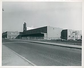
Boston Herald Traveler Building, 1952–1956
-
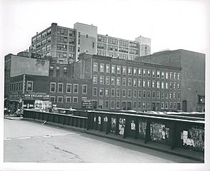
Motte Street with 1000 Washington in the background, June 24, 1952
-
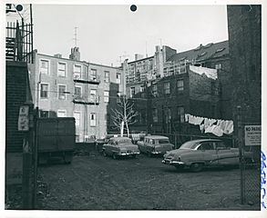
Rear of houses on Harrision Avenue and Johnny Court, 1952–1958
-
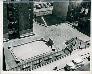
Tot lot on Troy Street, 1952–1958
-
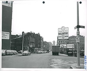
Shawmut Avenue at Tremont Street, December 4, 1956
-
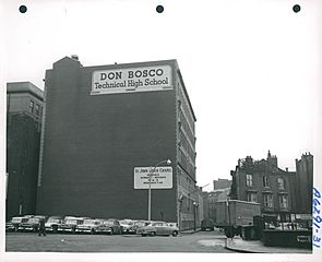
Don Bosco Technical High School, Warrenton Street, December 4, 1956
-
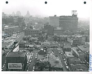
Northeast from roof of 100 Arlington Street, December 4, 1956


Contemporary images
-
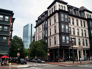
Columbus Avenue and Dartmouth Street
-
Lawrence Street
-
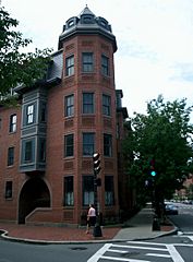
Dartmouth Place
-
Side street
-
Union Park Street
-
Worcester Square
-
Union Park and Tremont Streets
-
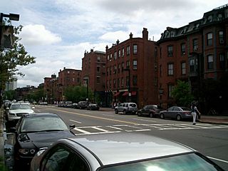
Tremont Street
-
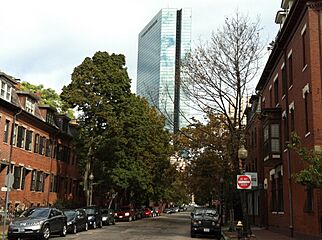
Clarendon Street, with the John Hancock Tower in the background


