New Sarpy, Louisiana facts for kids
Quick facts for kids
New Sarpy
L'Anse Aux Outardes
|
|
|---|---|
| Country | United States |
| State | Louisiana |
| Parish | St. Charles |
| Area | |
| • Total | 1.38 sq mi (3.57 km2) |
| • Land | 1.14 sq mi (2.94 km2) |
| • Water | 0.24 sq mi (0.63 km2) |
| Elevation | 3 ft (0.9 m) |
| Population
(2020)
|
|
| • Total | 1,169 |
| • Density | 1,029.96/sq mi (397.58/km2) |
| Time zone | UTC-6 (CST) |
| • Summer (DST) | UTC-5 (CDT) |
| Area code(s) | 985 |
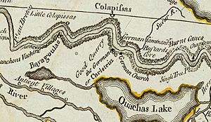
| L'Anse Aux Outardes | Bustard’s cove, 1722. Settled by Canadians, French, Bienville came here in 1699 from Lake Pontchartrain using small waterways, portage. LeSueur and Canadians used the route and were met here by Iberville and Tonti February 24, 1700. It became part of the Second German Coast about 1730. |
New Sarpy is a small community in St. Charles Parish, Louisiana, United States. It is known as a census-designated place (CDP). This means it is a special area defined by the government for counting people. In 2020, about 1,169 people lived here.
Contents
History of New Sarpy

In 1699, two explorers named Pierre Le Moyne d'Iberville and Jean-Baptiste Le Moyne de Bienville made an important discovery. They found a village of the Bayagoula people. This village was located near where the Mississippi River met a smaller stream. Today, this area is part of New Sarpy.
The explorers named this place L’Anse aux Outardes. This French name means Bustard’s Cove.
Later, in 1722 and 1723, new settlers arrived. These settlers were from France, Germany, and French Canada. They were given land on the east side of the Mississippi River. They moved from villages on the west side of the river.
These settlers created the first community on the east bank at Bustard’s Cove. This led to the creation of the Second German Coast around 1730. From then on, there were official settlements on both sides of the Mississippi River.
Geography of New Sarpy
New Sarpy is located at 29°58′44″N 90°23′8″W / 29.97889°N 90.38556°W. This is its exact spot on a map.
The United States Census Bureau says that New Sarpy covers a total area of about 2.0 square miles (5.3 square kilometers). Most of this area is land. About 1.7 square miles (4.4 square kilometers) is land.
The rest of the area is water. About 0.3 square miles (0.9 square kilometers) is water. This means about 17% of New Sarpy's area is water.
Population and People
| Historical population | |||
|---|---|---|---|
| Census | Pop. | %± | |
| 2020 | 1,169 | — | |
| U.S. Decennial Census | |||
The 2020 United States census counted 1,169 people living in New Sarpy. There were 441 households, which are groups of people living together. Also, there were 353 families.
Here is a look at the different groups of people living in New Sarpy in 2020:
| Race | Number | Percentage |
|---|---|---|
| White (not Hispanic) | 497 | 42.51% |
| Black or African American (not Hispanic) | 565 | 48.33% |
| Native American | 2 | 0.17% |
| Other/Mixed | 51 | 4.36% |
| Hispanic or Latino | 54 | 4.62% |
Education
The St. Charles Parish Public School System runs the public schools in the area. Students in New Sarpy attend these schools:
- New Sarpy Elementary School
- Destrehan High School in Destrehan
Notable People
Some well-known people have come from New Sarpy:
- Jerico Nelson: He is a former NFL safety. He played for the New Orleans Saints.
See also
 In Spanish: New Sarpy para niños
 | Ernest Everett Just |
 | Mary Jackson |
 | Emmett Chappelle |
 | Marie Maynard Daly |


