Ola, South Dakota facts for kids
Quick facts for kids
Ola, South Dakota
|
|
|---|---|
| Country | United States |
| State | South Dakota |
| Counties | Brule |
| Area | |
| • Total | 4.02 sq mi (10.41 km2) |
| • Land | 4.02 sq mi (10.41 km2) |
| • Water | 0.00 sq mi (0.00 km2) |
| Elevation | 1,732 ft (528 m) |
| Population
(2020)
|
|
| • Total | 15 |
| • Density | 3.73/sq mi (1.44/km2) |
| Time zone | UTC-6 (Central (CST)) |
| • Summer (DST) | UTC-5 (CDT) |
| FIPS code | 46-46700 |
| GNIS feature ID | 2584564 |
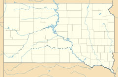
Ola is a very small place in Brule County, South Dakota, in the United States. It's known as an "unincorporated community." This means it doesn't have its own local government like a city or town. It's also a "census-designated place" (CDP). This is a special area that the United States Census Bureau defines just for counting people.
Ola is located in the southern part of Brule County. It is about 2 miles (3.2 km) west of South Dakota Highway 50. It is also about 12 miles (19 km) south of Interstate 90, a major highway.
Who Lives in Ola?
This section talks about the people living in Ola. It's called "demographics."
Population Count
According to the 2020 census, only 15 people lived in Ola. This makes it a very small community.
| Historical population | |||
|---|---|---|---|
| Census | Pop. | %± | |
| 2020 | 15 | — | |
| U.S. Decennial Census | |||
See also
- In Spanish: Ola (Dakota del Sur) para niños
Black History Month on Kiddle
African-American Astronauts:
 | Jessica Watkins |
 | Robert Henry Lawrence Jr. |
 | Mae Jemison |
 | Sian Proctor |
 | Guion Bluford |

All content from Kiddle encyclopedia articles (including the article images and facts) can be freely used under Attribution-ShareAlike license, unless stated otherwise. Cite this article:
Ola, South Dakota Facts for Kids. Kiddle Encyclopedia.

