
Pampas, Peru facts for kids
Quick facts for kids
Pampas
|
|||
|---|---|---|---|

Plaza de Armas, Pampas
|
|||
|
|||
| Nickname(s):
Ciudad de los Cuchimichis (The Cuchimichis City)
|
|||

Pampas, Peru
Location in Peru
|
|||
| Country | Peru | ||
| Region | Huancavelica | ||
| Province | Tayacaja | ||
| Established | 21 June 1825 | ||
| Area | |||
| • Total | 52.264 km2 (20.179 sq mi) | ||
| Elevation | 3,276 m (10,748 ft) | ||
| Population | |||
| • Total | 11,566 | ||
| • Density | 221.3/km2 (573/sq mi) | ||
| Time zone | UTC-5 (PET) | ||
| • Summer (DST) | UTC-5 (PET) | ||
| Area code(s) | 067 | ||
| Website | www.munitayacaja.gob.pe | ||


Pampas is a city located in the country of Peru. It is the main city, or capital, of the Tayacaja Province. This city was officially started on June 21, 1825.
Pampas is home to many people. In 2007, about 9,973 people lived there. If you count the surrounding areas, the total population was around 11,566. The city is quite high up, sitting at an altitude of about 3,276 meters (which is over 10,700 feet!).
Getting Around Pampas
Pampas is connected to other important cities like Huancayo and Ayacucho. You can travel between these cities using roads that are partly paved.
Learning in Pampas
Pampas is a place where you can get a good education.
- It has a part of the Universidad Nacional de Huancavelica, which is a big university.
- The city also has a local technical school called the Instituto Tecnologico Pampas - Tayacaja. This school teaches useful skills for jobs.
Images for kids
-
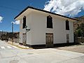
A house in Pampas.
-
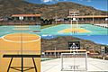
Futsal court in Pampas.
-
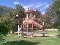
Slide in the "Parque Ecolgico de Pampas".
-
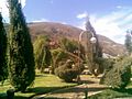
Gardens in the "Parque Ecolgico de Pampas".
-
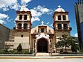
Cathedral of San Pedro de Pampas.
-
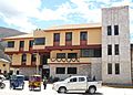
Municipality of Pampas.
-
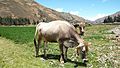
A cow in Pampas.
-
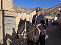
Pampino.


See also
 In Spanish: Pampas para niños
