Paramakatoi facts for kids
Quick facts for kids
Paramakatoi
|
|
|---|---|
 |
|
| Country | |
| Region | Potaro-Siparuni |
| Elevation | 3,180 ft (970 m) |
| Population
(2012)
|
|
| • Total | 1,423 |
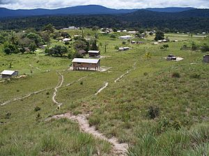
Paramakatoi is a village in Guyana, a country in South America. It is an Amerindian community, meaning it is home to indigenous people. You can find it in the Potaro-Siparuni Region, high up in the Pacaraima Mountains. The village sits at an elevation of about 970 meters (3,182 feet) above sea level. It is located about 18 kilometers (11 miles) east of another village called Kurukabaru.
History of Paramakatoi
Paramakatoi is part of the traditional lands of the Patamona people. They are one of the many indigenous groups in Guyana.
The name of the village comes from a nearby creek. This creek is surrounded by special plants called Palamaka. In the Patamona language, the word "toi" means "savannah," which is a type of grassland. So, "Palamakatoi" means "Palamaka savannah." When missionaries arrived in the area, the name changed slightly to "Paramakatoi."
About Paramakatoi Village
Paramakatoi is an important place for the surrounding area. It acts as a main center for many smaller communities. It is the biggest and most developed Amerindian village in its region.
The village is home to several different indigenous tribes. These include the Patamona, Macushi, and Wapishana peoples.
Paramakatoi has a secondary school, which means older kids can continue their education there. Since 2016, the village has also been part of the Hinterland Employment Youth Service (HEYS) program. This program helps young people in remote areas get job training and skills.
The village also has a special factory. This factory processes tomatoes to make sun-dried tomato products.
In 2019, Paramakatoi was chosen to host a special debate. This debate was held entirely in the Patamona language. It was part of a worldwide event to celebrate the International Year of Indigenous Languages. This showed how important it is to keep indigenous languages alive.
Getting to Paramakatoi
Paramakatoi has its own small airport. It is called the Paramakatoi Airport. This airport helps people travel to and from the village.
See also
 In Spanish: Paramakatoi para niños


