Pardines, Spain facts for kids
Quick facts for kids
Pardines
|
|||
|---|---|---|---|
|
Municipality
|
|||
 |
|||
|
|||
 |
|||
| Country | |||
| Autonomous Community | |||
| Province | Girona | ||
| Comarca | Ripollès | ||
| Area | |||
| • Total | 31.0 km2 (12.0 sq mi) | ||
| Elevation | 1,226 m (4,022 ft) | ||
| Population
(2018)
|
|||
| • Total | 162 | ||
| • Density | 5.226/km2 (13.53/sq mi) | ||
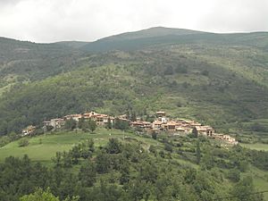
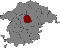
Pardines is a small and charming village located in the beautiful region of Catalonia, Spain. It's nestled among mountains in an area called Ripollès, which is part of the Girona province. Imagine a peaceful place with fresh air and stunning views – that's Pardines! It's a municipality, which means it's a local government area, much like a town or city.
Contents
Where is Pardines?
Pardines is surrounded by amazing nature. The highest point in the area is a mountain called Puig Cerverís, which stands tall at 2,202 meters (about 7,224 feet). The village shares its borders with other nearby towns. To the north, you'll find Queralbs and Vilallonga de Ter. To the east and south, it borders Ogassa, and to the west, it's next to Ribes de Freser and Queralbs.
A Look at Pardines' History
The name Pardines comes from an old word, parietinas, which means "building ruins." This suggests that there were old structures here a very long time ago! The first time Pardines was officially mentioned was in the year 839. This was in an important document about a church called Sant Ot d'Urgell.
Over the centuries, Pardines was owned by different powerful groups. It was once part of the lands belonging to the counts of Cerdanya. Later, it was controlled by the noble family of Sales. The monastery of Sant Martí de Canigó also had a claim to it, and eventually, it became a possession of the counts of Barcelona.
Population Over Time
Pardines is a small community. In 1900, about 476 people lived there. Like many small villages, its population changed over the years. By 2018, the village had a population of 162 people.
Places to See in Pardines
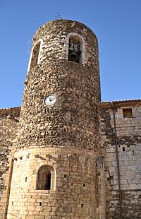
Pardines is home to several interesting old buildings, especially churches and chapels. These are small, historic places of worship that tell stories of the past.
- Church of Santa Magdalena
- Church of Sant Esteve
- Chapel of Santa Magdalena
- Chapel of Sant Martí
- Chapel of the Roser
See also
 In Spanish: Pardinas para niños


