Paucartambo, Paucartambo facts for kids
Quick facts for kids
Paucartambo
Pawqar Tampu
|
|
|---|---|
|
Town
|
|

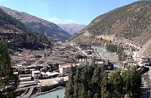
Panorama of Paucartambo
|
|
| Country | |
| Region | Cusco |
| Province | Paucartambo |
| District | Paucartambo |
| Elevation | 2,906 m (9,534 ft) |
| Time zone | UTC-5 (PET) |
Paucartambo is a charming town located in the southern part of Peru. It is the main town of the Paucartambo Province, which is part of the beautiful Cusco Region. The name "Paucartambo" comes from the Quechua language, "Pawqar Tampu." This means "colored tambo." A "tambo" was a special building used by the ancient Incas as a resting place or a storage spot.
This town is most famous for its incredibly colorful and lively festival, the Virgen del Carmen festival. This celebration honors Our Lady of Mount Carmel and takes place every year on July 16th. The Fiesta de la Virgen del Carmen lasts for three days. It is one of the biggest street parties in all of Peru. Tens of thousands of visitors, mostly from Peru, come to enjoy the fun each year.
Weather in Paucartambo
The weather in Paucartambo is important for its people and visitors. The town is located high up in the mountains, at about 2,906 meters (9,534 feet) above sea level. This high elevation affects the climate.
| Climate data for Paucartambo, elevation 2,931 m (9,616 ft), (1991–2020) | |||||||||||||
|---|---|---|---|---|---|---|---|---|---|---|---|---|---|
| Month | Jan | Feb | Mar | Apr | May | Jun | Jul | Aug | Sep | Oct | Nov | Dec | Year |
| Mean daily maximum °C (°F) | 20.4 (68.7) |
20.4 (68.7) |
20.7 (69.3) |
21.3 (70.3) |
21.8 (71.2) |
21.8 (71.2) |
21.6 (70.9) |
21.4 (70.5) |
21.3 (70.3) |
21.3 (70.3) |
21.6 (70.9) |
20.9 (69.6) |
21.2 (70.2) |
| Mean daily minimum °C (°F) | 9.2 (48.6) |
9.3 (48.7) |
8.9 (48.0) |
7.9 (46.2) |
6.3 (43.3) |
5.1 (41.2) |
4.3 (39.7) |
5.0 (41.0) |
6.6 (43.9) |
7.9 (46.2) |
8.7 (47.7) |
9.2 (48.6) |
7.4 (45.3) |
| Average precipitation mm (inches) | 125.8 (4.95) |
124.6 (4.91) |
97.9 (3.85) |
40.5 (1.59) |
11.7 (0.46) |
8.0 (0.31) |
9.8 (0.39) |
16.3 (0.64) |
14.3 (0.56) |
43.4 (1.71) |
47.6 (1.87) |
95.6 (3.76) |
635.5 (25) |
| Source: National Meteorology and Hydrology Service of Peru | |||||||||||||
The table above shows the average temperatures and rainfall throughout the year. You can see that the warmest months are usually from January to March. The coolest months are June and July. Paucartambo gets the most rain during the summer months, from December to March. The dry season is from May to August.
More to Explore
 In Spanish: Paucartambo para niños
 | Ernest Everett Just |
 | Mary Jackson |
 | Emmett Chappelle |
 | Marie Maynard Daly |


