Peñas del Chache facts for kids
Quick facts for kids Peñas del Chache |
|
|---|---|

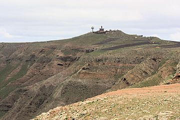
Las Peñas del Chache, with the facilities of the Air Force Barracks
|
|
| Highest point | |
| Elevation | 672 m (2,205 ft) |
| Prominence | 672 m (2,205 ft) |
| Geography | |
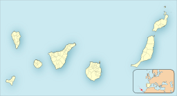
| Location | Haría, Lanzarote, Canary Islands, Spain |
| Geology | |
| Mountain type | Stratovolcano |
Peñas del Chache is the tallest mountain on Lanzarote island in the Canary Islands, Spain. It stands 672 meters (about 2,205 feet) above the sea. You can find it in the northern part of the island, in an area called Haría.
Contents
What's in a Name?
The name Chache likely comes from the ancient Guanche language. This was the language spoken by the first people who lived in the Canary Islands. A language expert named Maximiano Trapero thinks Chache means 'the height' or 'the tall place'. This makes sense because it is the highest point on Lanzarote!
About Peñas del Chache
Peñas del Chache is a rocky mountain that is part of the Famara mountain range. This range is located in the northern part of Lanzarote. At the very top of Peñas del Chache, there is a special building. This building is used by the Spanish Air Force for air surveillance. It helps them watch the skies.
How the Mountain Formed
Peñas del Chache is made of a type of rock called basalt. This rock formed a very long time ago, during a period called the Miocene. This was millions of years ago! The mountain is part of the Famara volcanic area. This area is one of the oldest parts of Lanzarote, formed by ancient volcanoes.
Plants and Nature
In the past, the area around Peñas del Chache was covered in thick forests. These were special forests with plants that liked warm weather. However, over many years, human activities changed the landscape. Now, you will mostly see different kinds of bushes and shrubs. These include plants like the wild spurge (Euphorbia regis-jubae) and other local plants such as Asteriscus intermedius and Lavandula dentata.
Ancient Discoveries
Close to Peñas del Chache, archaeologists have found exciting clues about the past. They discovered remains from the ancient people who lived on Lanzarote. These people were called the majos. Finding these old sites helps us learn more about how they lived long ago.
See also
 In Spanish: Peñas del Chache para niños
 | Sharif Bey |
 | Hale Woodruff |
 | Richmond Barthé |
 | Purvis Young |


