Lanzarote facts for kids

Satellite view (October 2019)
|
|
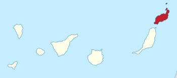
Location in the Canary Islands
|
|
| Geography | |
|---|---|
| Coordinates | 29°02′06″N 13°38′06″W / 29.035°N 13.635°W |
| Archipelago | Canary Islands |
| Area | 845.94 km2 (326.62 sq mi) |
| Coastline | 191 km (118.7 mi) |
| Highest elevation | 671 m (2,201 ft) |
| Highest point | Peñas del Chache |
| Administration | |
|
Spain
|
|
| Autonomous community | Canary Islands |
| Province | Las Palmas |
| Capital and largest city | Arrecife (pop. 68025) |
| President of the cabildo insular | María Dolores Corujo Berriel |
| Demographics | |
| Demonym | lanzaroteño, -ña; conejero, -a (es) |
| Population | 163230 (2024) |
| Pop. density | 180.0 /km2 (466.2 /sq mi) |
| Languages | Spanish, specifically Canarian Spanish |
| Ethnic groups | Spanish, Canary Islanders, other minority groups |
| Additional information | |
| Time zone |
|
| • Summer (DST) | |
Lanzarote is a Spanish island, the most eastern of the Canary Islands. It's about 125 kilometers (78 miles) from the north coast of Africa. The island is also about 1,000 kilometers (620 miles) from the Iberian Peninsula, which is where mainland Spain is.
Lanzarote is the fourth largest island in the Canary Islands, covering about 846 square kilometers (327 square miles). As of early 2024, about 163,230 people live here. This makes it the third most populated Canary Island, after Tenerife and Gran Canaria. A major attraction on the island is Timanfaya National Park, located in the central-west part. In 1993, UNESCO declared Lanzarote a biosphere reserve, recognizing its special natural environment. The island's capital city is Arrecife, found on the eastern coast.
The first recorded name for the island was Insula de Lanzarotus Marocelus. This name was given by an Italian mapmaker, Angelino Dulcert. It was named after a Genoese sailor named Lancelotto Malocello. The island's original name in the native Guanche language was Tyterogaka or Tytheroygaka. This might mean "one that is all ochre", referring to the island's reddish color before the big eruptions in Timanfaya National Park.
Contents
History of Lanzarote
Lanzarote is thought to be the first Canary Island where people settled. Ancient people called the Phoenicians might have visited or lived here, but we don't have clear proof. The first written record comes from the Roman writer Pliny the Elder. He wrote about an expedition to the Canary Islands in his book Naturalis Historia.
Early Settlements and Roman Times
The Romans called these islands the "Fortunate Isles" (Insulae Fortunatae). Pliny listed some of the islands, but Lanzarote and Fuerteventura were only mentioned as the "purple islands." Later, the Roman poet Lucan and the Greek geographer Ptolemy gave their exact locations. The island was settled by the Majos tribe, who were part of the Guanches. After the Western Roman Empire ended, there are no records of contact with the Canary Islands until 999 AD. This is when Arabs arrived and called the island al-Djezir al-Khalida.
European Arrival and Conquest
In 1336, a ship from Lisbon arrived, led by the Genoese sailor Lancelotto Malocello. He used the name "Lanzarote da Framqua." A fort was later built near today's Teguise. In the late 1300s, Spanish expeditions captured hundreds of Guanches and sold them as slaves in Spain. This started the slave trade in the islands.
French explorer Jean de Béthencourt arrived in 1402. He led an expedition supported by Spain. Bethencourt first landed in the south of Lanzarote at Playas de Papagayo. The French quickly took over the island. Lanzarote didn't have many mountains or deep valleys where the Guanches could hide. Because of this, many Guanches were taken as slaves, and it's said only 300 Guanche men were left.
First European Settlement
The first European settlement in the Canary Islands was in 1402. It was in the area called El Rubicón, in the south of the Yaiza municipality. This is where the conquest of the whole Canary Archipelago began. A cathedral, the Cathedral of Saint Martial of Limoges, was built here. However, English pirates destroyed it in the 16th century. In 1404, the Castilians (from Spain) fought the local Guanches, which further reduced their numbers. The nearby islands of Fuerteventura and El Hierro were also conquered.
In 1477, the Spanish royal council gave control of Lanzarote and Fuerteventura (along with El Hierro and La Gomera) to the Castilian noble family Herrera. They ruled the islands until the late 1700s. In 1586, the Ottoman admiral Murat Reis briefly took control of Lanzarote. In the 1600s, pirates often raided the island. They captured about 1,000 people and took them as slaves to Cueva de los Verdes.
Lanzarote's Role in Trade
For a long time, Lanzarote and Fuerteventura were the main suppliers of wheat and grains. They sent these goods to the central islands of the Canary Archipelago, Tenerife and Gran Canaria, during the 16th, 17th, and 18th centuries. However, the landowners on Lanzarote and Fuerteventura mostly benefited from this trade. This often led to times of hunger for the local people. Because of this, many people from Lanzarote and Fuerteventura had to travel to Tenerife and Gran Canaria to find food. This created a strong connection between the people of these islands and Tenerife.
Volcanic Eruptions and Their Impact
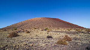
From 1730 to 1736, Lanzarote experienced a series of huge volcanic eruptions. These eruptions created 32 new volcanoes over an 18-kilometer (11-mile) stretch. A priest from Yaiza, Don Andrés Lorenzo Curbelo, wrote down detailed observations of the eruption until 1731. Lava covered a quarter of the island, including its most fertile land and 11 villages. About 100 smaller volcanoes formed in an area called Montañas del Fuego, which means "Mountains of Fire."
In 1768, a severe drought hit the island. There was no rain during the winter, and the island had already lost many of its trees. This forced many people to leave Lanzarote and move to Cuba and the Americas. A group of these emigrants even became important Spanish settlers in Texas at San Antonio de Bexar in 1731.
Modern Times and UNESCO Status
In 1927, Lanzarote and Fuerteventura became part of the province of Las Palmas. Scientists have found evidence of ancient settlements at a place called El Bebedero in the village of Teguise. During one of these digs, teams from the University of Las Palmas de Gran Canaria and the University of Zaragoza found about 100 Roman pottery pieces, nine metal items, and one piece of glass. These items date back to between the 1st and 4th centuries. This shows that Romans traded with the people of the Canary Islands, even though there's no proof they actually settled there.
Lanzarote has a special status as a UNESCO Biosphere Reserve. This means its natural environment is protected. There have been some concerns about this status due to building projects on the island. The President of the Cabildo (island council) of Lanzarote has stated that the island's UNESCO status is not at risk.
Geography of Lanzarote
Lanzarote is located about 125 kilometers (78 miles) northwest of Africa. It's also about 11 kilometers (7 miles) northeast of Fuerteventura and just over 1 kilometer (0.6 miles) from La Graciosa. The island is about 60 kilometers (37 miles) long from north to south and 25 kilometers (16 miles) wide from west to east.
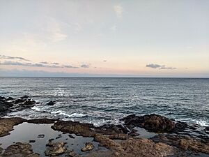
Lanzarote has 213 kilometers (132 miles) of coastline. About 10 kilometers (6 miles) of this is sand, and 16.5 kilometers (10 miles) are beaches. The rest of the coastline is rocky. The island's landscape includes the Famara mountain range in the north, which is about 671 meters (2,201 feet) high. To the south, there are the Ajaches mountains, about 608 meters (1,995 feet) high. South of the Famara mountains is the El Jable desert. This desert separates Famara from the Montañas del Fuego (Mountains of Fire). The highest point on the island is Peñas del Chache, which reaches 670 meters (2,198 feet) above sea level. Lanzarote is also home to the "Tunnel of Atlantis", which is the largest underwater volcanic tunnel in the world. It's part of the Cueva de los Verdes lava tube.
Climate of Lanzarote
Lanzarote is often called the "Island of Eternal Spring." It has a hot desert climate. This means it's usually warm and sunny all year round. The island gets very little rain, and most of it falls in the winter. Rain during the summer is very rare, and summers are often completely dry. On average, the island has about 16 rainy days between December and February. Sometimes, a hot, dusty wind called the sirocco blows across the island. This can make conditions very dry and dusty. In June and August, the average rainfall is less than 0.5 millimeters (0.02 inches).
| Climate data for Lanzarote Airport (1991–2020 normals) | |||||||||||||
|---|---|---|---|---|---|---|---|---|---|---|---|---|---|
| Month | Jan | Feb | Mar | Apr | May | Jun | Jul | Aug | Sep | Oct | Nov | Dec | Year |
| Mean daily maximum °C (°F) | 21.7 (71.1) |
22.2 (72.0) |
23.6 (74.5) |
24.4 (75.9) |
25.8 (78.4) |
27.3 (81.1) |
28.9 (84.0) |
29.9 (85.8) |
29.0 (84.2) |
27.5 (81.5) |
24.9 (76.8) |
22.7 (72.9) |
25.7 (78.3) |
| Daily mean °C (°F) | 17.6 (63.7) |
18.0 (64.4) |
19.1 (66.4) |
20.0 (68.0) |
21.3 (70.3) |
23.0 (73.4) |
24.5 (76.1) |
25.5 (77.9) |
24.8 (76.6) |
23.3 (73.9) |
20.9 (69.6) |
18.8 (65.8) |
21.4 (70.5) |
| Mean daily minimum °C (°F) | 13.6 (56.5) |
13.8 (56.8) |
14.6 (58.3) |
15.5 (59.9) |
16.9 (62.4) |
18.7 (65.7) |
20.2 (68.4) |
21.0 (69.8) |
20.5 (68.9) |
19.1 (66.4) |
16.8 (62.2) |
14.9 (58.8) |
17.1 (62.8) |
| Average precipitation mm (inches) | 15.4 (0.61) |
16.1 (0.63) |
10.9 (0.43) |
4.1 (0.16) |
1.2 (0.05) |
0.1 (0.00) |
0.0 (0.0) |
0.5 (0.02) |
1.8 (0.07) |
12.8 (0.50) |
15.5 (0.61) |
21.4 (0.84) |
99.8 (3.93) |
| Average precipitation days (≥ 1.0 mm) | 2.8 | 2.5 | 2.2 | 0.9 | 0.3 | trace | 0.0 | 0.1 | 0.4 | 2.1 | 3.0 | 3.2 | 17.5 |
| Average relative humidity (%) | 68.0 | 67.6 | 67.1 | 66.2 | 66.1 | 67.0 | 67.8 | 68.7 | 70.6 | 70.6 | 69.0 | 70.2 | 68.2 |
| Mean monthly sunshine hours | 212.5 | 208.5 | 256.6 | 264.8 | 300.0 | 297.3 | 320.3 | 309.1 | 267.1 | 240.3 | 208.4 | 207.7 | 3,092.6 |
| Source: NOAA/NCEI | |||||||||||||
| Climate data for Lanzarote Airport (altitude 14m, 1981–2010 normals, extremes 1972–present) | |||||||||||||
|---|---|---|---|---|---|---|---|---|---|---|---|---|---|
| Month | Jan | Feb | Mar | Apr | May | Jun | Jul | Aug | Sep | Oct | Nov | Dec | Year |
| Record high °C (°F) | 27.9 (82.2) |
29.4 (84.9) |
34.4 (93.9) |
36.3 (97.3) |
42.6 (108.7) |
40.7 (105.3) |
43.4 (110.1) |
43.6 (110.5) |
40.5 (104.9) |
37.3 (99.1) |
34.2 (93.6) |
27.5 (81.5) |
43.6 (110.5) |
| Mean daily maximum °C (°F) | 20.7 (69.3) |
21.3 (70.3) |
22.9 (73.2) |
23.5 (74.3) |
24.6 (76.3) |
26.3 (79.3) |
28.2 (82.8) |
29.1 (84.4) |
28.6 (83.5) |
26.7 (80.1) |
24.2 (75.6) |
21.8 (71.2) |
24.8 (76.6) |
| Daily mean °C (°F) | 17.4 (63.3) |
17.9 (64.2) |
19.0 (66.2) |
19.6 (67.3) |
20.8 (69.4) |
22.6 (72.7) |
24.3 (75.7) |
25.2 (77.4) |
24.7 (76.5) |
23.0 (73.4) |
20.7 (69.3) |
18.6 (65.5) |
20.7 (69.3) |
| Mean daily minimum °C (°F) | 14.0 (57.2) |
14.3 (57.7) |
15.0 (59.0) |
15.7 (60.3) |
16.8 (62.2) |
18.8 (65.8) |
20.4 (68.7) |
21.2 (70.2) |
20.8 (69.4) |
19.4 (66.9) |
17.2 (63.0) |
15.4 (59.7) |
17.4 (63.3) |
| Record low °C (°F) | 8.0 (46.4) |
7.6 (45.7) |
8.3 (46.9) |
9.5 (49.1) |
11.5 (52.7) |
12.4 (54.3) |
15.4 (59.7) |
16.6 (61.9) |
15.5 (59.9) |
12.0 (53.6) |
10.9 (51.6) |
9.0 (48.2) |
7.6 (45.7) |
| Average precipitation mm (inches) | 16 (0.6) |
18 (0.7) |
12 (0.5) |
5 (0.2) |
2 (0.1) |
0 (0) |
0 (0) |
trace | 2 (0.1) |
10 (0.4) |
15 (0.6) |
29 (1.1) |
111 (4.4) |
| Average precipitation days (≥ 1.0 mm) | 3.2 | 2.7 | 2.4 | 1.3 | 0.4 | 0.0 | 0.0 | 0.1 | 0.4 | 1.9 | 3.0 | 3.8 | 19.0 |
| Average relative humidity (%) | 68 | 68 | 66 | 66 | 66 | 66 | 68 | 68 | 70 | 71 | 69 | 71 | 68 |
| Mean monthly sunshine hours | 203 | 201 | 241 | 255 | 297 | 292 | 308 | 295 | 248 | 235 | 207 | 196 | 2,986 |
| Average ultraviolet index | 4 | 5 | 7 | 9 | 10 | 11 | 11 | 10 | 9 | 7 | 5 | 4 | 8 |
| Source: Agencia Estatal de Meteorología | |||||||||||||
Geology of Lanzarote
Lanzarote is the northernmost and easternmost of the main Canary Islands. It was formed by volcanoes. The island first appeared about 15 million years ago. This happened because of a "hotspot" under the Earth's crust, which caused magma to rise. The island, like others nearby, formed after the African and American continental plates broke apart.
The biggest recorded eruptions on Lanzarote happened between 1730 and 1736. This period of eruptions started outside the Timanfaya National Park area. It began at the Caldera de Los Cuervos volcano on September 1, 1730. The eruptions ended with the activity of the Montaña Colorada volcano, which stopped on April 16, 1736.
Biodiversity on Lanzarote
Lanzarote is home to many interesting plants and animals.
Flora: Plants of Lanzarote
There are 500 different types of plants on the island. Seventeen of these plant species are endemic, meaning they are found only on Lanzarote. These plants have learned to live with very little water, much like succulents do.
Some important plants include the Canary Island date palm (Phoenix canariensis). You can find these palms in the wetter areas of the north. Other plants are the Canary Island pine (Pinus canariensis), ferns, and wild olive trees (Olea europaea). Laurisilva trees once covered the highest parts of Risco de Famara, but they are rare today. After winter rains, the island's plants bloom with colorful flowers between February and March.
Unique Vineyards of La Geria
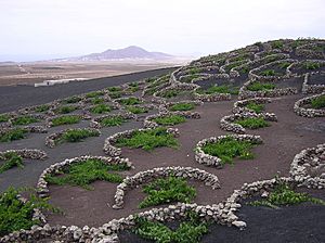
The vineyards of La Geria are a special protected area. This is where the Lanzarote DO wine region is located. Here, single grapevines are planted in deep pits, about 4 to 5 meters (13 to 16 feet) wide and 2 to 3 meters (7 to 10 feet) deep. Small stone walls are built around each pit. This special farming method helps to collect rainfall and overnight dew. It also protects the plants from the strong winds.
Fungi: Lichens on Rocks
Lanzarote has 180 different types of lichen-forming fungi. These fungi can survive on rock surfaces. They also help to break down rocks over time.
Fauna: Animals of Lanzarote
Besides native bats and animals brought by humans (like the dromedary, which was used for farming and is now a tourist attraction), Lanzarote has few types of large animals. However, it is home to many birds, such as falcons, and various reptiles.
Endemic Animals of Lanzarote
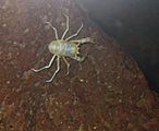
Some unique animals found only on Lanzarote include the Gallotia lizards. There are also blind Munidopsis polymorpha crabs. These crabs live in the Jameos del Agua salt lake, which was formed by a volcanic eruption. The island is also one of only two places where the endangered Canarian Egyptian vulture still lives.
Natural Symbols of Lanzarote
The official natural symbols of Lanzarote are the Munidopsis polymorpha (Blind crab) and the Euphorbia balsamifera (Tabaiba dulce).
Population of Lanzarote
As of 2024, about 163,230 people live on Lanzarote. This is an increase of 4.6% from the year before. The main government office for the island, called the Cabildo insular, is in the capital city, Arrecife. Arrecife has a population of 68,025 people in 2024.
According to the 2024 census, most of the people living on Lanzarote are Spanish (76.1%). There are also many residents from other countries. The largest groups include Colombians (4.4%), Britons (3.8%), Italians (2.6%), Moroccans (2.4%), and Germans (1.4%).
| Nationality | Population | Percentage |
|---|---|---|
| Spanish | 124174 |
76.1%
|
| Colombian | 7121 |
4.4%
|
| British | 6254 |
3.8%
|
| Italian | 4317 |
2.6%
|
| Moroccan | 3870 |
2.4%
|
| German | 2243 |
1.4%
|
| Other nationalities | 15251 |
9.3%
|
Administration of Lanzarote
Lanzarote is part of the province of Las Palmas. The island is divided into seven different areas, called municipalities.
| Name | Area (km2) |
Census Population | Estimated Population (2023) |
||
|---|---|---|---|---|---|
| 2001 | 2011 | 2021 | |||
| Arrecife | 22.72 | 44,980 | 55,381 | 64,278 | 64,735 |
| Haría | 106.59 | 4,027 | 5,054 | 5,395 | 5,543 |
| San Bartolomé | 40.89 | 13,030 | 18,118 | 19,305 | 19,443 |
| Teguise | 263.98 | 12,392 | 20,294 | 22,976 | 23,788 |
| Tías | 64.61 | 12,820 | 19,148 | 20,469 | 21,296 |
| Tinajo | 135.28 | 4,512 | 5,738 | 6,441 | 6,725 |
| Yaiza | 211.85 | 5,020 | 14,468 | 17,080 | 17,268 |
| Totals | 845.92 | 96,781 | 138,201 | 155,944 | 158,798 |
Transport on Lanzarote
Getting around Lanzarote is easy, with options for air, sea, and road travel.
Air Travel to Lanzarote
The main airport on the island is César Manrique-Lanzarote Airport. In 2018, over 7.3 million passengers used this airport. In 2019, it was renamed to honor local artist César Manrique. This was done to celebrate his contributions to the island and his 100th birthday. The airport has two passenger terminals. Terminal 2 is only for flights between the Canary Islands. Regional airlines like Binter Canarias and Canaryfly operate these flights. Lanzarote Airport is about 5 kilometers (3 miles) southwest of the capital, Arrecife. The LZ-2 road connects the airport to the city.
Sea Travel to Lanzarote
Most goods arrive on the island by sea through the Port of Arrecife, also known as Puerto de los Mármoles. This port is also used by large cruise ships. Regular ferry services connect the Port of Arrecife to Las Palmas de Gran Canaria, Santa Cruz de Tenerife, and Cadiz.
If you want to visit the nearby island of Fuerteventura, ferries leave from Playa Blanca. This is the southernmost town on Lanzarote. For trips to the island of La Graciosa, ferries depart from Órzola, Lanzarote's northernmost town. The two main companies that run these ferry services are Fred Olsen Express and Naviera Armas.
Roads and Public Transport
The LZ-1 road connects Arrecife, the capital, to Órzola in the north. The LZ-2 road links Arrecife to Playa Blanca in the south. The LZ-3 is a highway that goes around Arrecife. It connects Puerto de los Mármoles in the north of the city to the LZ-2 in the south. These three roads form the main road network of the island. Other roads connect to all the towns, villages, and interesting places on Lanzarote.
Public transport on the island is provided by Arrecife Bus. They operate under the name Intercity Bus Lanzarote. The company has 30 bus lines that connect major and minor settlements. They also serve the airport. There are also local bus services within the towns of Playa Blanca, San Bartolomé, and Tías. Most bus lines start or end in Arrecife. The local council provides public bus service within Arrecife itself. This service has five lines, including one to the nearby town of Playa Honda.
Notable People from Lanzarote
Many interesting people have connections to Lanzarote, including:
- Rosana Arbelo (born 1963), a famous singer.
- Blas Cabrera Felipe (1878–1945), a well-known physicist.
- César Manrique (1919–1992), a very important artist, architect, and sculptor who greatly influenced the island's look.
- José Saramago (1922–2010), a Portuguese writer who lived on the island.
- Goya Toledo (born 1969), an actress and model.
- Rayderley Zapata (born 1993), a talented gymnast.
Festivals on Lanzarote
The most important festival on the island happens every year on September 15. It takes place in the village of Mancha Blanca. This festival honors Our Lady of Dolours (Virgen de los Dolores), who is also called the "Virgin of the Volcanoes." She is the Patron Saint of Lanzarote. People from all over the island take part in this pilgrimage. Most of them dress in traditional costumes.
Sports on Lanzarote
Lanzarote has its own professional football team called UD Lanzarote. It was founded in 1970 and plays at the Ciudad Deportiva de Lanzarote, which can hold 7,000 fans. The island also has smaller football clubs like CD Teguise and CD Orientación Marítima. In tennis, the Open Isla de Lanzarote tournament was held here between 2006 and 2008.
Views of Lanzarote

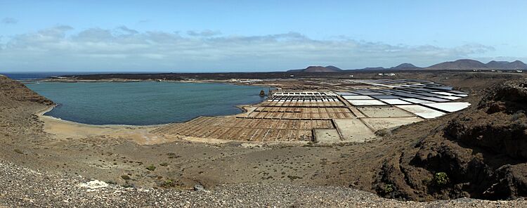
See also
 In Spanish: Lanzarote para niños
 | Bayard Rustin |
 | Jeannette Carter |
 | Jeremiah A. Brown |


