
Iberian Peninsula facts for kids

Satellite image of the Iberian Peninsula.
|
|
.svg) |
|
| Geography | |
|---|---|
| Location | Southwest Europe |
| Coordinates | 40°N 4°W / 40°N 4°W |
| Area | 582,000 km2 (225,000 sq mi) |
| Highest elevation | 3,478 m (11,411 ft) |
| Administration | |
| Demographics | |
| Demonym | Iberian |
| Population | Over 57 million |
The Iberian Peninsula, also called Iberia, is a large piece of land in the southwest of Europe. Like other peninsulas, it has water on most of its sides. The Mediterranean Sea is to its south and east. The Atlantic Ocean is to its north and west.
It is the third largest peninsula in Europe. Its total area is about 582,860 square kilometers. The name "Iberia" comes from the Ancient Greeks. The Romans later called this area "Hispania". Today, "Hispania" is used for Spain, while "Iberia" refers to the whole peninsula.
Interestingly, the Ancient Greeks and Romans also used the name "Iberia" for another place. This other place, Caucasian Iberia, was far away near the Black Sea.
Countries and Territories
The Iberian Peninsula is home to several countries and territories:
- Spain: This country covers most of the peninsula. It includes the central, eastern, and northwestern parts.
- Portugal: This country takes up most of the western part of the peninsula.
- Andorra: This is a very small nation located in the Pyrenees mountains. It sits on the northern edge of the peninsula, between Spain and France.
- Gibraltar: This is a tiny British territory in the south. It shares a border with Spain.
Images for kids
-
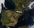
The Iberian Peninsula and southern France from space in March 2014.
-
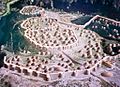
A model showing the ancient settlement of Los Millares.
-
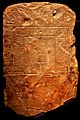
An example of ancient writing from the Southwest Paleohispanic script.
-
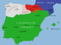
A map showing Islamic rule in al-Andalus around the year 1000.
-
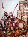
Two warriors before a castle siege from an old book.
-
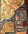
A map of the Iberian Peninsula and North Africa by Fra Mauro (around 1450).
-
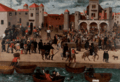
A painting showing people being expelled from the Port of Denia.
-
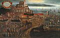
A picture of Lisbon, an important city in the late 1500s.
-
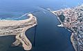
The Douro River flowing into the Atlantic Ocean near Porto.
-
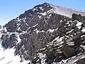
Mount Mulhacén, the highest mountain on the Iberian Peninsula.
-
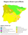
A map showing different climate types across Iberia.
-
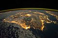
A satellite image of Iberia at night.
-
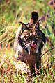
An Iberian lynx, a wild cat found in the region.


.png)


See also
 In Spanish: Península ibérica para niños
