Peale Inlet facts for kids
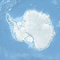
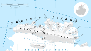
Peale Inlet is a long, ice-filled bay located in the icy continent of Antarctica. It stretches for about 16 nautical miles (which is about 30 kilometers). This inlet is found just west of a place called Noville Peninsula. It also cuts into the northern side of Thurston Island.
Scientists and explorers first mapped Peale Inlet using pictures taken from airplanes. These photos were captured during a big mission called U.S. Navy Operation Highjump in December 1946.
Contents
What is Peale Inlet and Where is it Located?
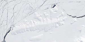
Peale Inlet is a large, narrow arm of the sea that is filled with ice. It is a significant geographical feature in the Antarctic region. Its icy nature means it's often covered by glaciers or sea ice.
Geographical Features of Peale Inlet
Peale Inlet is situated in a very cold and remote part of the world. It is next to Noville Peninsula, a piece of land that sticks out into the ocean. The inlet also borders Thurston Island, a large island in Antarctica.
- Length: Peale Inlet is approximately 16 nautical miles (30 kilometers) long. This makes it a notable feature on the map of Antarctica.
- Ice-filled: As with many features in Antarctica, the inlet is mostly covered or filled with ice. This ice can be part of glaciers or frozen sea water.
- Location: It is found on the north side of Thurston Island, which is a large, ice-covered island.
How Peale Inlet Got Its Name
Peale Inlet was named by a group called the Advisory Committee on Antarctic Names (US-ACAN). They chose the name to honor a special person named Titian Ramsay Peale.
Who Was Titian Ramsay Peale?
Titian Ramsay Peale was a famous artist and naturalist. A naturalist is someone who studies nature, like plants and animals. He was part of an important journey called the United States Exploring Expedition. This expedition was led by Wilkes and took place between 1838 and 1842.
- His Role: Titian Ramsay Peale worked on a ship called the Peacock. This ship was a "sloop of war," which was a type of warship.
- The Expedition: In March 1839, the Peacock and another smaller ship called the Flying Fish sailed near Thurston Island. They explored the edge of the thick sea ice for several days. This exploration helped map parts of Antarctica.
Exploring Antarctica: Operation Highjump
The first detailed maps of Peale Inlet were made thanks to a large American expedition. This expedition was known as U.S. Navy Operation Highjump.
What Was Operation Highjump?
Operation Highjump was a major United States Navy mission to Antarctica. It took place in 1946. The main goal was to train personnel and test equipment in very cold conditions. It also aimed to explore and map large parts of the continent.
- Aerial Photography: During this operation, airplanes took many pictures from above. These "aerial photographs" were very important. They helped explorers draw accurate maps of places like Peale Inlet for the first time.
- Date of Discovery: The photographs that helped map Peale Inlet were taken in December 1946.
 | Laphonza Butler |
 | Daisy Bates |
 | Elizabeth Piper Ensley |


