
Phetchabun Province facts for kids
Quick facts for kids
Phetchabun
เพชรบูรณ์
|
|
|---|---|

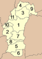
Map of Thailand highlighting Phetchabun Province
|
|
| Country | |
| Capital | Mueang Phetchabun |
| Area | |
| • Total | 12,668.4 km2 (4,891.3 sq mi) |
| Area rank | Ranked 9th |
| Population
(2000)
|
|
| • Total | 965,784 |
| • Rank | Ranked 19th |
| • Density | 76.2357/km2 (197.4495/sq mi) |
| • Density rank | Ranked 55th |
| Time zone | UTC+7 (Thailand Standard Time) |
| ISO 3166 code | TH-67 |
Phetchabun (pronounced Pet-cha-boon, in Thai: Thai: เพชรบูรณ์) is a cool province in the northern part of Thailand. A province is like a state or a region. In Thailand, provinces are called changwat.
As of the year 2000, about 965,784 people lived in Phetchabun. The province covers a big area of 12,668.4 square kilometers. The main city and capital of Phetchabun is called Mueang Phetchabun. The person in charge of the province is called the Governor.
How Phetchabun is Organized
Phetchabun province is divided into smaller parts to help manage everything. These smaller parts are called districts.
- The province has 117 subdistricts, which are known as tambon.
- It also has 1261 villages, which are called muban.
This way of organizing helps the local government work better for all the people living in Phetchabun.
Images for kids
-
Map showing the districts (Amphoe) of Phetchabun
-
Road to Khao Kho


See also
 In Spanish: Provincia de Phetchabun para niños
