Pleasanton Ridge Regional Park facts for kids
Quick facts for kids Pleasanton Ridge Regional Park |
|
|---|---|

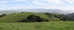
View looking south along the ridge from one of the peaks
|
|
| Lua error in Module:Location_map at line 420: attempt to index field 'wikibase' (a nil value). | |
| Location | Pleasanton, California |
| Area | 5,271-acre (21.33 km2) |
| Created | 1988 |
| Operated by | East Bay Regional Park District |
Pleasanton Ridge Regional Park is a huge park in Pleasanton, California. It covers about 5,271-acre (21.33 km2) of land. The park is managed by the East Bay Regional Park District. It offers amazing views of Pleasanton and the Livermore Valley.
Contents
About Pleasanton Ridge Regional Park
This park is west of the I-680 freeway and the city of Pleasanton. It's one of the largest parks in the East Bay Regional Park District. The park is always growing, with new land being added to protect more open space.
How the Park Started
The story of Pleasanton Ridge Regional Park began in 1988. That's when the East Bay Regional Park District bought about 1,700 acres (6.9 km2) of land. This purchase helped create what would become a very large park.
Before the park was created, there were plans to build a golf course and many homes on Pleasanton Ridge in 1980. But many people who lived nearby didn't like this idea. They worked together and stopped the building plans in 1983. This showed how much the community wanted to protect this natural area.
Park Expansions
The park has grown bigger over the years. In 2012, the park district bought another 1,367 acres (5.53 km2) from Robertson Ranch. This new land included Sunol Peak, which is about 2,163 feet (659 m) high. This addition made the park even larger.
The park is also set to grow by almost 1,500 acres (6.1 km2) with the addition of the Tyler Ranch. This ranch stretches for about 3.5 miles (5.6 km) along Sunol Ridge. The Tyler Ranch land connects well with the existing park. This expansion was supported by a group called the Priem Family Foundation, which helps save open spaces in the Bay Area.
The purchase of Tyler Ranch was a special moment. It meant that the East Bay Regional Park District had acquired a total of 100,000 acres (400 km2) of land since it was formed in 1934!
Trails and Activities
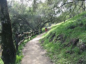
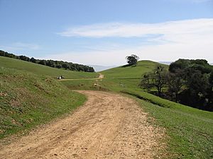
Pleasanton Ridge Regional Park has more than 25 miles (40 km) of trails for you to explore. Most of these trails are wide dirt roads, perfect for hiking, biking, or horseback riding. Some trails, like the Woodland Trail and the Bay Leaf Trail, are narrower paths.
The park's elevation changes a lot. It starts at about 400 feet (120 m) at the main entrance and goes up to over 1,600 feet (490 m) at its highest point. This means you can get some great exercise and enjoy amazing views as you climb higher.
Right next to Pleasanton Ridge Regional Park is another park called Augustin Bernal Park.
 | Bessie Coleman |
 | Spann Watson |
 | Jill E. Brown |
 | Sherman W. White |


