Point Isabel (promontory) facts for kids
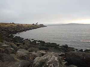
Point Isabel is a piece of land that sticks out into the San Francisco Bay in Richmond, United States. It's a cool spot on the eastern side of the bay.
Contents
A Look Back at Point Isabel's Past
Point Isabel was once a hilltop that was part of a very old chain of hills. Other hills in this chain include Albany Hill and Brooks Island. After the last Ice Age, the ocean levels rose. This created San Francisco Bay and left Point Isabel as a rocky area connected to the main land by a marshy area. This marsh would fill with water when the tides were high.
Long ago, Native American people, especially the Huchiun Indians, used this area. We know this because a large pile of shells, called a shell midden, was found there. This shows they lived and ate seafood in this spot.
How Point Isabel Got Its Name
In the 1800s, Point Isabel was part of a big ranch called Rancho San Pablo. This ranch belonged to a man named Don Victór Castro. His father had received this land from the Mexican government. Victor Castro decided to name this special point after his daughter, Isabel.
Victor Castro used Point Isabel as a place where boats could load and unload goods. They would ship things like grain across the bay. He also built a dock, a place to prepare meat, and even a hotel there.
After the United States took control of California, Castro had to sell much of his land. In the 1850s, a woman named Minna Quilfeldt bought about 500 acres around Point Isabel. Her husband, Richard Stege, used the land to raise bullfrogs and create a fun resort.
Later, a company called Vigoret Powder Works bought the land. This company was part of Du Pont. They used Point Isabel mainly to store explosives. There was also a dock and a train track to serve the site.
Changes Over Time
In the early 1900s, special "training walls" were built in the area. These walls helped keep shipping channels open. Because of these walls, a marsh grew behind them. This marsh became a home for many different kinds of shorebirds and waterbirds.
Around the same time, a company called Stauffer Chemical started making sulfuric acid nearby. This company continued its work until 1997. Over the years, many chemicals were found in the soil here. These included things like arsenic, lead, mercury, and benzene.
In the 1930s, a group called the San Pablo Avenue Sportsmen’s Club used Point Isabel for fishing and hunting ducks. During World War II, the Navy used Point Isabel as a place for shooting practice.
In the 1950s, the original hilltop of Point Isabel was much higher than it is today. It was blown up with dynamite to make way for new buildings. The broken rocks were used to fill in marshlands. This made Point Isabel wider and connected it more to the mainland.
A dump for industrial waste was also created north of the original point. This area became known as "Battery Point" because many old batteries were buried there. Over the years, different industries used the land around Point Isabel. This left some areas very polluted. However, some of these areas have since been cleaned up.
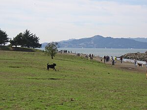
Today, parts of the original Point Isabel, the Hoffmann Marsh, and Battery Point are protected. They are now part of the Point Isabel Regional Shoreline, which is managed by the East Bay Regional Parks District. They are also part of the Eastshore State Park.
Environmental Concerns at Point Isabel
Point Isabel has faced some environmental challenges over the years.
TEPCO Beach
One part of Point Isabel is known as TEPCO Beach. This area is covered in thousands of broken pieces of ceramic dishes. A company called Technical Porcelain and Chinaware Company (TEPCO) started in 1918. For about 50 years, until 1968, TEPCO threw their broken dishes along the banks of Point Isabel.
Lead Pollution
Point Isabel was also used as a dumping ground for battery casings that contained lead. This caused harmful lead to leak into the soil. In the 1970s and 1980s, thousands of tons of soil were removed from the site to fix this problem.
However, in 2018, new lead leaks were found. This showed that the cleanup work from the 1970s and 1980s was not fully completed. Experts are still working to find out where these new lead leaks are coming from.


