Point Pleasant, Indiana facts for kids
Quick facts for kids
Point Pleasant, Indiana
|
|
|---|---|
| Country | United States |
| State | Indiana |
| County | Warren |
| Township | Steuben |
| Time zone | UTC-5 (Eastern (EST)) |
| • Summer (DST) | UTC-4 (EDT) |
| Area code(s) | 765 |
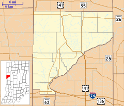
Point Pleasant was once a small village in Warren County, Indiana. Today, it no longer exists and is considered a ghost town. It was located about one and a half miles southwest of Rainsville. This area is near where Big Pine Creek and Mud Pine Creek meet, a spot now called Rocky Ford.
Point Pleasant was planned by a person named John H. Bartlett. He officially mapped out the town on July 14, 1830. However, the village never really grew. It only had Bartlett's home, a store, and possibly a saw mill. An old book from 1883 about the county mentioned Point Pleasant. It said that the town was "a paper town only," meaning it mostly existed on maps and not much in real life.
Where Was Point Pleasant Located?
Point Pleasant was situated in the northwest part of the northeast quarter of section 33. This area is within township 23, range 8. It was a specific spot on the map in rural Indiana.
 | May Edward Chinn |
 | Rebecca Cole |
 | Alexa Canady |
 | Dorothy Lavinia Brown |


