Potter, Kansas facts for kids
Quick facts for kids
Potter, Kansas
|
|
|---|---|

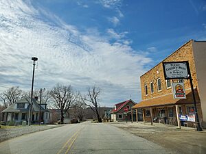
Intersection in Potter
|
|

|
|
| Country | United States |
| State | Kansas |
| County | Atchison |
| Founded | 1886 |
| Named for | Joseph Potter |
| Elevation | 968 ft (295 m) |
| Time zone | UTC-6 (CST) |
| • Summer (DST) | UTC-5 (CDT) |
| Area code | 913 |
| FIPS code | 20-57275 |
| GNIS ID | 478256 |
Potter is a small place in Atchison County, Kansas, United States. It is called an unincorporated community. This means it is a settlement that is not part of an official city or town.
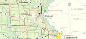
Potter is located where two roads meet: 210th Road and Rawlins Road. It is about 9.5 miles (15.3 km) south of a bigger town called Atchison.
History of Potter
How Potter Started
Potter began in the year 1886. This was when a railroad was built through the area. The community was named after Joseph Potter. He was one of the first people to settle there.
Potter's Post Office
Potter used to have its own post office. It had a special ZIP code, which was 66077. The post office first opened a long time ago, on May 14, 1865. It served the community for many years. However, it closed its doors on May 16, 2009.
See also
 In Spanish: Potter (Kansas) para niños
 | Sharif Bey |
 | Hale Woodruff |
 | Richmond Barthé |
 | Purvis Young |


