Pripyat (river) facts for kids
Quick facts for kids Pripyat |
|
|---|---|
Pripyat River
|
|
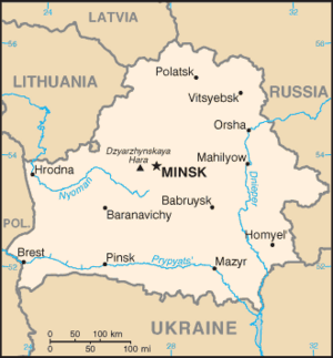
Course of the Pripyat River
|
|
| Other name(s) | Prypiat, Prypiać, Prypeć |
| Country | Ukraine, Belarus |
| Physical characteristics | |
| Main source | Volyn Oblast, Ukraine 51°28′05″N 24°18′54″E / 51.468°N 24.315°E |
| River mouth | Dnieper Kyiv Reservoir 51°09′31″N 30°29′27″E / 51.15861°N 30.49083°E |
| Length | 761 km (473 mi) |
| Basin features | |
| Progression | Dnieper→ Dnieper–Bug estuary→ Black Sea |
| Basin size | 121,000 km2 (47,000 sq mi) |
| Tributaries |
|
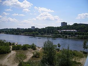
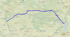
The Pripyat River is a long river in Eastern Europe. It stretches for about 761 kilometers (473 miles). The river flows east through Ukraine, then into Belarus, and then back into Ukraine. Finally, it empties into the Dnieper River.
Contents
The Pripyat River: An Important Waterway
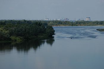
The Pripyat River is well-known because it flows through the Chernobyl Exclusion Zone. This is an area set up after the Chernobyl disaster. The city of Pripyat, Ukraine, which had 45,000 people, was completely emptied after the accident.
The river's basin, which is the land area that drains into it, covers a huge 121,000 square kilometers (46,700 square miles). A large part of this area, about 50,900 square kilometers (19,650 square miles), is in Belarus. About 495 kilometers (308 miles) of the river's total length is also in Belarus.
As of 2020, parts of the river are being deepened. This work is happening to help create the Waterway E40. This waterway is a planned shipping route that would connect the Baltic Sea to the Black Sea.
Where the River Flows
The Pripyat River starts in Ukraine, on the Volyn Hill. It begins between the small villages of Budnik and Horn Smolars. After flowing for about 204 kilometers (127 miles), it crosses into Belarus.
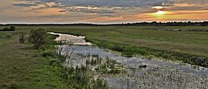
In Belarus, the river travels for 500 kilometers (310 miles) through a huge natural area called Polesia. This is Europe's largest wilderness. Polesia has vast sandy wetlands, including the famous Pinsk marshes. These marshes are a big network of swamps, bogs, rivers, and small streams within a forested area.
For its last 50 kilometers (31 miles), the Pripyat River flows back into Ukraine. It then flows a few kilometers south of Chernobyl before joining the Kyiv Reservoir.
The River's Journey and Features
The Pripyat River is about 775 kilometers (482 miles) long. The total area of land that drains water into the river is 114,300 square kilometers (44,100 square miles). The river valley is not very deep at its beginning but becomes clearer further downstream.
The river has two main flat areas next to it that can flood. In the upper parts of the river, this flooded area can be 2 to 4 kilometers (1.2 to 2.5 miles) wide. Sometimes, it stays flooded for several months. In the lower parts of the river, this flooded area can reach 10 to 15 kilometers (6 to 9 miles) wide.
The river's path is winding, forming many curves and old river channels. There are also many sandy islands in the river. The width of the river changes along its path. In the upper parts, it's up to 40 meters (130 feet) wide. On average, it's 50 to 70 meters (160 to 230 feet) wide. In the lower parts, it's usually 100 to 250 meters (330 to 820 feet) wide. Where it enters the Kyiv Reservoir, it can be 4 to 5 kilometers (2.5 to 3 miles) wide. The bottom of the river is mostly sandy.
What's in a Name?
The name of the Pripyat River has an interesting history. In old East Slavic writings, the river was called Pripet'. Some language experts believe the name meant "tributary." A tributary is a smaller river or stream that flows into a larger river.
Another idea is that the name might come from a local word, pripech. This word was used to describe a river that had sandy banks.
See also
 In Spanish: Río Prípiat para niños
- Pripyat (city)
- Chernobyl disaster
- Chernobyl Exclusion Zone
- Dnieper–Bug Canal
 | Jewel Prestage |
 | Ella Baker |
 | Fannie Lou Hamer |


