
Quebradilla facts for kids
Quick facts for kids
Quebradilla
|
|
|---|---|
|
District
|
|

Quebradilla
Location in Costa Rica
|
|
| Country | |
| Province | Cartago |
| Canton | Cartago |
| Creation | 16 March 1983 |
| Area | |
| • Total | 18.91 km2 (7.30 sq mi) |
| Elevation | 1,410 m (4,630 ft) |
| Population
(2011)
|
|
| • Total | 5,349 |
| • Density | 282.87/km2 (732.62/sq mi) |
| Time zone | UTC−06:00 |
| Postal code |
30111
|
Quebradilla is a special area called a district in the Cartago canton. It is located in the Cartago province of Costa Rica. This district is known for its beautiful natural surroundings and its friendly community.
Contents
History of Quebradilla
Quebradilla became its own district on March 16, 1983. This happened because of a special government decision. Before that, it was part of another district called Guadalupe.
Geography of Quebradilla
Quebradilla covers an area of about 18.91 square kilometers. That's like a little over seven square miles! It is also quite high up, at an elevation of 1,410 meters (about 4,626 feet) above sea level. This high elevation often means cooler temperatures.
Population of Quebradilla
According to the 2011 census, about 5,349 people lived in Quebradilla. The district has been growing over the years, with more people choosing to live there.
Getting Around Quebradilla
You can travel through Quebradilla using several important roads. These roads help people get to and from the district easily.
- National Route 206
- National Route 228
- National Route 407
Images for kids
-

National Route 206 sign
-
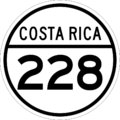
National Route 228 sign
-
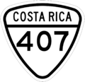
National Route 407 sign


See also
 In Spanish: Quebradilla para niños
