Río Grande de Matagalpa facts for kids
Quick facts for kids Río grande de Matagalpa |
|
|---|---|
|
Location of mouth
|
|
| Country | Nicaragua |
| Physical characteristics | |
| Main source | Selva Negra, Matagalpa |
| River mouth | South Caribbean Autonomous Region 12°54′N 83°32′W / 12.900°N 83.533°W |
| Length | 267 mi (430 km) |
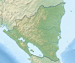
The Río Grande de Matagalpa is a very important river in Nicaragua. It flows for about 430 kilometers (267 miles). This makes it the second longest river in the country. The river starts near the city of Matagalpa. It then travels all the way to the Caribbean Sea. This part of the Caribbean coast is called the South Caribbean Coast Autonomous Region.
The river has different names. In the Miskito language, it is called Awaltara. In the old Matagalpa language, it was known as Ucumulalí. The city and municipality of La Cruz de Río Grande are even named after this river.
The River's Journey
The Río Grande de Matagalpa begins its long journey in the mountains. It flows through many different areas of Nicaragua. As it moves, it collects water from smaller streams and rivers. This helps it grow wider and deeper. Finally, it reaches the Caribbean Sea. This journey is important for many plants and animals.
Building the Tumarín Dam
A big project is happening on the lower part of the river. This project is the Tumarín Dam. A dam is a large wall built across a river. It holds back water to create a reservoir. Dams are often used to generate electricity. They can also help control floods or provide water for farming. The Tumarín Dam is being built to help Nicaragua with its energy needs.
Why Rivers Are Important
Rivers like the Río Grande de Matagalpa are vital for many reasons. They provide fresh water for people and animals. They are also home to many different kinds of fish and other wildlife. Rivers can be used for transportation, allowing boats to move goods and people. They also help shape the land around them.
See also
 In Spanish: Río Grande de Matagalpa para niños
 | Emma Amos |
 | Edward Mitchell Bannister |
 | Larry D. Alexander |
 | Ernie Barnes |


