La Cruz de Río Grande facts for kids
Quick facts for kids
La Cruz de Río Grande
|
|
|---|---|
|
Municipality
|
|
| Country | |
| Department | South Caribbean Coast Autonomous Region |
| Area | |
| • Municipality | 1,332 sq mi (3,449 km2) |
| Population
(2023)
|
|
| • Municipality | 49,445 |
| • Density | 37.130/sq mi (14.3360/km2) |
| • Urban | 7,705 |
| Climate | Am |
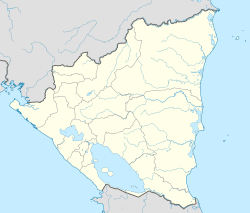
La Cruz de Río Grande is a special area called a municipality in Nicaragua. It is part of the South Caribbean Coast Autonomous Region. The name "La Cruz de Río Grande" comes from the Rio Grande de Matagalpa river. This river flows right through the area. In 2005, about 3,000 people lived here. By 2023, the population grew to around 49,445 people.
Contents
Where is La Cruz de Río Grande?
This municipality is located in the eastern part of Nicaragua. It shares borders with several other municipalities. To the north, you'll find Prinzapolka. To the south, it borders El Tortuguero. To the east is Desembocadura. Finally, to the west are Mulukukú and Paiwas.
The main town of La Cruz de Río Grande is quite far from Managua. Managua is the capital city of Nicaragua. The distance between them is about 410 kilometers.
A Look at History
We don't have clear records about the very first people who lived here. It is thought that the Miskito people originally lived in this area. However, today, very few Miskito people remain.
La Cruz de Río Grande was officially started as a district around 1893. Its history really became known in the mid-1900s. At that time, companies from North America came to the area. They set up businesses to grow bananas and collect rubber. They also harvested a plant called raicilla and cut down wood.
These companies brought many modern things to the area. They built stores, large buildings, and even casinos and theaters. They also had phonographs (early music players) and telephones. To help with transport, they built air strips and roads that could be used all year. They even built railroads! All these new things attracted many farmers from other parts of Nicaragua. Many Chinese people also moved here.
The banana companies left in 1940. A big storm called Hurricane Irene then destroyed their banana farms.
Later, in 1996, parts of La Cruz de Río Grande became new municipalities. These new areas were named El Tortuguero and Desembocadura.
People and Population
Today, La Cruz de Río Grande has about 49,445 people living there. More than half of the people, about 50.6%, are men. The rest, about 49.4%, are women. A smaller part of the population, about 15.6%, lives in the main town area. The rest live in the surrounding communities.
Nature and Climate
The weather in La Cruz de Río Grande is a tropical monsoon climate. This means it's warm and wet most of the time. The average temperature is usually between 25 and 26 degrees Celsius.
It rains a lot here, between 2800 and 3200 millimeters of rain each year. The rain is spread out nicely throughout the year. This helps the plants and crops grow well.
The land is mostly flat or gently sloping. It has many natural streams and rivers. These help water drain away easily. The soil in this area is quite acidic. It doesn't have many natural nutrients and isn't very fertile.
Local Communities
The municipality is divided into one main town and 49 smaller communities. These communities are grouped into ten larger areas called microregions. These microregions are:
- Makantaka
- Matagalpa
- Muelle Real
- San Miguel de Casa de Alto
- Batitán
- Uliwas
- Aguas Calientes
- Mayawas
- Santo Domingo del Carmen
- La Cruz
Economy and Jobs
Most people in La Cruz de Río Grande work in farming and raising animals. There are many small and medium-sized farms here. They grow crops and raise livestock to support their families and sell to others.
Getting Around
La Cruz de Río Grande is one of the most isolated places in Nicaragua. This means it's hard to get to by road. There isn't a direct road connecting the main town to the rest of the country.
The most important way to travel is by using the Río Grande de Matagalpa river. This river flows through the municipality from west to east. You can travel downstream by boat to Bluefields in about six hours. Bluefields is a city on the coast. You can also travel upstream to San Pedro del Norte. From San Pedro del Norte, there is a road that connects to the rest of the country.
See also
 In Spanish: La Cruz de Río Grande para niños
 | Stephanie Wilson |
 | Charles Bolden |
 | Ronald McNair |
 | Frederick D. Gregory |


