Bluefields facts for kids
Quick facts for kids
Bluefields
|
||
|---|---|---|
|
Municipality
|
||
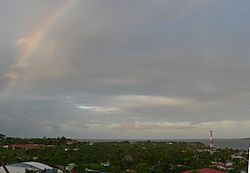
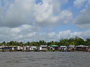
Bluefields and Bluefields Bay (Bahia de Bluefields)
|
||
|
||
| Country | ||
| Autonomous Region | South Caribbean Autonomous Region | |
| Municipality | Bluefields | |
| Area | ||
| • Municipality | 4,775 km2 (1,844 sq mi) | |
| Elevation | 25 m (82 ft) | |
| Population
(2022 estimate)
|
||
| • Municipality | 58,306 | |
| • Density | 12.2107/km2 (31.626/sq mi) | |
| • Urban | 56,005 | |
| Time zone | UTCGMT-6 | |
| Climate | Af | |
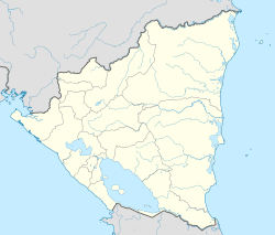
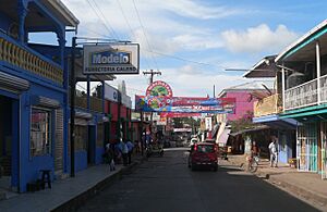
Bluefields is an important city in Nicaragua. It is the capital of the South Caribbean Autonomous Region. This city was once the capital of the old Kingdom of Mosquitia. It was also the capital of the Zelaya Department before it was split into two regions. Bluefields is located on Bluefields Bay, right where the Bluefields River meets the sea.
The city got its name from Abraham Blauvelt. He was a Dutch explorer and pirate who visited the area in the 1600s. Bluefields has about 56,000 people (as of 2022). Many of its residents are Afro-descendant Creoles and Miskitu people. There are also smaller groups like Mestizo, Garinagu, Chinese, Mayangna, and Rama people.
Bluefields is Nicaragua's main port on the Caribbean side. From here, things like wood, seafood, shrimp, and lobster are sent to other countries. In the 16th and 17th centuries, European buccaneers (pirates) often met up here. In 1678, it became the capital of the English protectorate of the Kingdom of Mosquitia.
Later, during times when the United States was involved in Nicaragua (1912–15, 1926–33), US Marines were stationed in Bluefields. In 1984, the United States placed mines in the harbor during the Nicaraguan Revolution. In 1988, Hurricane Joan badly damaged Bluefields, but the city was rebuilt.
Contents
History of Bluefields
The city of Bluefields started because European pirates came to the Caribbean coast of Nicaragua. These pirates were often against Spain. They used the Escondido River to rest, fix their ships, and get supplies. At that time, native groups like the Kukra and Branch people lived in this area.
In 1602, a Dutch adventurer named Abraham Blauvelt found the bay of the Escondido River. He thought it was a great place for his operations. The city's name, Bluefields, comes from his last name, Blauvelt. 'Blau' means 'blue' and 'velt' means 'field' in Dutch.
African slaves first arrived on the Caribbean coast in 1641. This happened when a Portuguese ship carrying slaves crashed near the Miskito Cays. English people started moving to the region in 1633. By 1705, they had set up their own governments. In 1730, the Kingdom of Moskitia became linked to the British government in Jamaica. The British gave weapons to the Miskito people. The Miskito used these weapons to protect themselves from other groups. These groups included the Afro-descendant Creoles and native tribes like the Mayangnas, Ulwas, and Ramas.
In 1740, the Miskitos agreed to British rule over their land. In 1744, some White colonists from Jamaica moved to the Kingdom of Moskitia. They brought enslaved people with them. French colonists also arrived around this time. The area was a British protectorate until 1796. Then, Britain decided to remove all English settlers from the Kingdom of Moskitia. This was because the Spanish Monarch offered Britain more land in the Yucatán Peninsula. This land was for cutting wood. The British also left the islands. However, the Spanish did not fully take control of them.
After the Viceroyalty of New Granada became independent, the Kingdom of Moskitia was part of Gran Colombia. When Gran Colombia broke apart in 1831, it became part of the Republic of New Granada (now Colombia). Later, through a treaty, Colombia officially gave the land to Nicaragua.
The Moravian Church was established in Bluefields in 1847. In 1860, the Treaty of Managua created the Miskito Reserve. This was an agreement between the British and Nicaraguan governments. Bluefields was chosen as the capital of this Reserve.
By the 1880s, the local people had adopted more European ways. British and American businesses started growing bananas and cutting wood. This brought a lot of money to the area. Bluefields became a diverse city with busy trade. Different groups of people had different jobs. White people often worked for foreign businesses. People of mixed race were artisans or workers. Darker-skinned Creoles did physical labor. Native people often worked as servants. In 1894, the government of Nicaragua took control of the Miskito Reserve. This ended the Miskito monarchy. On October 11, 1903, Bluefields was named the capital of the Department of Zelaya.
Bluefields Climate
Bluefields has a tropical rainforest climate. This means it is hot and rainy all year round. Even during the drier months from February to April, it still rains often. This is because of the trade winds. For the rest of the year, rainfall is very heavy. This is due to tropical low pressure and the shape of the coast.
| Climate data for Bluefields, Nicaragua | |||||||||||||
|---|---|---|---|---|---|---|---|---|---|---|---|---|---|
| Month | Jan | Feb | Mar | Apr | May | Jun | Jul | Aug | Sep | Oct | Nov | Dec | Year |
| Mean daily maximum °C (°F) | 27.8 (82.0) |
28.4 (83.1) |
29.0 (84.2) |
29.8 (85.6) |
29.9 (85.8) |
28.9 (84.0) |
28.1 (82.6) |
28.5 (83.3) |
29.1 (84.4) |
28.8 (83.8) |
28.4 (83.1) |
28.0 (82.4) |
28.7 (83.7) |
| Daily mean °C (°F) | 24.9 (76.8) |
25.2 (77.4) |
26.2 (79.2) |
27.0 (80.6) |
27.0 (80.6) |
26.0 (78.8) |
25.6 (78.1) |
25.6 (78.1) |
25.8 (78.4) |
25.6 (78.1) |
25.3 (77.5) |
25.2 (77.4) |
25.8 (78.4) |
| Mean daily minimum °C (°F) | 22.2 (72.0) |
22.3 (72.1) |
23.3 (73.9) |
23.7 (74.7) |
24.2 (75.6) |
23.9 (75.0) |
23.7 (74.7) |
23.6 (74.5) |
23.5 (74.3) |
23.1 (73.6) |
22.8 (73.0) |
22.6 (72.7) |
23.2 (73.8) |
| Average rainfall mm (inches) | 218 (8.6) |
114 (4.5) |
71 (2.8) |
101 (4.0) |
264 (10.4) |
581 (22.9) |
828 (32.6) |
638 (25.1) |
383 (15.1) |
418 (16.5) |
376 (14.8) |
328 (12.9) |
4,320 (170.2) |
| Average rainy days (≥ 1.0 mm) | 19 | 13 | 10 | 10 | 15 | 23 | 26 | 25 | 21 | 21 | 20 | 22 | 225 |
| Source: HKO | |||||||||||||
Bluefields Districts
Bluefields is located next to its bay. It has 17 neighborhoods, including the port of El Bluff. El Bluff is on a peninsula, which is a piece of land almost surrounded by water. Because of erosion, this peninsula is slowly becoming a real island. It helps close off Bluefields Bay on the east side. El Bluff is about 1.29 square kilometers in size. It is about 8 kilometers away from Bluefields.
Bluefields also has several municipal offices and many rural communities. These include:
City Neighborhoods:
- Santa Rosa
- Central
- San Mateo
- Pointeen
- Fátima
- Tres Cruces
- Ricardo Morales
- Old Bank
- San Pedro
- Teodoro Martínez
- 19 de Julio
- Pancasán
- Punta Fría
- New York
- Beholden
- Canal
- Loma Fresca
Rural Communities:
- Cuenca Río Escondido
- Cuenca Río Maíz
- San Nicolás
- La Fonseca
- Rama Cay
- San Luís
- Caño Frijol
- Torsuani
- Long Beach
- Dalzuno
- Cuenca Río Indio
- Río Maíz
- Guana Creek
- Nueva Chontales
- Neysi Ríos
- La Palma
- Sub-Cuenca Mahagony
- Krisinbila
- Sub-Cuenca Caño Negro
- Río Kama
- El Bluff
- Las Mercedes
- Monkey Point
- El Corozo
- Cuenca Punta Gorda
- Caño Dalzuno
- Haulover
- Villa Hermosa
- San Ramón
- Río Cama (El Cilicio)
- San Brown
- La Virgen
- San Mariano
- La Pichinga
- Musulaine
- Caño Blanco
- Aurora (San Francisco)
- Kukra River (Delirio)
- Barra Punta Gorda
- Kukra River
Education in Bluefields
Bluefields has two universities. One is the Bluefields campus of the University of the Autonomous Regions of the Nicaraguan Caribbean Coast. The other is the Bluefields Indian and Caribbean University (BICU). These universities offer many learning opportunities for students.
Transportation and Travel
For a long time, there was no direct road to Bluefields from the west coast of Nicaragua. However, a new highway from Nueva Guinea was finished in May 2019. Now, buses regularly travel on this road. The road was built with help from the Inter-American Development Bank and the World Bank.
Most visitors fly into Bluefields Airport. Others take a bus from Managua or other cities. Some people take a small boat called a Panga down the Rio Escondido. This boat trip starts from the city of El Rama, which you can reach by bus from Managua.
In Bluefields, taxis are easy to find. They usually cost a fixed price per person (14 cordobas in 2020) and are often shared with other passengers. The city's main dock is where commercial boats leave from. These boats go to places like Corn Island, LaBarra, and many other spots only reachable by water. Not many people own cars in Bluefields.
The local government does not provide all services. So, groups like blueEnergy help with water, energy, and sanitation. Bluefields is also known as a base for the British Armed Forces. This base helps stop illegal goods from being smuggled. It also stores humanitarian aid for natural disasters.
Notable People from Bluefields
- Barbara Carrera, an American actress, model, and painter.
- Norchad Omier, a Nicaraguan international basketball player.
See also
 In Spanish: Bluefields para niños
 | James Van Der Zee |
 | Alma Thomas |
 | Ellis Wilson |
 | Margaret Taylor-Burroughs |


