Río Rico, Tamaulipas facts for kids
Quick facts for kids
Río Rico
|
|
|---|---|
|
Village
|
|
| Country | |
| State | Tamaulipas |
| Time zone | UTC-6 (CST) |
| • Summer (DST) | UTC-5 (CST) |
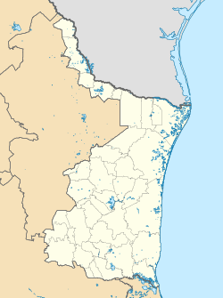
Río Rico is a small village located in the Mexican state of Tamaulipas. It sits right along the Rio Grande, which forms part of the border between Mexico and the United States.
A special part of Río Rico is called the Horcón Tract. This piece of land, about 461-acre (1.87 km2) in size, used to be part of the United States. However, the river changed its path in 1906. This change cut the Horcón Tract off from the rest of Texas.
Years later, in 1929, Río Rico was founded. It grew on this land, which was technically still part of the U.S. but acted like it was in Mexico.
In 1967, a professor found out about this border mix-up. It was then decided that parts of Río Rico were legally on U.S. land. This meant that people born there could be American citizens. The border was officially moved in 1977. This made the Horcón Tract and the village of Río Rico fully part of Mexico.
Contents
History of the Border Change
How the Border Was Set
In 1845, the Rio Grande became the official border between Mexico and the U.S. state of Texas. Rivers like the Rio Grande often have many bends, called meanders. These bends can create "fingers" of land that are almost surrounded by the other country's territory.
The Horcón Tract was one of these "fingers." It was a 413-acre (1.67 km2) piece of land that was mostly surrounded by the river and Mexico. It only had a small connection to the U.S. at one end.
The River's New Path
In July 1906, a company called the American Rio Grande Land and Irrigation Company dug a new, shorter path for the river. This was done to help control the water for farming. This new path cut off the Horcón Tract from the main part of Texas.
This river change was not allowed. The company was taken to court by landowners in both the U.S. and Mexico. In 1907, the company was fined and had to pay damages. The new river path, however, was allowed to stay because it was too hard to change back.
According to an 1884 border treaty, borders only change if a river naturally moves. Since this change was made by people, the land was still legally U.S. territory.
Río Rico Grows on U.S. Land
After the river's path changed, the old riverbed dried up. The company never put up new border markers. This made it hard to tell where the U.S. land ended and Mexican territory began.
In 1929, the Mexican village of Río Rico was founded nearby. Over time, as the Rio Grande changed its course due to floods, the village slowly moved onto the Horcón Tract. Most people living there were of Mexican heritage. They followed Mexican laws, and everyone generally thought the land was part of Mexico.
Discovering the Mix-Up
Decades later, the truth about the border was discovered. A new agreement, called the Boundary Treaty of 1970, was made. This treaty said that the Horcón Tract would become part of Mexico once two new flood control projects were finished.
In 1972, the United States officially gave the land to Mexico. It became part of the Mexican state of Tamaulipas. The official handover happened in 1977.
After this, a person who was born in Río Rico filed a lawsuit. They wanted to make sure they could claim U.S. citizenship. As a result, U.S. immigration authorities decided that anyone born in Río Rico between 1906 and 1972 could claim U.S. citizenship by birth. Because of this, many people from the village moved to the United States.
See also
 In Spanish: Río Rico (Tamaulipas) para niños
 | Bessie Coleman |
 | Spann Watson |
 | Jill E. Brown |
 | Sherman W. White |


